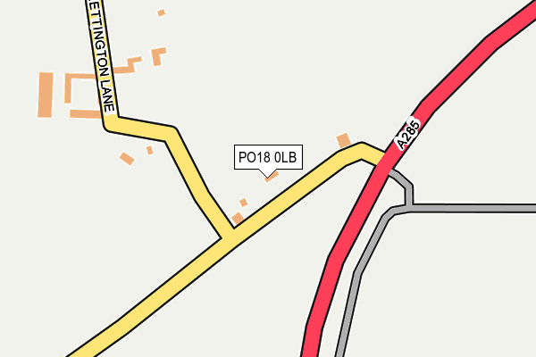
PO18 0LB is in Strettington, Chichester. PO18 0LB is located in the Goodwood electoral ward, within the local authority district of Chichester and the English Parliamentary constituency of Chichester. The Sub Integrated Care Board (ICB) Location is NHS Sussex ICB - 70F and the police force is Sussex. This postcode has been in use since January 1980.


GetTheData
Source: OS OpenMap – Local (Ordnance Survey)
Source: OS VectorMap District (Ordnance Survey)
Licence: Open Government Licence (requires attribution)
| Easting | 489501 |
| Northing | 107166 |
| Latitude | 50.857092 |
| Longitude | -0.729792 |
GetTheData
Source: Open Postcode Geo
Licence: Open Government Licence
| Locality | Strettington |
| Town/City | Chichester |
| Country | England |
| Postcode District | PO18 |
➜ See where PO18 is on a map ➜ Where is Strettington? | |
GetTheData
Source: Land Registry Price Paid Data
Licence: Open Government Licence
Elevation or altitude of PO18 0LB as distance above sea level:
| Metres | Feet | |
|---|---|---|
| Elevation | 30m | 98ft |
Elevation is measured from the approximate centre of the postcode, to the nearest point on an OS contour line from OS Terrain 50, which has contour spacing of ten vertical metres.
➜ How high above sea level am I? Find the elevation of your current position using your device's GPS.
GetTheData
Source: Open Postcode Elevation
Licence: Open Government Licence
| Ward | Goodwood |
| Constituency | Chichester |
GetTheData
Source: ONS Postcode Database
Licence: Open Government Licence
| Strettington Lane (Stane Street) | Temple Bar | 55m |
| Strettington Lane (Stane Street) | Temple Bar | 92m |
| Strettington Lane (New Road) | Strettington | 469m |
| New Road | Strettington | 485m |
| New Barn Hill (Westerton Rd) | Westerton | 705m |
| Chichester Station | 4.6km |
GetTheData
Source: NaPTAN
Licence: Open Government Licence
| Percentage of properties with Next Generation Access | 100.0% |
| Percentage of properties with Superfast Broadband | 0.0% |
| Percentage of properties with Ultrafast Broadband | 0.0% |
| Percentage of properties with Full Fibre Broadband | 0.0% |
Superfast Broadband is between 30Mbps and 300Mbps
Ultrafast Broadband is > 300Mbps
| Percentage of properties unable to receive 2Mbps | 0.0% |
| Percentage of properties unable to receive 5Mbps | 0.0% |
| Percentage of properties unable to receive 10Mbps | 0.0% |
| Percentage of properties unable to receive 30Mbps | 100.0% |
GetTheData
Source: Ofcom
Licence: Ofcom Terms of Use (requires attribution)
GetTheData
Source: ONS Postcode Database
Licence: Open Government Licence


➜ Get more ratings from the Food Standards Agency
GetTheData
Source: Food Standards Agency
Licence: FSA terms & conditions
| Last Collection | |||
|---|---|---|---|
| Location | Mon-Fri | Sat | Distance |
| Near Westerton House | 16:20 | 08:00 | 835m |
| Chestnut Walk Tangmere | 16:00 | 08:00 | 1,198m |
| Boxgrove Post Office | 17:00 | 11:00 | 1,213m |
GetTheData
Source: Dracos
Licence: Creative Commons Attribution-ShareAlike
The below table lists the International Territorial Level (ITL) codes (formerly Nomenclature of Territorial Units for Statistics (NUTS) codes) and Local Administrative Units (LAU) codes for PO18 0LB:
| ITL 1 Code | Name |
|---|---|
| TLJ | South East (England) |
| ITL 2 Code | Name |
| TLJ2 | Surrey, East and West Sussex |
| ITL 3 Code | Name |
| TLJ27 | West Sussex (South West) |
| LAU 1 Code | Name |
| E07000225 | Chichester |
GetTheData
Source: ONS Postcode Directory
Licence: Open Government Licence
The below table lists the Census Output Area (OA), Lower Layer Super Output Area (LSOA), and Middle Layer Super Output Area (MSOA) for PO18 0LB:
| Code | Name | |
|---|---|---|
| OA | E00160519 | |
| LSOA | E01031477 | Chichester 006A |
| MSOA | E02006566 | Chichester 006 |
GetTheData
Source: ONS Postcode Directory
Licence: Open Government Licence
| PO18 0LA | 383m | |
| PO18 0PF | 774m | |
| PO20 2LA | Nicolson Close | 799m |
| PO20 2JA | Gibson Road | 854m |
| PO20 2HU | Mannock Road | 901m |
| PO18 0TH | Old Arundel Road | 935m |
| PO20 2HP | Edwards Avenue | 937m |
| PO20 2HZ | Nettleton Avenue | 946m |
| PO20 2HT | Cheshire Crescent | 948m |
| PO18 0PG | 951m |
GetTheData
Source: Open Postcode Geo; Land Registry Price Paid Data
Licence: Open Government Licence