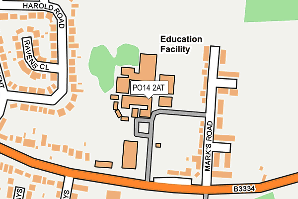
PO14 2AT is located in the Stubbington electoral ward, within the local authority district of Fareham and the English Parliamentary constituency of Gosport. The Sub Integrated Care Board (ICB) Location is NHS Hampshire and Isle of Wight ICB - D9Y0V and the police force is Hampshire. This postcode has been in use since January 1980.


GetTheData
Source: OS OpenMap – Local (Ordnance Survey)
Source: OS VectorMap District (Ordnance Survey)
Licence: Open Government Licence (requires attribution)
| Easting | 456112 |
| Northing | 102881 |
| Latitude | 50.822760 |
| Longitude | -1.204755 |
GetTheData
Source: Open Postcode Geo
Licence: Open Government Licence
| Country | England |
| Postcode District | PO14 |
➜ See where PO14 is on a map ➜ Where is Stubbington? | |
GetTheData
Source: Land Registry Price Paid Data
Licence: Open Government Licence
Elevation or altitude of PO14 2AT as distance above sea level:
| Metres | Feet | |
|---|---|---|
| Elevation | 10m | 33ft |
Elevation is measured from the approximate centre of the postcode, to the nearest point on an OS contour line from OS Terrain 50, which has contour spacing of ten vertical metres.
➜ How high above sea level am I? Find the elevation of your current position using your device's GPS.
GetTheData
Source: Open Postcode Elevation
Licence: Open Government Licence
| Ward | Stubbington |
| Constituency | Gosport |
GetTheData
Source: ONS Postcode Database
Licence: Open Government Licence
| Crofton School (Gosport Road) | Peel Common | 184m |
| Crofton School | Peel Common | 191m |
| Marks Road (Mark's Road) | Peel Common | 248m |
| Marks Road (Gosport Road) | Peel Common | 259m |
| Harold Road (Gosport Road) | Stubbington | 363m |
| Fareham Station | 3.5km |
GetTheData
Source: NaPTAN
Licence: Open Government Licence
GetTheData
Source: ONS Postcode Database
Licence: Open Government Licence


➜ Get more ratings from the Food Standards Agency
GetTheData
Source: Food Standards Agency
Licence: FSA terms & conditions
| Last Collection | |||
|---|---|---|---|
| Location | Mon-Fri | Sat | Distance |
| Marks Road | 17:15 | 12:00 | 189m |
| Harold Road | 17:15 | 12:00 | 370m |
| Queens Crescent | 17:15 | 12:00 | 376m |
GetTheData
Source: Dracos
Licence: Creative Commons Attribution-ShareAlike
The below table lists the International Territorial Level (ITL) codes (formerly Nomenclature of Territorial Units for Statistics (NUTS) codes) and Local Administrative Units (LAU) codes for PO14 2AT:
| ITL 1 Code | Name |
|---|---|
| TLJ | South East (England) |
| ITL 2 Code | Name |
| TLJ3 | Hampshire and Isle of Wight |
| ITL 3 Code | Name |
| TLJ35 | South Hampshire |
| LAU 1 Code | Name |
| E07000087 | Fareham |
GetTheData
Source: ONS Postcode Directory
Licence: Open Government Licence
The below table lists the Census Output Area (OA), Lower Layer Super Output Area (LSOA), and Middle Layer Super Output Area (MSOA) for PO14 2AT:
| Code | Name | |
|---|---|---|
| OA | E00115757 | |
| LSOA | E01032877 | Fareham 013F |
| MSOA | E02004739 | Fareham 013 |
GetTheData
Source: ONS Postcode Directory
Licence: Open Government Licence
| PO14 2AH | Marks Road | 107m |
| PO14 2AD | Marks Road | 151m |
| PO14 2AE | Gosport Road | 157m |
| PO14 2AU | Spencer Court | 199m |
| PO14 2QN | Harold Road | 204m |
| PO14 2QP | Harold Road | 206m |
| PO14 2AF | Gosport Road | 227m |
| PO14 2QW | Ravens Close | 249m |
| PO14 2AN | Gosport Road | 261m |
| PO14 2QL | Queens Crescent | 289m |
GetTheData
Source: Open Postcode Geo; Land Registry Price Paid Data
Licence: Open Government Licence