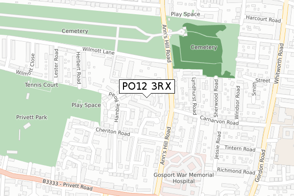
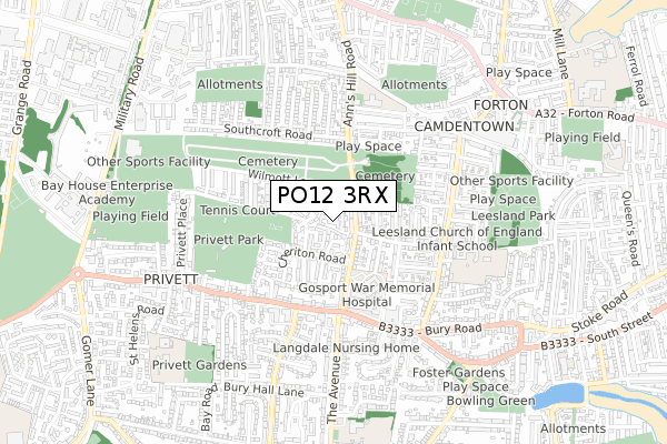
PO12 3RX is located in the Brockhurst & Privett electoral ward, within the local authority district of Gosport and the English Parliamentary constituency of Gosport. The Sub Integrated Care Board (ICB) Location is NHS Hampshire and Isle of Wight ICB - D9Y0V and the police force is Hampshire. This postcode has been in use since October 1984.


GetTheData
Source: OS Open Zoomstack (Ordnance Survey)
Licence: Open Government Licence (requires attribution)
Attribution: Contains OS data © Crown copyright and database right 2025
Source: Open Postcode Geo
Licence: Open Government Licence (requires attribution)
Attribution: Contains OS data © Crown copyright and database right 2025; Contains Royal Mail data © Royal Mail copyright and database right 2025; Source: Office for National Statistics licensed under the Open Government Licence v.3.0
| Easting | 460020 |
| Northing | 99947 |
| Latitude | 50.795988 |
| Longitude | -1.149759 |
GetTheData
Source: Open Postcode Geo
Licence: Open Government Licence
| Country | England |
| Postcode District | PO12 |
➜ See where PO12 is on a map ➜ Where is Gosport? | |
GetTheData
Source: Land Registry Price Paid Data
Licence: Open Government Licence
Elevation or altitude of PO12 3RX as distance above sea level:
| Metres | Feet | |
|---|---|---|
| Elevation | 10m | 33ft |
Elevation is measured from the approximate centre of the postcode, to the nearest point on an OS contour line from OS Terrain 50, which has contour spacing of ten vertical metres.
➜ How high above sea level am I? Find the elevation of your current position using your device's GPS.
GetTheData
Source: Open Postcode Elevation
Licence: Open Government Licence
| Ward | Brockhurst & Privett |
| Constituency | Gosport |
GetTheData
Source: ONS Postcode Database
Licence: Open Government Licence
| Cheriton Road (Ann's Hill Road) | Ann's Hill | 127m |
| Cheriton Road (Ann's Hill Road) | Ann's Hill | 131m |
| Anns Hill Cemetery (Ann's Hill Road) | Ann's Hill | 260m |
| Anns Hill Cemetery (Ann's Hill Road) | Ann's Hill | 273m |
| Jellicoe Avenue | Ann's Hill | 381m |
| Portsmouth Harbour Station | 3km |
| Southsea Hoverport | 3.7km |
| Portsmouth & Southsea Station | 4.2km |
GetTheData
Source: NaPTAN
Licence: Open Government Licence
| Median download speed | 60.0Mbps |
| Average download speed | 46.7Mbps |
| Maximum download speed | 80.00Mbps |
| Median upload speed | 20.0Mbps |
| Average upload speed | 11.8Mbps |
| Maximum upload speed | 20.00Mbps |
GetTheData
Source: Ofcom
Licence: Ofcom Terms of Use (requires attribution)
GetTheData
Source: ONS Postcode Database
Licence: Open Government Licence


➜ Get more ratings from the Food Standards Agency
GetTheData
Source: Food Standards Agency
Licence: FSA terms & conditions
| Last Collection | |||
|---|---|---|---|
| Location | Mon-Fri | Sat | Distance |
| Anns Hill Road | 16:15 | 11:30 | 304m |
| Bury Cross Post Office | 17:00 | 12:00 | 348m |
| Gordon Road | 17:00 | 12:00 | 419m |
GetTheData
Source: Dracos
Licence: Creative Commons Attribution-ShareAlike
The below table lists the International Territorial Level (ITL) codes (formerly Nomenclature of Territorial Units for Statistics (NUTS) codes) and Local Administrative Units (LAU) codes for PO12 3RX:
| ITL 1 Code | Name |
|---|---|
| TLJ | South East (England) |
| ITL 2 Code | Name |
| TLJ3 | Hampshire and Isle of Wight |
| ITL 3 Code | Name |
| TLJ35 | South Hampshire |
| LAU 1 Code | Name |
| E07000088 | Gosport |
GetTheData
Source: ONS Postcode Directory
Licence: Open Government Licence
The below table lists the Census Output Area (OA), Lower Layer Super Output Area (LSOA), and Middle Layer Super Output Area (MSOA) for PO12 3RX:
| Code | Name | |
|---|---|---|
| OA | E00116048 | |
| LSOA | E01022839 | Gosport 007E |
| MSOA | E02004747 | Gosport 007 |
GetTheData
Source: ONS Postcode Directory
Licence: Open Government Licence
| PO12 3RU | Westfield Road | 62m |
| PO12 3TL | Normandy Gardens | 64m |
| PO12 3TW | Dieppe Gardens | 65m |
| PO12 3RE | Anns Hill Road | 91m |
| PO12 3RH | Selborne Gardens | 92m |
| PO12 3RG | Cheriton Road | 120m |
| PO12 3TN | Salerno Drive | 149m |
| PO12 3RF | Anns Hill Road | 149m |
| PO12 3QY | Lyndhurst Road | 152m |
| PO12 3RA | Droxford Close | 158m |
GetTheData
Source: Open Postcode Geo; Land Registry Price Paid Data
Licence: Open Government Licence