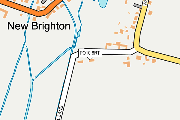
PO10 8RT lies on Mill Lane in Emsworth. PO10 8RT is located in the Westbourne electoral ward, within the local authority district of Chichester and the English Parliamentary constituency of Chichester. The Sub Integrated Care Board (ICB) Location is NHS Sussex ICB - 70F and the police force is Sussex. This postcode has been in use since January 1980.


GetTheData
Source: OS OpenMap – Local (Ordnance Survey)
Source: OS VectorMap District (Ordnance Survey)
Licence: Open Government Licence (requires attribution)
| Easting | 475620 |
| Northing | 107064 |
| Latitude | 50.858144 |
| Longitude | -0.926970 |
GetTheData
Source: Open Postcode Geo
Licence: Open Government Licence
| Street | Mill Lane |
| Town/City | Emsworth |
| Country | England |
| Postcode District | PO10 |
➜ See where PO10 is on a map ➜ Where is Westbourne? | |
GetTheData
Source: Land Registry Price Paid Data
Licence: Open Government Licence
Elevation or altitude of PO10 8RT as distance above sea level:
| Metres | Feet | |
|---|---|---|
| Elevation | 40m | 131ft |
Elevation is measured from the approximate centre of the postcode, to the nearest point on an OS contour line from OS Terrain 50, which has contour spacing of ten vertical metres.
➜ How high above sea level am I? Find the elevation of your current position using your device's GPS.
GetTheData
Source: Open Postcode Elevation
Licence: Open Government Licence
| Ward | Westbourne |
| Constituency | Chichester |
GetTheData
Source: ONS Postcode Database
Licence: Open Government Licence
3, BROOK COTTAGES, MILL LANE, EMSWORTH, PO10 8RT 2004 25 FEB £315,000 |
GetTheData
Source: HM Land Registry Price Paid Data
Licence: Contains HM Land Registry data © Crown copyright and database right 2025. This data is licensed under the Open Government Licence v3.0.
| Mill Lane (Whitechimney Row) | Westbourne | 212m |
| Mill Lane (Whitechimney Row) | Westbourne | 222m |
| Lumley Farm (Old Farm Lane) | Westbourne | 251m |
| Lumley Farm (Old Farm Lane) | Westbourne | 257m |
| The Wren Centre (Westbourne Road) | Emsworth | 275m |
| Emsworth Station | 1.1km |
| Southbourne Station | 1.7km |
| Warblington Station | 2.9km |
GetTheData
Source: NaPTAN
Licence: Open Government Licence
| Percentage of properties with Next Generation Access | 100.0% |
| Percentage of properties with Superfast Broadband | 100.0% |
| Percentage of properties with Ultrafast Broadband | 0.0% |
| Percentage of properties with Full Fibre Broadband | 0.0% |
Superfast Broadband is between 30Mbps and 300Mbps
Ultrafast Broadband is > 300Mbps
| Percentage of properties unable to receive 2Mbps | 0.0% |
| Percentage of properties unable to receive 5Mbps | 0.0% |
| Percentage of properties unable to receive 10Mbps | 0.0% |
| Percentage of properties unable to receive 30Mbps | 0.0% |
GetTheData
Source: Ofcom
Licence: Ofcom Terms of Use (requires attribution)
GetTheData
Source: ONS Postcode Database
Licence: Open Government Licence


➜ Get more ratings from the Food Standards Agency
GetTheData
Source: Food Standards Agency
Licence: FSA terms & conditions
| Last Collection | |||
|---|---|---|---|
| Location | Mon-Fri | Sat | Distance |
| Westbourne Square | 16:45 | 12:15 | 349m |
| Westbourne Avenue | 17:30 | 12:15 | 378m |
| East Street | 16:15 | 12:00 | 431m |
GetTheData
Source: Dracos
Licence: Creative Commons Attribution-ShareAlike
The below table lists the International Territorial Level (ITL) codes (formerly Nomenclature of Territorial Units for Statistics (NUTS) codes) and Local Administrative Units (LAU) codes for PO10 8RT:
| ITL 1 Code | Name |
|---|---|
| TLJ | South East (England) |
| ITL 2 Code | Name |
| TLJ2 | Surrey, East and West Sussex |
| ITL 3 Code | Name |
| TLJ27 | West Sussex (South West) |
| LAU 1 Code | Name |
| E07000225 | Chichester |
GetTheData
Source: ONS Postcode Directory
Licence: Open Government Licence
The below table lists the Census Output Area (OA), Lower Layer Super Output Area (LSOA), and Middle Layer Super Output Area (MSOA) for PO10 8RT:
| Code | Name | |
|---|---|---|
| OA | E00160872 | |
| LSOA | E01031543 | Chichester 007E |
| MSOA | E02006567 | Chichester 007 |
GetTheData
Source: ONS Postcode Directory
Licence: Open Government Licence
| PO10 8UL | Westbourne Road | 199m |
| PO10 8RU | Old Farm Lane | 216m |
| PO10 8RS | White Chimney Row | 261m |
| PO10 8UB | Old Rectory Close | 272m |
| PO10 8UJ | The Grove | 307m |
| PO10 8UH | New Road | 326m |
| PO10 8UA | Church Road | 351m |
| PO10 8FA | Dukes Close | 351m |
| PO10 7QL | Westwood Close | 355m |
| PO10 7RN | Westbourne Road | 382m |
GetTheData
Source: Open Postcode Geo; Land Registry Price Paid Data
Licence: Open Government Licence