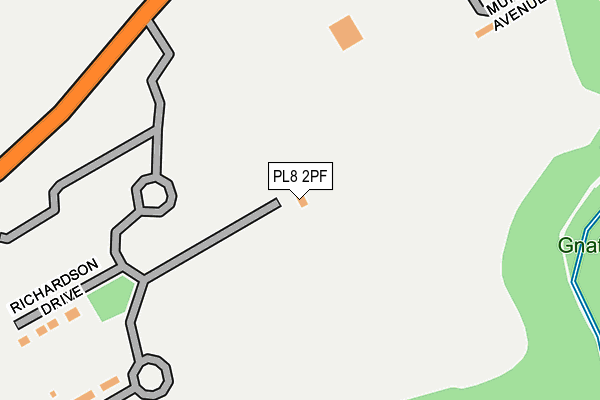
PL8 2PF is located in the Newton & Yealmpton electoral ward, within the local authority district of South Hams and the English Parliamentary constituency of South West Devon. The Sub Integrated Care Board (ICB) Location is NHS Devon ICB - 15N and the police force is Devon & Cornwall. This postcode has been in use since May 2012.


GetTheData
Source: OS OpenMap – Local (Ordnance Survey)
Source: OS VectorMap District (Ordnance Survey)
Licence: Open Government Licence (requires attribution)
| Easting | 256742 |
| Northing | 49304 |
| Latitude | 50.326209 |
| Longitude | -4.013957 |
GetTheData
Source: Open Postcode Geo
Licence: Open Government Licence
| Country | England |
| Postcode District | PL8 |
➜ See where PL8 is on a map | |
GetTheData
Source: Land Registry Price Paid Data
Licence: Open Government Licence
Elevation or altitude of PL8 2PF as distance above sea level:
| Metres | Feet | |
|---|---|---|
| Elevation | 90m | 295ft |
Elevation is measured from the approximate centre of the postcode, to the nearest point on an OS contour line from OS Terrain 50, which has contour spacing of ten vertical metres.
➜ How high above sea level am I? Find the elevation of your current position using your device's GPS.
GetTheData
Source: Open Postcode Elevation
Licence: Open Government Licence
| Ward | Newton & Yealmpton |
| Constituency | South West Devon |
GetTheData
Source: ONS Postcode Database
Licence: Open Government Licence
| Raf Houses (B3186) | Newton Ferrers | 247m |
| Raf Houses (B3186) | Newton Ferrers | 252m |
| Collaton Cross (B3186) | Newton Ferrers | 408m |
| Collaton Cross (B3186) | Newton Ferrers | 409m |
| Butts Park | Newton Ferrers | 1,210m |
GetTheData
Source: NaPTAN
Licence: Open Government Licence
GetTheData
Source: ONS Postcode Database
Licence: Open Government Licence
| Last Collection | |||
|---|---|---|---|
| Location | Mon-Fri | Sat | Distance |
| The Brook | 16:30 | 10:15 | 2,356m |
| Yealmpton Post Office | 16:45 | 10:40 | 2,747m |
| Brixton Post Office | 17:00 | 10:45 | 3,160m |
GetTheData
Source: Dracos
Licence: Creative Commons Attribution-ShareAlike
The below table lists the International Territorial Level (ITL) codes (formerly Nomenclature of Territorial Units for Statistics (NUTS) codes) and Local Administrative Units (LAU) codes for PL8 2PF:
| ITL 1 Code | Name |
|---|---|
| TLK | South West (England) |
| ITL 2 Code | Name |
| TLK4 | Devon |
| ITL 3 Code | Name |
| TLK43 | Devon CC |
| LAU 1 Code | Name |
| E07000044 | South Hams |
GetTheData
Source: ONS Postcode Directory
Licence: Open Government Licence
The below table lists the Census Output Area (OA), Lower Layer Super Output Area (LSOA), and Middle Layer Super Output Area (MSOA) for PL8 2PF:
| Code | Name | |
|---|---|---|
| OA | E00102162 | |
| LSOA | E01020171 | South Hams 009A |
| MSOA | E02004197 | South Hams 009 |
GetTheData
Source: ONS Postcode Directory
Licence: Open Government Licence
| PL8 2NQ | Munro Avenue | 276m |
| PL8 2NJ | Richardson Drive | 277m |
| PL8 2NH | Livingstone Avenue | 290m |
| PL8 2NG | Fell Close | 328m |
| PL8 2NF | Whittingham Road | 372m |
| PL8 1HX | 841m | |
| PL8 2NL | 877m | |
| PL8 1HT | 1134m | |
| PL8 1HZ | Perches Close | 1183m |
| PL8 1HS | 1234m |
GetTheData
Source: Open Postcode Geo; Land Registry Price Paid Data
Licence: Open Government Licence