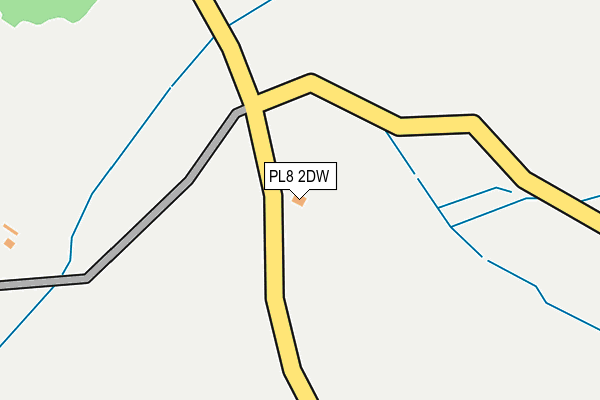
PL8 2DW is located in the Wembury & Brixton electoral ward, within the local authority district of South Hams and the English Parliamentary constituency of South West Devon. The Sub Integrated Care Board (ICB) Location is NHS Devon ICB - 15N and the police force is Devon & Cornwall. This postcode has been in use since January 1980.


GetTheData
Source: OS OpenMap – Local (Ordnance Survey)
Source: OS VectorMap District (Ordnance Survey)
Licence: Open Government Licence (requires attribution)
| Easting | 255190 |
| Northing | 53495 |
| Latitude | 50.363481 |
| Longitude | -4.037385 |
GetTheData
Source: Open Postcode Geo
Licence: Open Government Licence
| Country | England |
| Postcode District | PL8 |
➜ See where PL8 is on a map ➜ Where is Sherford? | |
GetTheData
Source: Land Registry Price Paid Data
Licence: Open Government Licence
Elevation or altitude of PL8 2DW as distance above sea level:
| Metres | Feet | |
|---|---|---|
| Elevation | 40m | 131ft |
Elevation is measured from the approximate centre of the postcode, to the nearest point on an OS contour line from OS Terrain 50, which has contour spacing of ten vertical metres.
➜ How high above sea level am I? Find the elevation of your current position using your device's GPS.
GetTheData
Source: Open Postcode Elevation
Licence: Open Government Licence
| Ward | Wembury & Brixton |
| Constituency | South West Devon |
GetTheData
Source: ONS Postcode Database
Licence: Open Government Licence
| Candish Drive East (Candish Drive) | Elburton | 1,186m |
| Brookwood Road | Elburton | 1,292m |
| Brookwood Road (Sherford Road) | Elburton | 1,316m |
| Brookwood Road (Sherford Road) | Elburton | 1,339m |
| Candish Drive | Elburton | 1,349m |
GetTheData
Source: NaPTAN
Licence: Open Government Licence
| Percentage of properties with Next Generation Access | 100.0% |
| Percentage of properties with Superfast Broadband | 0.0% |
| Percentage of properties with Ultrafast Broadband | 0.0% |
| Percentage of properties with Full Fibre Broadband | 0.0% |
Superfast Broadband is between 30Mbps and 300Mbps
Ultrafast Broadband is > 300Mbps
| Percentage of properties unable to receive 2Mbps | 0.0% |
| Percentage of properties unable to receive 5Mbps | 0.0% |
| Percentage of properties unable to receive 10Mbps | 0.0% |
| Percentage of properties unable to receive 30Mbps | 100.0% |
GetTheData
Source: Ofcom
Licence: Ofcom Terms of Use (requires attribution)
GetTheData
Source: ONS Postcode Database
Licence: Open Government Licence


➜ Get more ratings from the Food Standards Agency
GetTheData
Source: Food Standards Agency
Licence: FSA terms & conditions
| Last Collection | |||
|---|---|---|---|
| Location | Mon-Fri | Sat | Distance |
| Brixton Post Office | 17:00 | 10:45 | 1,354m |
| Elburton Post Office | 17:00 | 12:00 | 2,066m |
| Reservoir Road | 17:00 | 12:45 | 2,290m |
GetTheData
Source: Dracos
Licence: Creative Commons Attribution-ShareAlike
The below table lists the International Territorial Level (ITL) codes (formerly Nomenclature of Territorial Units for Statistics (NUTS) codes) and Local Administrative Units (LAU) codes for PL8 2DW:
| ITL 1 Code | Name |
|---|---|
| TLK | South West (England) |
| ITL 2 Code | Name |
| TLK4 | Devon |
| ITL 3 Code | Name |
| TLK43 | Devon CC |
| LAU 1 Code | Name |
| E07000044 | South Hams |
GetTheData
Source: ONS Postcode Directory
Licence: Open Government Licence
The below table lists the Census Output Area (OA), Lower Layer Super Output Area (LSOA), and Middle Layer Super Output Area (MSOA) for PL8 2DW:
| Code | Name | |
|---|---|---|
| OA | E00165894 | |
| LSOA | E01020187 | South Hams 009D |
| MSOA | E02004197 | South Hams 009 |
GetTheData
Source: ONS Postcode Directory
Licence: Open Government Licence
| PL8 2DL | 713m | |
| PL8 2DB | Stamps Hill | 1092m |
| PL9 8BG | Sherford Road | 1123m |
| PL9 8BB | Sherford Walk | 1148m |
| PL8 2BZ | Tapps Lane | 1152m |
| PL7 5AB | 1169m | |
| PL9 8BL | Hazelwood Crescent | 1195m |
| PL8 2DD | Cherry Tree Drive | 1201m |
| PL9 8BJ | Sherford Road | 1245m |
| PL9 8BW | Sherford Road | 1258m |
GetTheData
Source: Open Postcode Geo; Land Registry Price Paid Data
Licence: Open Government Licence