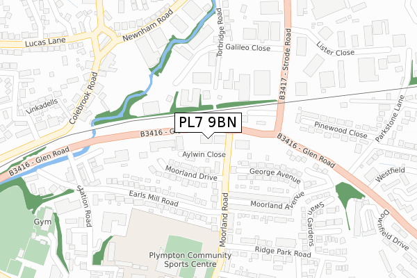
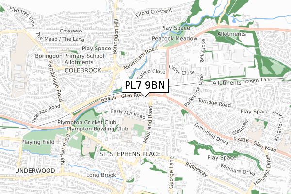
PL7 9BN is located in the Plympton St Mary electoral ward, within the unitary authority of Plymouth and the English Parliamentary constituency of South West Devon. The Sub Integrated Care Board (ICB) Location is NHS Devon ICB - 15N and the police force is Devon & Cornwall. This postcode has been in use since June 2019.


GetTheData
Source: OS Open Zoomstack (Ordnance Survey)
Licence: Open Government Licence (requires attribution)
Attribution: Contains OS data © Crown copyright and database right 2024
Source: Open Postcode Geo
Licence: Open Government Licence (requires attribution)
Attribution: Contains OS data © Crown copyright and database right 2024; Contains Royal Mail data © Royal Mail copyright and database right 2024; Source: Office for National Statistics licensed under the Open Government Licence v.3.0
| Easting | 254366 |
| Northing | 56673 |
| Latitude | 50.391841 |
| Longitude | -4.050193 |
GetTheData
Source: Open Postcode Geo
Licence: Open Government Licence
| Country | England |
| Postcode District | PL7 |
| ➜ PL7 open data dashboard ➜ See where PL7 is on a map ➜ Where is Plymouth? | |
GetTheData
Source: Land Registry Price Paid Data
Licence: Open Government Licence
| Ward | Plympton St Mary |
| Constituency | South West Devon |
GetTheData
Source: ONS Postcode Database
Licence: Open Government Licence
| June 2022 | Anti-social behaviour | On or near George Avenue | 170m |
| June 2022 | Violence and sexual offences | On or near Torbridge Road | 251m |
| June 2022 | Violence and sexual offences | On or near Torbridge Road | 251m |
| ➜ Get more crime data in our Crime section | |||
GetTheData
Source: data.police.uk
Licence: Open Government Licence
| Glenside Surgey | Plympton | 100m |
| Lord Louis (Glen Road) | Plympton | 102m |
| Moorland Avenue (Moorland Road) | Plympton | 170m |
| Ridge Park Road (Moorland Road) | Plympton | 235m |
| Newnham Road | Woodford | 311m |
GetTheData
Source: NaPTAN
Licence: Open Government Licence
GetTheData
Source: ONS Postcode Database
Licence: Open Government Licence


➜ Get more ratings from the Food Standards Agency
GetTheData
Source: Food Standards Agency
Licence: FSA terms & conditions
| Last Collection | |||
|---|---|---|---|
| Location | Mon-Fri | Sat | Distance |
| Westfield | 17:15 | 10:45 | 709m |
| Hemerdon | 16:30 | 07:10 | 1,179m |
| Longbridge Road | 19:00 | 3,425m | |
GetTheData
Source: Dracos
Licence: Creative Commons Attribution-ShareAlike
| Facility | Distance |
|---|---|
| Westcountry Squash And Fitness Centre (Closed) Aylwin Close, Plympton, Plymouth Health and Fitness Gym, Studio, Squash Courts | 9m |
| Plympton Academy Moorland Road, Plymouth Sports Hall, Health and Fitness Gym, Grass Pitches, Artificial Grass Pitch | 392m |
| Euphoria Health And Fitness (Closed) Lister Close, Newnham Industrial Estate, Plympton, Plymouth Health and Fitness Gym, Studio | 411m |
GetTheData
Source: Active Places
Licence: Open Government Licence
| School | Phase of Education | Distance |
|---|---|---|
| Plympton Academy Moorland Road, Plympton, Plymouth, PL7 2RS | Secondary | 386m |
| Old Priory Junior Academy Ridgeway, Plympton, Plymouth, PL7 1QN | Primary | 637m |
| Boringdon Primary School Courtland Crescent, Plympton, Plymouth, PL7 4HJ | Primary | 770m |
GetTheData
Source: Edubase
Licence: Open Government Licence
| Risk of PL7 9BN flooding from rivers and sea | Low |
| ➜ PL7 9BN flood map | |
GetTheData
Source: Open Flood Risk by Postcode
Licence: Open Government Licence
The below table lists the International Territorial Level (ITL) codes (formerly Nomenclature of Territorial Units for Statistics (NUTS) codes) and Local Administrative Units (LAU) codes for PL7 9BN:
| ITL 1 Code | Name |
|---|---|
| TLK | South West (England) |
| ITL 2 Code | Name |
| TLK4 | Devon |
| ITL 3 Code | Name |
| TLK41 | Plymouth |
| LAU 1 Code | Name |
| E06000026 | Plymouth |
GetTheData
Source: ONS Postcode Directory
Licence: Open Government Licence
The below table lists the Census Output Area (OA), Lower Layer Super Output Area (LSOA), and Middle Layer Super Output Area (MSOA) for PL7 9BN:
| Code | Name | |
|---|---|---|
| OA | E00076384 | |
| LSOA | E01015124 | Plymouth 015D |
| MSOA | E02003136 | Plymouth 015 |
GetTheData
Source: ONS Postcode Directory
Licence: Open Government Licence
| PL7 2BZ | Moorland Drive | 107m |
| PL7 2BY | Moorland Drive | 112m |
| PL7 2BL | Moorland Road | 139m |
| PL7 2DB | George Avenue | 173m |
| PL7 2BU | Earls Mill Road | 188m |
| PL7 2DA | Moorland Avenue | 191m |
| PL7 2BJ | Moorland Road | 211m |
| PL7 2FP | Moorland Gardens | 237m |
| PL7 2BX | Earls Mill Road | 239m |
| PL7 4AX | Torbridge Road | 273m |
GetTheData
Source: Open Postcode Geo; Land Registry Price Paid Data
Licence: Open Government Licence