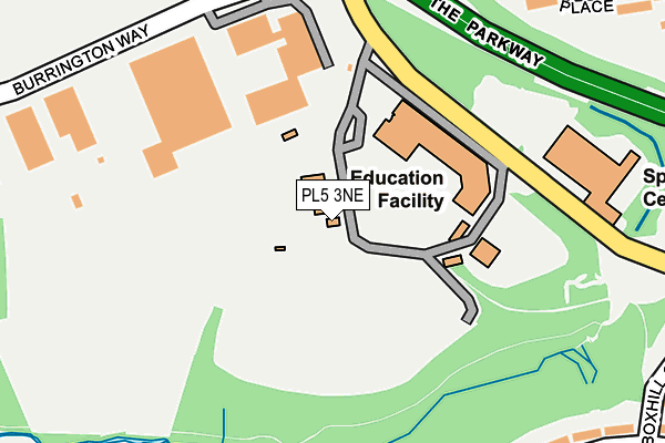
PL5 3NE is located in the Ham electoral ward, within the unitary authority of Plymouth and the English Parliamentary constituency of Plymouth, Moor View. The Sub Integrated Care Board (ICB) Location is NHS Devon ICB - 15N and the police force is Devon & Cornwall. This postcode has been in use since January 1980.


GetTheData
Source: OS OpenMap – Local (Ordnance Survey)
Source: OS VectorMap District (Ordnance Survey)
Licence: Open Government Licence (requires attribution)
| Easting | 246789 |
| Northing | 58032 |
| Latitude | 50.402127 |
| Longitude | -4.157267 |
GetTheData
Source: Open Postcode Geo
Licence: Open Government Licence
| Country | England |
| Postcode District | PL5 |
➜ See where PL5 is on a map ➜ Where is Plymouth? | |
GetTheData
Source: Land Registry Price Paid Data
Licence: Open Government Licence
Elevation or altitude of PL5 3NE as distance above sea level:
| Metres | Feet | |
|---|---|---|
| Elevation | 50m | 164ft |
Elevation is measured from the approximate centre of the postcode, to the nearest point on an OS contour line from OS Terrain 50, which has contour spacing of ten vertical metres.
➜ How high above sea level am I? Find the elevation of your current position using your device's GPS.
GetTheData
Source: Open Postcode Elevation
Licence: Open Government Licence
| Ward | Ham |
| Constituency | Plymouth, Moor View |
GetTheData
Source: ONS Postcode Database
Licence: Open Government Licence
| John Kitto Comm Coll Grounds | Honicknowle | 90m |
| All Saints C Of E Academy (Honicknowle Lane) | Honicknowle | 143m |
| All Saints C Of E Academy | Honicknowle | 156m |
| Kitto Centre (Honicknowle Lane) | Pennycross | 267m |
| Kitto Centre (Honicknowle Lane) | Pennycross | 279m |
| Keyham Station | 2.1km |
| St Budeaux Ferry Road Station | 2.1km |
| St Budeaux Victoria Road Station | 2.1km |
GetTheData
Source: NaPTAN
Licence: Open Government Licence
GetTheData
Source: ONS Postcode Database
Licence: Open Government Licence


➜ Get more ratings from the Food Standards Agency
GetTheData
Source: Food Standards Agency
Licence: FSA terms & conditions
| Last Collection | |||
|---|---|---|---|
| Location | Mon-Fri | Sat | Distance |
| Treveneague Gardens | 17:15 | 12:45 | 1,027m |
| Burnham Park Road | 17:30 | 12:15 | 1,506m |
| Venn Grove | 17:30 | 12:30 | 1,536m |
GetTheData
Source: Dracos
Licence: Creative Commons Attribution-ShareAlike
The below table lists the International Territorial Level (ITL) codes (formerly Nomenclature of Territorial Units for Statistics (NUTS) codes) and Local Administrative Units (LAU) codes for PL5 3NE:
| ITL 1 Code | Name |
|---|---|
| TLK | South West (England) |
| ITL 2 Code | Name |
| TLK4 | Devon |
| ITL 3 Code | Name |
| TLK41 | Plymouth |
| LAU 1 Code | Name |
| E06000026 | Plymouth |
GetTheData
Source: ONS Postcode Directory
Licence: Open Government Licence
The below table lists the Census Output Area (OA), Lower Layer Super Output Area (LSOA), and Middle Layer Super Output Area (MSOA) for PL5 3NE:
| Code | Name | |
|---|---|---|
| OA | E00076151 | |
| LSOA | E01015074 | Plymouth 011A |
| MSOA | E02003132 | Plymouth 011 |
GetTheData
Source: ONS Postcode Directory
Licence: Open Government Licence
| PL5 3LR | Burrington Way | 250m |
| PL2 3RE | Fountains Crescent | 282m |
| PL5 3ER | Tyndale Close | 289m |
| PL5 3LS | Walkham Business Park | 300m |
| PL2 3RD | Fountains Crescent | 308m |
| PL5 3ET | Coverdale Place | 325m |
| PL2 3RJ | Melrose Avenue | 350m |
| PL5 3EG | Chaucer Way | 351m |
| PL2 3RF | Boxhill Gardens | 354m |
| PL5 3HU | Masefield Gardens | 364m |
GetTheData
Source: Open Postcode Geo; Land Registry Price Paid Data
Licence: Open Government Licence