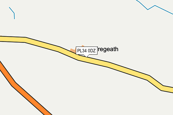
PL34 0DZ is located in the St Teath & Tintagel electoral ward, within the unitary authority of Cornwall and the English Parliamentary constituency of North Cornwall. The Sub Integrated Care Board (ICB) Location is NHS Cornwall and the Isles of Scilly ICB - 11N and the police force is Devon & Cornwall. This postcode has been in use since January 1980.


GetTheData
Source: OS OpenMap – Local (Ordnance Survey)
Source: OS VectorMap District (Ordnance Survey)
Licence: Open Government Licence (requires attribution)
| Easting | 206103 |
| Northing | 87267 |
| Latitude | 50.652731 |
| Longitude | -4.744325 |
GetTheData
Source: Open Postcode Geo
Licence: Open Government Licence
| Country | England |
| Postcode District | PL34 |
➜ See where PL34 is on a map | |
GetTheData
Source: Land Registry Price Paid Data
Licence: Open Government Licence
Elevation or altitude of PL34 0DZ as distance above sea level:
| Metres | Feet | |
|---|---|---|
| Elevation | 120m | 394ft |
Elevation is measured from the approximate centre of the postcode, to the nearest point on an OS contour line from OS Terrain 50, which has contour spacing of ten vertical metres.
➜ How high above sea level am I? Find the elevation of your current position using your device's GPS.
GetTheData
Source: Open Postcode Elevation
Licence: Open Government Licence
| Ward | St Teath & Tintagel |
| Constituency | North Cornwall |
GetTheData
Source: ONS Postcode Database
Licence: Open Government Licence
| Sea View Farm | Trewarmett | 419m |
| Sea View Farm (B3263) | Trewarmett | 426m |
| Bus Shelter (B3263) | Tregatta | 548m |
| Bus Shelter (B32263) | Tregatta | 556m |
| Tintagel School | Treven | 640m |
GetTheData
Source: NaPTAN
Licence: Open Government Licence
GetTheData
Source: ONS Postcode Database
Licence: Open Government Licence


➜ Get more ratings from the Food Standards Agency
GetTheData
Source: Food Standards Agency
Licence: FSA terms & conditions
| Last Collection | |||
|---|---|---|---|
| Location | Mon-Fri | Sat | Distance |
| Village West (Tintagel) | 16:00 | 10:15 | 1,640m |
| Trevalga | 16:40 | 11:30 | 3,417m |
| Tredorn | 16:20 | 11:45 | 4,781m |
GetTheData
Source: Dracos
Licence: Creative Commons Attribution-ShareAlike
The below table lists the International Territorial Level (ITL) codes (formerly Nomenclature of Territorial Units for Statistics (NUTS) codes) and Local Administrative Units (LAU) codes for PL34 0DZ:
| ITL 1 Code | Name |
|---|---|
| TLK | South West (England) |
| ITL 2 Code | Name |
| TLK3 | Cornwall and Isles of Scilly |
| ITL 3 Code | Name |
| TLK30 | Cornwall and Isles of Scilly |
| LAU 1 Code | Name |
| E06000052 | Cornwall |
GetTheData
Source: ONS Postcode Directory
Licence: Open Government Licence
The below table lists the Census Output Area (OA), Lower Layer Super Output Area (LSOA), and Middle Layer Super Output Area (MSOA) for PL34 0DZ:
| Code | Name | |
|---|---|---|
| OA | E00095657 | |
| LSOA | E01018941 | Cornwall 003B |
| MSOA | E02003933 | Cornwall 003 |
GetTheData
Source: ONS Postcode Directory
Licence: Open Government Licence
| PL34 0DY | 526m | |
| PL34 0EH | Palmers Terrace | 527m |
| PL34 0EJ | 587m | |
| PL34 0DX | 632m | |
| PL34 0DT | 643m | |
| PL34 0EN | 649m | |
| PL34 0DU | 656m | |
| PL34 0EL | Atlantic Close | 678m |
| PL34 0EW | Trelake Lane | 697m |
| PL34 0ES | 765m |
GetTheData
Source: Open Postcode Geo; Land Registry Price Paid Data
Licence: Open Government Licence