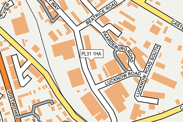
PL31 1HA lies on Normandy Way in Bodmin. PL31 1HA is located in the Bodmin St Petroc's electoral ward, within the unitary authority of Cornwall and the English Parliamentary constituency of North Cornwall. The Sub Integrated Care Board (ICB) Location is NHS Cornwall and the Isles of Scilly ICB - 11N and the police force is Devon & Cornwall. This postcode has been in use since January 1980.


GetTheData
Source: OS OpenMap – Local (Ordnance Survey)
Source: OS VectorMap District (Ordnance Survey)
Licence: Open Government Licence (requires attribution)
| Easting | 208058 |
| Northing | 65585 |
| Latitude | 50.458602 |
| Longitude | -4.705561 |
GetTheData
Source: Open Postcode Geo
Licence: Open Government Licence
| Street | Normandy Way |
| Town/City | Bodmin |
| Country | England |
| Postcode District | PL31 |
➜ See where PL31 is on a map ➜ Where is Bodmin? | |
GetTheData
Source: Land Registry Price Paid Data
Licence: Open Government Licence
Elevation or altitude of PL31 1HA as distance above sea level:
| Metres | Feet | |
|---|---|---|
| Elevation | 130m | 427ft |
Elevation is measured from the approximate centre of the postcode, to the nearest point on an OS contour line from OS Terrain 50, which has contour spacing of ten vertical metres.
➜ How high above sea level am I? Find the elevation of your current position using your device's GPS.
GetTheData
Source: Open Postcode Elevation
Licence: Open Government Licence
| Ward | Bodmin St Petroc's |
| Constituency | North Cornwall |
GetTheData
Source: ONS Postcode Database
Licence: Open Government Licence
| Normandy Way (Lucknow Road) | Bodmin | 42m |
| Normandy Way | Bodmin | 100m |
| Roman Drive | Bodmin | 230m |
| Roman Drive | Bodmin | 233m |
| Dragon Leisure Centre (Lostwithiel Road) | Bodmin | 379m |
| Bodmin General (Bodmin & Wenford Railway) | Bodmin | 1,071m |
| Bodmin Parkway Station | 3.3km |
GetTheData
Source: NaPTAN
Licence: Open Government Licence
GetTheData
Source: ONS Postcode Database
Licence: Open Government Licence


➜ Get more ratings from the Food Standards Agency
GetTheData
Source: Food Standards Agency
Licence: FSA terms & conditions
| Last Collection | |||
|---|---|---|---|
| Location | Mon-Fri | Sat | Distance |
| College Green | 17:00 | 11:15 | 565m |
| Bodmin Delivery Office | 17:45 | 12:30 | 1,585m |
| Midland Bank | 17:20 | 11:20 | 1,674m |
GetTheData
Source: Dracos
Licence: Creative Commons Attribution-ShareAlike
The below table lists the International Territorial Level (ITL) codes (formerly Nomenclature of Territorial Units for Statistics (NUTS) codes) and Local Administrative Units (LAU) codes for PL31 1HA:
| ITL 1 Code | Name |
|---|---|
| TLK | South West (England) |
| ITL 2 Code | Name |
| TLK3 | Cornwall and Isles of Scilly |
| ITL 3 Code | Name |
| TLK30 | Cornwall and Isles of Scilly |
| LAU 1 Code | Name |
| E06000052 | Cornwall |
GetTheData
Source: ONS Postcode Directory
Licence: Open Government Licence
The below table lists the Census Output Area (OA), Lower Layer Super Output Area (LSOA), and Middle Layer Super Output Area (MSOA) for PL31 1HA:
| Code | Name | |
|---|---|---|
| OA | E00095617 | |
| LSOA | E01018934 | Cornwall 014C |
| MSOA | E02003941 | Cornwall 014 |
GetTheData
Source: ONS Postcode Directory
Licence: Open Government Licence
| PL31 1EY | Paardeberg Road | 111m |
| PL31 1EZ | 190m | |
| PL31 1EX | Normandy Way | 199m |
| PL31 1EW | Beatrice Road | 204m |
| PL31 1DQ | Respryn Road | 229m |
| PL31 1EL | Roman Drive | 245m |
| PL31 1DN | Grass Valley Park | 246m |
| PL31 1EN | Roman Drive | 269m |
| PL31 1HB | Castle Canyke Road | 277m |
| PL31 1GD | Tryelyn | 294m |
GetTheData
Source: Open Postcode Geo; Land Registry Price Paid Data
Licence: Open Government Licence