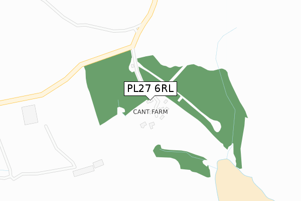
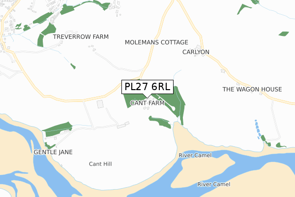
PL27 6RL is in St Minver, Wadebridge. PL27 6RL is located in the Wadebridge East & St Minver electoral ward, within the unitary authority of Cornwall and the English Parliamentary constituency of North Cornwall. The Sub Integrated Care Board (ICB) Location is NHS Cornwall and the Isles of Scilly ICB - 11N and the police force is Devon & Cornwall. This postcode has been in use since January 1980.


GetTheData
Source: OS Open Zoomstack (Ordnance Survey)
Licence: Open Government Licence (requires attribution)
Attribution: Contains OS data © Crown copyright and database right 2025
Source: Open Postcode Geo
Licence: Open Government Licence (requires attribution)
Attribution: Contains OS data © Crown copyright and database right 2025; Contains Royal Mail data © Royal Mail copyright and database right 2025; Source: Office for National Statistics licensed under the Open Government Licence v.3.0
| Easting | 195048 |
| Northing | 74904 |
| Latitude | 50.537909 |
| Longitude | -4.893686 |
GetTheData
Source: Open Postcode Geo
Licence: Open Government Licence
| Locality | St Minver |
| Town/City | Wadebridge |
| Country | England |
| Postcode District | PL27 |
➜ See where PL27 is on a map | |
GetTheData
Source: Land Registry Price Paid Data
Licence: Open Government Licence
Elevation or altitude of PL27 6RL as distance above sea level:
| Metres | Feet | |
|---|---|---|
| Elevation | 40m | 131ft |
Elevation is measured from the approximate centre of the postcode, to the nearest point on an OS contour line from OS Terrain 50, which has contour spacing of ten vertical metres.
➜ How high above sea level am I? Find the elevation of your current position using your device's GPS.
GetTheData
Source: Open Postcode Elevation
Licence: Open Government Licence
| Ward | Wadebridge East & St Minver |
| Constituency | North Cornwall |
GetTheData
Source: ONS Postcode Database
Licence: Open Government Licence
| Clock Garage (Rock Road) | Rock | 1,435m |
| Clock Garage (Rock Road) | Rock | 1,457m |
| Spar (Rock Road) | Rock | 1,491m |
| Spar (Rock Road) | Rock | 1,509m |
| Rock Villas (Rock Road) | Rock | 1,586m |
GetTheData
Source: NaPTAN
Licence: Open Government Licence
| Percentage of properties with Next Generation Access | 100.0% |
| Percentage of properties with Superfast Broadband | 0.0% |
| Percentage of properties with Ultrafast Broadband | 0.0% |
| Percentage of properties with Full Fibre Broadband | 0.0% |
Superfast Broadband is between 30Mbps and 300Mbps
Ultrafast Broadband is > 300Mbps
| Median download speed | 3.5Mbps |
| Average download speed | 3.9Mbps |
| Maximum download speed | 5.93Mbps |
| Median upload speed | 0.6Mbps |
| Average upload speed | 0.7Mbps |
| Maximum upload speed | 1.17Mbps |
| Percentage of properties unable to receive 2Mbps | 0.0% |
| Percentage of properties unable to receive 5Mbps | 0.0% |
| Percentage of properties unable to receive 10Mbps | 50.0% |
| Percentage of properties unable to receive 30Mbps | 100.0% |
GetTheData
Source: Ofcom
Licence: Ofcom Terms of Use (requires attribution)
GetTheData
Source: ONS Postcode Database
Licence: Open Government Licence


➜ Get more ratings from the Food Standards Agency
GetTheData
Source: Food Standards Agency
Licence: FSA terms & conditions
| Last Collection | |||
|---|---|---|---|
| Location | Mon-Fri | Sat | Distance |
| Station Road | 17:00 | 11:15 | 3,180m |
| Whitecross | 17:30 | 11:10 | 3,194m |
| Padstow Post Office | 17:30 | 11:45 | 3,240m |
GetTheData
Source: Dracos
Licence: Creative Commons Attribution-ShareAlike
The below table lists the International Territorial Level (ITL) codes (formerly Nomenclature of Territorial Units for Statistics (NUTS) codes) and Local Administrative Units (LAU) codes for PL27 6RL:
| ITL 1 Code | Name |
|---|---|
| TLK | South West (England) |
| ITL 2 Code | Name |
| TLK3 | Cornwall and Isles of Scilly |
| ITL 3 Code | Name |
| TLK30 | Cornwall and Isles of Scilly |
| LAU 1 Code | Name |
| E06000052 | Cornwall |
GetTheData
Source: ONS Postcode Directory
Licence: Open Government Licence
The below table lists the Census Output Area (OA), Lower Layer Super Output Area (LSOA), and Middle Layer Super Output Area (MSOA) for PL27 6RL:
| Code | Name | |
|---|---|---|
| OA | E00095774 | |
| LSOA | E01033289 | Cornwall 007E |
| MSOA | E02003937 | Cornwall 007 |
GetTheData
Source: ONS Postcode Directory
Licence: Open Government Licence
| PL27 6RJ | 779m | |
| PL27 6JY | 1024m | |
| PL27 6NF | 1024m | |
| PL27 6NA | Lower Greenbanks | 1129m |
| PL27 6ND | Little Trelyn | 1153m |
| PL27 6NE | 1176m | |
| PL27 6LQ | 1180m | |
| PL27 6NQ | 1214m | |
| PL27 6LX | Shores Lane | 1218m |
| PL27 6NB | Greenbanks Road | 1222m |
GetTheData
Source: Open Postcode Geo; Land Registry Price Paid Data
Licence: Open Government Licence