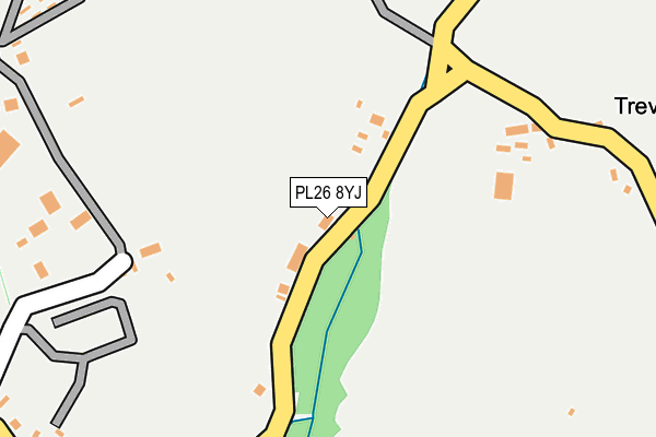
PL26 8YJ is in Carbis Moor, St. Austell. PL26 8YJ is located in the Penwithick & Boscoppa electoral ward, within the unitary authority of Cornwall and the English Parliamentary constituency of St Austell and Newquay. The Sub Integrated Care Board (ICB) Location is NHS Cornwall and the Isles of Scilly ICB - 11N and the police force is Devon & Cornwall. This postcode has been in use since January 1980.


GetTheData
Source: OS OpenMap – Local (Ordnance Survey)
Source: OS VectorMap District (Ordnance Survey)
Licence: Open Government Licence (requires attribution)
| Easting | 203092 |
| Northing | 56536 |
| Latitude | 50.375683 |
| Longitude | -4.770649 |
GetTheData
Source: Open Postcode Geo
Licence: Open Government Licence
| Locality | Carbis Moor |
| Town/City | St. Austell |
| Country | England |
| Postcode District | PL26 |
➜ See where PL26 is on a map | |
GetTheData
Source: Land Registry Price Paid Data
Licence: Open Government Licence
Elevation or altitude of PL26 8YJ as distance above sea level:
| Metres | Feet | |
|---|---|---|
| Elevation | 150m | 492ft |
Elevation is measured from the approximate centre of the postcode, to the nearest point on an OS contour line from OS Terrain 50, which has contour spacing of ten vertical metres.
➜ How high above sea level am I? Find the elevation of your current position using your device's GPS.
GetTheData
Source: Open Postcode Elevation
Licence: Open Government Licence
| Ward | Penwithick & Boscoppa |
| Constituency | St Austell And Newquay |
GetTheData
Source: ONS Postcode Database
Licence: Open Government Licence
| Bodmin Blocks (B3374) | Resugga Green | 616m |
| Bodmin Blocks (B3374) | Resugga Green | 640m |
| Penwithick Road (Penwithhick Road) | Penwithick | 773m |
| Penwithick Road (Penwithhick Road) | Penwithick | 786m |
| Pengrowyn (Penwithick Road) | Penwithick | 847m |
| Luxulyan Station | 2.3km |
| Bugle Station | 3.1km |
| St Austell Station | 4.2km |
GetTheData
Source: NaPTAN
Licence: Open Government Licence
| Percentage of properties with Next Generation Access | 100.0% |
| Percentage of properties with Superfast Broadband | 85.7% |
| Percentage of properties with Ultrafast Broadband | 0.0% |
| Percentage of properties with Full Fibre Broadband | 0.0% |
Superfast Broadband is between 30Mbps and 300Mbps
Ultrafast Broadband is > 300Mbps
| Median download speed | 31.2Mbps |
| Average download speed | 31.7Mbps |
| Maximum download speed | 39.06Mbps |
| Median upload speed | 4.1Mbps |
| Average upload speed | 5.1Mbps |
| Maximum upload speed | 7.12Mbps |
| Percentage of properties unable to receive 2Mbps | 0.0% |
| Percentage of properties unable to receive 5Mbps | 0.0% |
| Percentage of properties unable to receive 10Mbps | 0.0% |
| Percentage of properties unable to receive 30Mbps | 14.3% |
GetTheData
Source: Ofcom
Licence: Ofcom Terms of Use (requires attribution)
GetTheData
Source: ONS Postcode Database
Licence: Open Government Licence


➜ Get more ratings from the Food Standards Agency
GetTheData
Source: Food Standards Agency
Licence: FSA terms & conditions
| Last Collection | |||
|---|---|---|---|
| Location | Mon-Fri | Sat | Distance |
| Penwithick Park | 16:00 | 09:30 | 418m |
| Carloggas | 16:00 | 10:00 | 621m |
| Penwithick Post Office | 16:00 | 10:30 | 769m |
GetTheData
Source: Dracos
Licence: Creative Commons Attribution-ShareAlike
The below table lists the International Territorial Level (ITL) codes (formerly Nomenclature of Territorial Units for Statistics (NUTS) codes) and Local Administrative Units (LAU) codes for PL26 8YJ:
| ITL 1 Code | Name |
|---|---|
| TLK | South West (England) |
| ITL 2 Code | Name |
| TLK3 | Cornwall and Isles of Scilly |
| ITL 3 Code | Name |
| TLK30 | Cornwall and Isles of Scilly |
| LAU 1 Code | Name |
| E06000052 | Cornwall |
GetTheData
Source: ONS Postcode Directory
Licence: Open Government Licence
The below table lists the Census Output Area (OA), Lower Layer Super Output Area (LSOA), and Middle Layer Super Output Area (MSOA) for PL26 8YJ:
| Code | Name | |
|---|---|---|
| OA | E00096399 | |
| LSOA | E01019075 | Cornwall 027E |
| MSOA | E02003957 | Cornwall 027 |
GetTheData
Source: ONS Postcode Directory
Licence: Open Government Licence
| PL26 8YW | Hallaze Road | 245m |
| PL26 8YH | 474m | |
| PL26 8YU | Penwithick Park | 475m |
| PL26 8YR | Resugga Green Lane | 481m |
| PL26 8XA | 500m | |
| PL26 8UX | Cannamanning Road | 547m |
| PL26 8TT | Helena Court | 552m |
| PL26 8UZ | Tedder Road | 562m |
| PL26 8XZ | Penwithick Park | 563m |
| PL26 8NT | Moorstone Place | 567m |
GetTheData
Source: Open Postcode Geo; Land Registry Price Paid Data
Licence: Open Government Licence