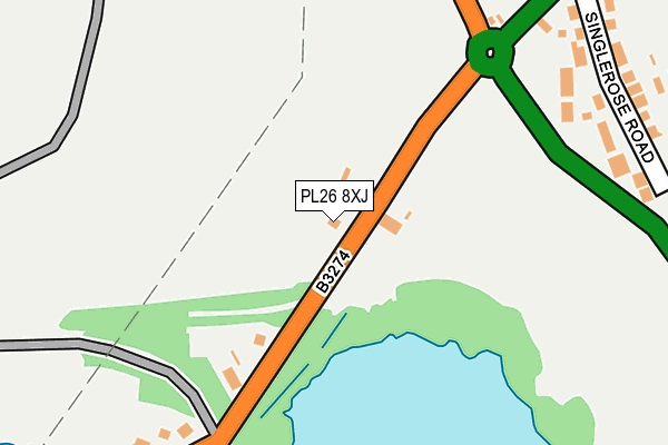
PL26 8XJ is in Carbean, St. Austell. PL26 8XJ is located in the Penwithick & Boscoppa electoral ward, within the unitary authority of Cornwall and the English Parliamentary constituency of St Austell and Newquay. The Sub Integrated Care Board (ICB) Location is NHS Cornwall and the Isles of Scilly ICB - 11N and the police force is Devon & Cornwall. This postcode has been in use since January 1980.


GetTheData
Source: OS OpenMap – Local (Ordnance Survey)
Source: OS VectorMap District (Ordnance Survey)
Licence: Open Government Licence (requires attribution)
| Easting | 200985 |
| Northing | 56539 |
| Latitude | 50.375000 |
| Longitude | -4.800246 |
GetTheData
Source: Open Postcode Geo
Licence: Open Government Licence
| Locality | Carbean |
| Town/City | St. Austell |
| Country | England |
| Postcode District | PL26 |
➜ See where PL26 is on a map ➜ Where is Stenalees? | |
GetTheData
Source: Land Registry Price Paid Data
Licence: Open Government Licence
Elevation or altitude of PL26 8XJ as distance above sea level:
| Metres | Feet | |
|---|---|---|
| Elevation | 220m | 722ft |
Elevation is measured from the approximate centre of the postcode, to the nearest point on an OS contour line from OS Terrain 50, which has contour spacing of ten vertical metres.
➜ How high above sea level am I? Find the elevation of your current position using your device's GPS.
GetTheData
Source: Open Postcode Elevation
Licence: Open Government Licence
| Ward | Penwithick & Boscoppa |
| Constituency | St Austell And Newquay |
GetTheData
Source: ONS Postcode Database
Licence: Open Government Licence
2021 5 JUL £151,000 |
CARBEAN FARMHOUSE, CARBEAN, ST AUSTELL, PL26 8XJ 2019 18 DEC £340,000 |
CARBEAN LODGE, CARBEAN, ST. AUSTELL, PL26 8XJ 2006 2 AUG £285,000 |
PENTON, CARBEAN, ST AUSTELL, PL26 8XJ 2003 19 SEP £150,000 |
CARBEAN LODGE, CARBEAN, ST. AUSTELL, PL26 8XJ 2002 7 MAY £150,000 |
CARBEAN FARMHOUSE, CARBEAN, ST. AUSTELL, PL26 8XJ 2002 11 APR £65,000 |
CARBEAN LODGE, CARBEAN, ST. AUSTELL, PL26 8XJ 2000 18 AUG £105,000 |
1997 26 SEP £74,500 |
CARBEAN LODGE, CARBEAN, ST. AUSTELL, PL26 8XJ 1996 27 SEP £48,000 |
GetTheData
Source: HM Land Registry Price Paid Data
Licence: Contains HM Land Registry data © Crown copyright and database right 2025. This data is licensed under the Open Government Licence v3.0.
| Roche Road | Stenalees | 236m |
| Roche Road | Stenalees | 242m |
| Singlerose Road | Stenalees | 288m |
| Singlerose Road | Stenalees | 298m |
| Stoney Cottage | Stenalees | 510m |
| Bugle Station | 2.9km |
| St Austell Station | 4km |
| Luxulyan Station | 4.1km |
GetTheData
Source: NaPTAN
Licence: Open Government Licence
| Percentage of properties with Next Generation Access | 100.0% |
| Percentage of properties with Superfast Broadband | 75.0% |
| Percentage of properties with Ultrafast Broadband | 0.0% |
| Percentage of properties with Full Fibre Broadband | 0.0% |
Superfast Broadband is between 30Mbps and 300Mbps
Ultrafast Broadband is > 300Mbps
| Percentage of properties unable to receive 2Mbps | 0.0% |
| Percentage of properties unable to receive 5Mbps | 0.0% |
| Percentage of properties unable to receive 10Mbps | 0.0% |
| Percentage of properties unable to receive 30Mbps | 25.0% |
GetTheData
Source: Ofcom
Licence: Ofcom Terms of Use (requires attribution)
GetTheData
Source: ONS Postcode Database
Licence: Open Government Licence


➜ Get more ratings from the Food Standards Agency
GetTheData
Source: Food Standards Agency
Licence: FSA terms & conditions
| Last Collection | |||
|---|---|---|---|
| Location | Mon-Fri | Sat | Distance |
| Stenalees Post Office | 17:00 | 11:15 | 784m |
| Penwithick Post Office | 16:00 | 10:30 | 1,430m |
| Carloggas | 16:00 | 10:00 | 1,492m |
GetTheData
Source: Dracos
Licence: Creative Commons Attribution-ShareAlike
The below table lists the International Territorial Level (ITL) codes (formerly Nomenclature of Territorial Units for Statistics (NUTS) codes) and Local Administrative Units (LAU) codes for PL26 8XJ:
| ITL 1 Code | Name |
|---|---|
| TLK | South West (England) |
| ITL 2 Code | Name |
| TLK3 | Cornwall and Isles of Scilly |
| ITL 3 Code | Name |
| TLK30 | Cornwall and Isles of Scilly |
| LAU 1 Code | Name |
| E06000052 | Cornwall |
GetTheData
Source: ONS Postcode Directory
Licence: Open Government Licence
The below table lists the Census Output Area (OA), Lower Layer Super Output Area (LSOA), and Middle Layer Super Output Area (MSOA) for PL26 8XJ:
| Code | Name | |
|---|---|---|
| OA | E00096385 | |
| LSOA | E01019075 | Cornwall 027E |
| MSOA | E02003957 | Cornwall 027 |
GetTheData
Source: ONS Postcode Directory
Licence: Open Government Licence
| PL26 8SL | Stannary Road | 275m |
| PL26 8TD | Singlerose Road | 298m |
| PL26 8NY | Cleavers Way | 322m |
| PL26 8TB | Stenalees Hill | 325m |
| PL26 8SN | Stannary Road | 352m |
| PL26 8TA | Wheeler Higman Close | 385m |
| PL26 8SY | Roche Road | 389m |
| PL26 8SP | Stannary Road | 405m |
| PL26 8SW | Stannary Road | 576m |
| PL26 8XH | 589m |
GetTheData
Source: Open Postcode Geo; Land Registry Price Paid Data
Licence: Open Government Licence