PL26 8UF maps, stats, and open data
PL26 8UF is located in the Roche & Bugle electoral ward, within the unitary authority of Cornwall and the English Parliamentary constituency of St Austell and Newquay. The Sub Integrated Care Board (ICB) Location is NHS Cornwall and the Isles of Scilly ICB - 11N and the police force is Devon & Cornwall. This postcode has been in use since June 2014.
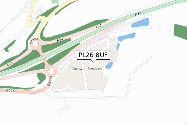
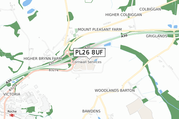
PL26 8UF maps


Licence: Open Government Licence (requires attribution)
Attribution: Contains OS data © Crown copyright and database right 2025
Source: Open Postcode Geo
Licence: Open Government Licence (requires attribution)
Attribution: Contains OS data © Crown copyright and database right 2025; Contains Royal Mail data © Royal Mail copyright and database right 2025; Source: Office for National Statistics licensed under the Open Government Licence v.3.0
PL26 8UF geodata
| Easting | 200094 |
| Northing | 62249 |
| Latitude | 50.425987 |
| Longitude | -4.815800 |
Where is PL26 8UF?
| Country | England |
| Postcode District | PL26 |
PL26 8UF Elevation
Elevation or altitude of PL26 8UF as distance above sea level:
| Metres | Feet | |
|---|---|---|
| Elevation | 150m | 492ft |
Elevation is measured from the approximate centre of the postcode, to the nearest point on an OS contour line from OS Terrain 50, which has contour spacing of ten vertical metres.
➜ How high above sea level am I? Find the elevation of your current position using your device's GPS.
Politics
| Ward | Roche & Bugle |
|---|---|
| Constituency | St Austell And Newquay |
Transport
Nearest bus stops to PL26 8UF
| Cornwall Services | Victoria | 180m |
| Mount Pleasant | Victoria | 325m |
| Mount Pleasant | Victoria | 363m |
| Higher Brynn Farm (A30) | Victoria | 722m |
| Vospers | Victoria | 1,074m |
Nearest railway stations to PL26 8UF
| Roche Station | 1.3km |
| Bugle Station | 3.3km |
| Luxulyan Station | 6.3km |
Broadband
Broadband speed in PL26 8UF (2019 data)
Download
| Median download speed | 6.4Mbps |
| Average download speed | 9.5Mbps |
| Maximum download speed | 22.87Mbps |
Upload
| Median upload speed | 1.0Mbps |
| Average upload speed | 1.3Mbps |
| Maximum upload speed | 2.59Mbps |
Deprivation
81.6% of English postcodes are less deprived than PL26 8UF:Food Standards Agency
Three nearest food hygiene ratings to PL26 8UF (metres)


➜ Get more ratings from the Food Standards Agency
Nearest post box to PL26 8UF
| Last Collection | |||
|---|---|---|---|
| Location | Mon-Fri | Sat | Distance |
| Tremodrett | 10:30 | 10:30 | 1,188m |
| Victoria Business Park | 16:15 | 08:30 | 1,295m |
| Roche Post Office | 16:50 | 10:50 | 2,629m |
PL26 8UF ITL and PL26 8UF LAU
The below table lists the International Territorial Level (ITL) codes (formerly Nomenclature of Territorial Units for Statistics (NUTS) codes) and Local Administrative Units (LAU) codes for PL26 8UF:
| ITL 1 Code | Name |
|---|---|
| TLK | South West (England) |
| ITL 2 Code | Name |
| TLK3 | Cornwall and Isles of Scilly |
| ITL 3 Code | Name |
| TLK30 | Cornwall and Isles of Scilly |
| LAU 1 Code | Name |
| E06000052 | Cornwall |
PL26 8UF census areas
The below table lists the Census Output Area (OA), Lower Layer Super Output Area (LSOA), and Middle Layer Super Output Area (MSOA) for PL26 8UF:
| Code | Name | |
|---|---|---|
| OA | E00096277 | |
| LSOA | E01019053 | Cornwall 024B |
| MSOA | E02003956 | Cornwall 024 |
Nearest postcodes to PL26 8UF
| PL26 8LH | 1073m | |
| PL26 8LX | Victoria Business Park | 1103m |
| PL26 8LJ | 1163m | |
| PL26 8LP | 1194m | |
| PL26 8LG | 1249m | |
| PL26 8LQ | 1252m | |
| PL26 8GQ | Penstraze Lane | 1303m |
| PL26 8LN | 1307m | |
| PL26 8LF | 1561m | |
| PL30 5JJ | 1646m |