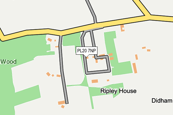
PL20 7NP lies on Green Lane in Buckland Monachorum, Yelverton. PL20 7NP is located in the Buckland Monachorum electoral ward, within the local authority district of West Devon and the English Parliamentary constituency of Torridge and West Devon. The Sub Integrated Care Board (ICB) Location is NHS Devon ICB - 15N and the police force is Devon & Cornwall. This postcode has been in use since January 1980.


GetTheData
Source: OS OpenMap – Local (Ordnance Survey)
Source: OS VectorMap District (Ordnance Survey)
Licence: Open Government Licence (requires attribution)
| Easting | 248135 |
| Northing | 68022 |
| Latitude | 50.492269 |
| Longitude | -4.142364 |
GetTheData
Source: Open Postcode Geo
Licence: Open Government Licence
| Street | Green Lane |
| Locality | Buckland Monachorum |
| Town/City | Yelverton |
| Country | England |
| Postcode District | PL20 |
➜ See where PL20 is on a map | |
GetTheData
Source: Land Registry Price Paid Data
Licence: Open Government Licence
Elevation or altitude of PL20 7NP as distance above sea level:
| Metres | Feet | |
|---|---|---|
| Elevation | 100m | 328ft |
Elevation is measured from the approximate centre of the postcode, to the nearest point on an OS contour line from OS Terrain 50, which has contour spacing of ten vertical metres.
➜ How high above sea level am I? Find the elevation of your current position using your device's GPS.
GetTheData
Source: Open Postcode Elevation
Licence: Open Government Licence
| Ward | Buckland Monachorum |
| Constituency | Torridge And West Devon |
GetTheData
Source: ONS Postcode Database
Licence: Open Government Licence
| Bradford Cottages | Buckland Monachorum | 724m |
| Bradford Cottages | Buckland Monachorum | 731m |
| Modyford Walk (Hill View) | Buckland Monachorum | 820m |
| Modyford Walk (Hill View) | Buckland Monachorum | 831m |
| Gate Cottage Junction | Buckland Monachorum | 852m |
| Bere Alston Station | 4.2km |
| Calstock Station | 4.8km |
| Bere Ferrers Station | 5.3km |
GetTheData
Source: NaPTAN
Licence: Open Government Licence
GetTheData
Source: ONS Postcode Database
Licence: Open Government Licence


➜ Get more ratings from the Food Standards Agency
GetTheData
Source: Food Standards Agency
Licence: FSA terms & conditions
| Last Collection | |||
|---|---|---|---|
| Location | Mon-Fri | Sat | Distance |
| Magpie | 16:00 | 09:30 | 3,203m |
| The Down | 16:30 | 11:45 | 3,228m |
| Sadlers Shop | 16:00 | 10:45 | 3,402m |
GetTheData
Source: Dracos
Licence: Creative Commons Attribution-ShareAlike
The below table lists the International Territorial Level (ITL) codes (formerly Nomenclature of Territorial Units for Statistics (NUTS) codes) and Local Administrative Units (LAU) codes for PL20 7NP:
| ITL 1 Code | Name |
|---|---|
| TLK | South West (England) |
| ITL 2 Code | Name |
| TLK4 | Devon |
| ITL 3 Code | Name |
| TLK43 | Devon CC |
| LAU 1 Code | Name |
| E07000047 | West Devon |
GetTheData
Source: ONS Postcode Directory
Licence: Open Government Licence
The below table lists the Census Output Area (OA), Lower Layer Super Output Area (LSOA), and Middle Layer Super Output Area (MSOA) for PL20 7NP:
| Code | Name | |
|---|---|---|
| OA | E00102920 | |
| LSOA | E01020315 | West Devon 007C |
| MSOA | E02004235 | West Devon 007 |
GetTheData
Source: ONS Postcode Directory
Licence: Open Government Licence
| PL20 7NN | 351m | |
| PL20 7NW | 413m | |
| PL20 7NR | 631m | |
| PL20 7NF | 650m | |
| PL20 7NE | 659m | |
| PL20 6ET | Winsbeer Cottages | 693m |
| PL20 7NG | Cuxton Meadows | 713m |
| PL20 6ES | Bradford Cottages | 714m |
| PL20 7ND | Hill View | 765m |
| PL20 7NQ | Modyford Walk | 793m |
GetTheData
Source: Open Postcode Geo; Land Registry Price Paid Data
Licence: Open Government Licence