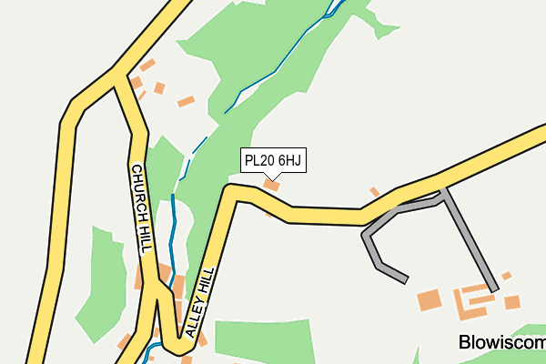
PL20 6HJ lies on Blowiscombe Cottages in Milton Combe, Yelverton. PL20 6HJ is located in the Buckland Monachorum electoral ward, within the local authority district of West Devon and the English Parliamentary constituency of Torridge and West Devon. The Sub Integrated Care Board (ICB) Location is NHS Devon ICB - 15N and the police force is Devon & Cornwall. This postcode has been in use since January 1980.


GetTheData
Source: OS OpenMap – Local (Ordnance Survey)
Source: OS VectorMap District (Ordnance Survey)
Licence: Open Government Licence (requires attribution)
| Easting | 249011 |
| Northing | 66210 |
| Latitude | 50.476211 |
| Longitude | -4.129291 |
GetTheData
Source: Open Postcode Geo
Licence: Open Government Licence
| Street | Blowiscombe Cottages |
| Locality | Milton Combe |
| Town/City | Yelverton |
| Country | England |
| Postcode District | PL20 |
➜ See where PL20 is on a map ➜ Where is Milton Combe? | |
GetTheData
Source: Land Registry Price Paid Data
Licence: Open Government Licence
Elevation or altitude of PL20 6HJ as distance above sea level:
| Metres | Feet | |
|---|---|---|
| Elevation | 90m | 295ft |
Elevation is measured from the approximate centre of the postcode, to the nearest point on an OS contour line from OS Terrain 50, which has contour spacing of ten vertical metres.
➜ How high above sea level am I? Find the elevation of your current position using your device's GPS.
GetTheData
Source: Open Postcode Elevation
Licence: Open Government Licence
| Ward | Buckland Monachorum |
| Constituency | Torridge And West Devon |
GetTheData
Source: ONS Postcode Database
Licence: Open Government Licence
| Who'd Have Thought It (Alley Hill) | Milton Coombe | 171m |
| Who'd Have Thought It (Church Hill) | Milton Coombe | 188m |
| Church Hill | Milton Coombe | 206m |
| Church Hill | Milton Coombe | 213m |
| Abbey Cross | Milton Coombe | 462m |
| Bere Ferrers Station | 4.6km |
GetTheData
Source: NaPTAN
Licence: Open Government Licence
| Percentage of properties with Next Generation Access | 100.0% |
| Percentage of properties with Superfast Broadband | 100.0% |
| Percentage of properties with Ultrafast Broadband | 0.0% |
| Percentage of properties with Full Fibre Broadband | 0.0% |
Superfast Broadband is between 30Mbps and 300Mbps
Ultrafast Broadband is > 300Mbps
| Percentage of properties unable to receive 2Mbps | 0.0% |
| Percentage of properties unable to receive 5Mbps | 0.0% |
| Percentage of properties unable to receive 10Mbps | 0.0% |
| Percentage of properties unable to receive 30Mbps | 0.0% |
GetTheData
Source: Ofcom
Licence: Ofcom Terms of Use (requires attribution)
GetTheData
Source: ONS Postcode Database
Licence: Open Government Licence
| Last Collection | |||
|---|---|---|---|
| Location | Mon-Fri | Sat | Distance |
| Chubb Tor | 09:00 | 09:00 | 2,862m |
| Hoo Meavy | 10:00 | 10:00 | 3,826m |
| The Down | 16:30 | 11:45 | 3,918m |
GetTheData
Source: Dracos
Licence: Creative Commons Attribution-ShareAlike
The below table lists the International Territorial Level (ITL) codes (formerly Nomenclature of Territorial Units for Statistics (NUTS) codes) and Local Administrative Units (LAU) codes for PL20 6HJ:
| ITL 1 Code | Name |
|---|---|
| TLK | South West (England) |
| ITL 2 Code | Name |
| TLK4 | Devon |
| ITL 3 Code | Name |
| TLK43 | Devon CC |
| LAU 1 Code | Name |
| E07000047 | West Devon |
GetTheData
Source: ONS Postcode Directory
Licence: Open Government Licence
The below table lists the Census Output Area (OA), Lower Layer Super Output Area (LSOA), and Middle Layer Super Output Area (MSOA) for PL20 6HJ:
| Code | Name | |
|---|---|---|
| OA | E00102919 | |
| LSOA | E01020316 | West Devon 007D |
| MSOA | E02004235 | West Devon 007 |
GetTheData
Source: ONS Postcode Directory
Licence: Open Government Licence
| PL20 6HH | Mill Cottages | 177m |
| PL20 6HF | 182m | |
| PL20 6HL | Victoria Terrace | 192m |
| PL20 6HR | 266m | |
| PL20 6HE | Bolts Cottages | 274m |
| PL20 6HP | 276m | |
| PL20 6HG | Church Terrace | 316m |
| PL20 6HQ | Woodside Cottages | 375m |
| PL20 6HD | Leys Villas | 406m |
| PL20 6HW | 476m |
GetTheData
Source: Open Postcode Geo; Land Registry Price Paid Data
Licence: Open Government Licence