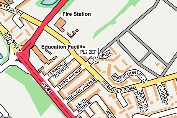
PL2 2EP is located in the Ham electoral ward, within the unitary authority of Plymouth and the English Parliamentary constituency of Plymouth, Moor View. The Sub Integrated Care Board (ICB) Location is NHS Devon ICB - 15N and the police force is Devon & Cornwall. This postcode has been in use since January 1980.


GetTheData
Source: OS OpenMap – Local (Ordnance Survey)
Source: OS VectorMap District (Ordnance Survey)
Licence: Open Government Licence (requires attribution)
| Easting | 245479 |
| Northing | 57370 |
| Latitude | 50.395848 |
| Longitude | -4.175384 |
GetTheData
Source: Open Postcode Geo
Licence: Open Government Licence
| Country | England |
| Postcode District | PL2 |
➜ See where PL2 is on a map ➜ Where is Plymouth? | |
GetTheData
Source: Land Registry Price Paid Data
Licence: Open Government Licence
Elevation or altitude of PL2 2EP as distance above sea level:
| Metres | Feet | |
|---|---|---|
| Elevation | 20m | 66ft |
Elevation is measured from the approximate centre of the postcode, to the nearest point on an OS contour line from OS Terrain 50, which has contour spacing of ten vertical metres.
➜ How high above sea level am I? Find the elevation of your current position using your device's GPS.
GetTheData
Source: Open Postcode Elevation
Licence: Open Government Licence
| Ward | Ham |
| Constituency | Plymouth, Moor View |
GetTheData
Source: ONS Postcode Database
Licence: Open Government Licence
| Second Avenue | Camel's Head | 59m |
| Second Avenue (Ferndale Road) | Camel's Head | 64m |
| Oak Villa Social Club (Ferndale Road) | Camel's Head | 80m |
| Ferndale Avenue (Ferndale Road) | Camel's Head | 84m |
| Weston Mill Primary School | Camel's Head | 192m |
| Keyham Station | 0.7km |
| St Budeaux Ferry Road Station | 1km |
| St Budeaux Victoria Road Station | 1.1km |
GetTheData
Source: NaPTAN
Licence: Open Government Licence
GetTheData
Source: ONS Postcode Database
Licence: Open Government Licence


➜ Get more ratings from the Food Standards Agency
GetTheData
Source: Food Standards Agency
Licence: FSA terms & conditions
| Last Collection | |||
|---|---|---|---|
| Location | Mon-Fri | Sat | Distance |
| Victory Street Post Office | 16:45 | 12:15 | 584m |
| Cardinal Avenue | 17:30 | 12:00 | 734m |
| Henderson Place | 17:00 | 12:00 | 992m |
GetTheData
Source: Dracos
Licence: Creative Commons Attribution-ShareAlike
The below table lists the International Territorial Level (ITL) codes (formerly Nomenclature of Territorial Units for Statistics (NUTS) codes) and Local Administrative Units (LAU) codes for PL2 2EP:
| ITL 1 Code | Name |
|---|---|
| TLK | South West (England) |
| ITL 2 Code | Name |
| TLK4 | Devon |
| ITL 3 Code | Name |
| TLK41 | Plymouth |
| LAU 1 Code | Name |
| E06000026 | Plymouth |
GetTheData
Source: ONS Postcode Directory
Licence: Open Government Licence
The below table lists the Census Output Area (OA), Lower Layer Super Output Area (LSOA), and Middle Layer Super Output Area (MSOA) for PL2 2EP:
| Code | Name | |
|---|---|---|
| OA | E00076167 | |
| LSOA | E01015075 | Plymouth 014D |
| MSOA | E02003135 | Plymouth 014 |
GetTheData
Source: ONS Postcode Directory
Licence: Open Government Licence
| PL2 2BQ | Southern Close | 64m |
| PL2 2EH | Third Avenue | 86m |
| PL2 2EJ | Ferndale Avenue | 100m |
| PL2 2EQ | Second Avenue | 111m |
| PL2 2BJ | Westcountry Close | 123m |
| PL2 2EG | Erith Avenue | 132m |
| PL2 2EB | Wolseley Road | 147m |
| PL2 2ED | Wolseley Road | 158m |
| PL2 2BL | Drummond Close | 180m |
| PL2 2EF | Ainslie Terrace | 183m |
GetTheData
Source: Open Postcode Geo; Land Registry Price Paid Data
Licence: Open Government Licence