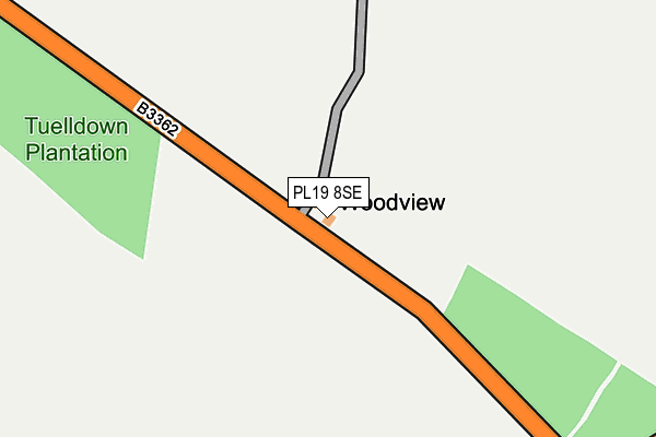
PL19 8SE is in Lamerton, Tavistock. PL19 8SE is located in the Milton Ford electoral ward, within the local authority district of West Devon and the English Parliamentary constituency of Torridge and West Devon. The Sub Integrated Care Board (ICB) Location is NHS Devon ICB - 15N and the police force is Devon & Cornwall. This postcode has been in use since January 1980.


GetTheData
Source: OS OpenMap – Local (Ordnance Survey)
Source: OS VectorMap District (Ordnance Survey)
Licence: Open Government Licence (requires attribution)
| Easting | 242726 |
| Northing | 77848 |
| Latitude | 50.579139 |
| Longitude | -4.222708 |
GetTheData
Source: Open Postcode Geo
Licence: Open Government Licence
| Locality | Lamerton |
| Town/City | Tavistock |
| Country | England |
| Postcode District | PL19 |
➜ See where PL19 is on a map | |
GetTheData
Source: Land Registry Price Paid Data
Licence: Open Government Licence
Elevation or altitude of PL19 8SE as distance above sea level:
| Metres | Feet | |
|---|---|---|
| Elevation | 200m | 656ft |
Elevation is measured from the approximate centre of the postcode, to the nearest point on an OS contour line from OS Terrain 50, which has contour spacing of ten vertical metres.
➜ How high above sea level am I? Find the elevation of your current position using your device's GPS.
GetTheData
Source: Open Postcode Elevation
Licence: Open Government Licence
| Ward | Milton Ford |
| Constituency | Torridge And West Devon |
GetTheData
Source: ONS Postcode Database
Licence: Open Government Licence
| Tuell Post Office (B3362) | Milton Green | 456m |
| Tuell Post Office (B3362) | Milton Green | 462m |
| Carrs Garage (B3362) | Lamerton | 974m |
| Carrs Garage (B3362) | Lamerton | 979m |
| Post Box | Sydenham Damerel | 1,072m |
GetTheData
Source: NaPTAN
Licence: Open Government Licence
| Percentage of properties with Next Generation Access | 0.0% |
| Percentage of properties with Superfast Broadband | 0.0% |
| Percentage of properties with Ultrafast Broadband | 0.0% |
| Percentage of properties with Full Fibre Broadband | 0.0% |
Superfast Broadband is between 30Mbps and 300Mbps
Ultrafast Broadband is > 300Mbps
| Percentage of properties unable to receive 2Mbps | 0.0% |
| Percentage of properties unable to receive 5Mbps | 16.7% |
| Percentage of properties unable to receive 10Mbps | 83.3% |
| Percentage of properties unable to receive 30Mbps | 100.0% |
GetTheData
Source: Ofcom
Licence: Ofcom Terms of Use (requires attribution)
Estimated total energy consumption in PL19 8SE by fuel type, 2015.
| Consumption (kWh) | 51,714 |
|---|---|
| Meter count | 7 |
| Mean (kWh/meter) | 7,388 |
| Median (kWh/meter) | 5,424 |
GetTheData
Source: Postcode level gas estimates: 2015 (experimental)
Source: Postcode level electricity estimates: 2015 (experimental)
Licence: Open Government Licence
GetTheData
Source: ONS Postcode Database
Licence: Open Government Licence
| Last Collection | |||
|---|---|---|---|
| Location | Mon-Fri | Sat | Distance |
| Tuell Down | 11:00 | 07:30 | 446m |
| Culver Hill | 10:00 | 10:00 | 1,101m |
| Long Cross | 10:00 | 10:00 | 1,739m |
GetTheData
Source: Dracos
Licence: Creative Commons Attribution-ShareAlike
The below table lists the International Territorial Level (ITL) codes (formerly Nomenclature of Territorial Units for Statistics (NUTS) codes) and Local Administrative Units (LAU) codes for PL19 8SE:
| ITL 1 Code | Name |
|---|---|
| TLK | South West (England) |
| ITL 2 Code | Name |
| TLK4 | Devon |
| ITL 3 Code | Name |
| TLK43 | Devon CC |
| LAU 1 Code | Name |
| E07000047 | West Devon |
GetTheData
Source: ONS Postcode Directory
Licence: Open Government Licence
The below table lists the Census Output Area (OA), Lower Layer Super Output Area (LSOA), and Middle Layer Super Output Area (MSOA) for PL19 8SE:
| Code | Name | |
|---|---|---|
| OA | E00103009 | |
| LSOA | E01020331 | West Devon 004C |
| MSOA | E02004232 | West Devon 004 |
GetTheData
Source: ONS Postcode Directory
Licence: Open Government Licence
| PL19 0PU | 466m | |
| PL19 0PX | 926m | |
| PL19 8PZ | 939m | |
| PL19 8QZ | 1052m | |
| PL19 8SD | 1129m | |
| PL19 8PY | 1152m | |
| PL19 8QA | 1358m | |
| PL19 8SB | 1533m | |
| PL19 8QY | 1597m | |
| PL19 0PJ | 1696m |
GetTheData
Source: Open Postcode Geo; Land Registry Price Paid Data
Licence: Open Government Licence