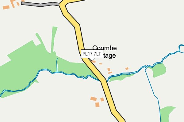
PL17 7LT is in South Hill, Callington. PL17 7LT is located in the Lynher electoral ward, within the unitary authority of Cornwall and the English Parliamentary constituency of South East Cornwall. The Sub Integrated Care Board (ICB) Location is NHS Cornwall and the Isles of Scilly ICB - 11N and the police force is Devon & Cornwall. This postcode has been in use since October 1985.


GetTheData
Source: OS OpenMap – Local (Ordnance Survey)
Source: OS VectorMap District (Ordnance Survey)
Licence: Open Government Licence (requires attribution)
| Easting | 232771 |
| Northing | 71795 |
| Latitude | 50.521984 |
| Longitude | -4.360471 |
GetTheData
Source: Open Postcode Geo
Licence: Open Government Licence
| Locality | South Hill |
| Town/City | Callington |
| Country | England |
| Postcode District | PL17 |
➜ See where PL17 is on a map | |
GetTheData
Source: Land Registry Price Paid Data
Licence: Open Government Licence
Elevation or altitude of PL17 7LT as distance above sea level:
| Metres | Feet | |
|---|---|---|
| Elevation | 100m | 328ft |
Elevation is measured from the approximate centre of the postcode, to the nearest point on an OS contour line from OS Terrain 50, which has contour spacing of ten vertical metres.
➜ How high above sea level am I? Find the elevation of your current position using your device's GPS.
GetTheData
Source: Open Postcode Elevation
Licence: Open Government Licence
| Ward | Lynher |
| Constituency | South East Cornwall |
GetTheData
Source: ONS Postcode Database
Licence: Open Government Licence
| Bus Shelter | Golberdon | 540m |
| St Sampsons Church | South Hill | 833m |
GetTheData
Source: NaPTAN
Licence: Open Government Licence
| Percentage of properties with Next Generation Access | 100.0% |
| Percentage of properties with Superfast Broadband | 100.0% |
| Percentage of properties with Ultrafast Broadband | 100.0% |
| Percentage of properties with Full Fibre Broadband | 100.0% |
Superfast Broadband is between 30Mbps and 300Mbps
Ultrafast Broadband is > 300Mbps
| Percentage of properties unable to receive 2Mbps | 0.0% |
| Percentage of properties unable to receive 5Mbps | 0.0% |
| Percentage of properties unable to receive 10Mbps | 0.0% |
| Percentage of properties unable to receive 30Mbps | 0.0% |
GetTheData
Source: Ofcom
Licence: Ofcom Terms of Use (requires attribution)
Estimated total energy consumption in PL17 7LT by fuel type, 2015.
| Consumption (kWh) | 78,550 |
|---|---|
| Meter count | 10 |
| Mean (kWh/meter) | 7,855 |
| Median (kWh/meter) | 5,451 |
GetTheData
Source: Postcode level gas estimates: 2015 (experimental)
Source: Postcode level electricity estimates: 2015 (experimental)
Licence: Open Government Licence
GetTheData
Source: ONS Postcode Database
Licence: Open Government Licence

➜ Get more ratings from the Food Standards Agency
GetTheData
Source: Food Standards Agency
Licence: FSA terms & conditions
| Last Collection | |||
|---|---|---|---|
| Location | Mon-Fri | Sat | Distance |
| Golberdon | 16:00 | 10:30 | 565m |
| Bray Shop | 15:15 | 10:00 | 2,696m |
| Bowling Green | 16:30 | 10:00 | 3,424m |
GetTheData
Source: Dracos
Licence: Creative Commons Attribution-ShareAlike
The below table lists the International Territorial Level (ITL) codes (formerly Nomenclature of Territorial Units for Statistics (NUTS) codes) and Local Administrative Units (LAU) codes for PL17 7LT:
| ITL 1 Code | Name |
|---|---|
| TLK | South West (England) |
| ITL 2 Code | Name |
| TLK3 | Cornwall and Isles of Scilly |
| ITL 3 Code | Name |
| TLK30 | Cornwall and Isles of Scilly |
| LAU 1 Code | Name |
| E06000052 | Cornwall |
GetTheData
Source: ONS Postcode Directory
Licence: Open Government Licence
The below table lists the Census Output Area (OA), Lower Layer Super Output Area (LSOA), and Middle Layer Super Output Area (MSOA) for PL17 7LT:
| Code | Name | |
|---|---|---|
| OA | E00094791 | |
| LSOA | E01018777 | Cornwall 012A |
| MSOA | E02003893 | Cornwall 012 |
GetTheData
Source: ONS Postcode Directory
Licence: Open Government Licence
| PL17 7ND | 534m | |
| PL17 7NW | Mooreland View | 550m |
| PL17 7NG | 686m | |
| PL17 7NN | Mooreland View | 693m |
| PL17 7LP | 699m | |
| PL17 7NJ | 746m | |
| PL17 7NH | 801m | |
| PL17 7LU | 905m | |
| PL17 7LW | South Hill Road | 1043m |
| PL17 7NL | 1132m |
GetTheData
Source: Open Postcode Geo; Land Registry Price Paid Data
Licence: Open Government Licence