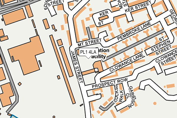
PL1 4LA is in St Leonards Street, Plymouth. PL1 4LA is located in the Devonport electoral ward, within the unitary authority of Plymouth and the English Parliamentary constituency of Plymouth, Sutton and Devonport. The Sub Integrated Care Board (ICB) Location is NHS Devon ICB - 15N and the police force is Devon & Cornwall. This postcode has been in use since January 1980.


GetTheData
Source: OS OpenMap – Local (Ordnance Survey)
Source: OS VectorMap District (Ordnance Survey)
Licence: Open Government Licence (requires attribution)
| Easting | 245276 |
| Northing | 54262 |
| Latitude | 50.367850 |
| Longitude | -4.176988 |
GetTheData
Source: Open Postcode Geo
Licence: Open Government Licence
| Locality | St Leonards Street |
| Town/City | Plymouth |
| Country | England |
| Postcode District | PL1 |
➜ See where PL1 is on a map ➜ Where is Plymouth? | |
GetTheData
Source: Land Registry Price Paid Data
Licence: Open Government Licence
Elevation or altitude of PL1 4LA as distance above sea level:
| Metres | Feet | |
|---|---|---|
| Elevation | 20m | 66ft |
Elevation is measured from the approximate centre of the postcode, to the nearest point on an OS contour line from OS Terrain 50, which has contour spacing of ten vertical metres.
➜ How high above sea level am I? Find the elevation of your current position using your device's GPS.
GetTheData
Source: Open Postcode Elevation
Licence: Open Government Licence
| Ward | Devonport |
| Constituency | Plymouth, Sutton And Devonport |
GetTheData
Source: ONS Postcode Database
Licence: Open Government Licence
240, ST LEONARDS STREET, PLYMOUTH, PL1 4LA 2002 5 FEB £14,000 |
GetTheData
Source: HM Land Registry Price Paid Data
Licence: Contains HM Land Registry data © Crown copyright and database right 2025. This data is licensed under the Open Government Licence v3.0.
| Mount Wise Primary School (James Street) | Mount Wise | 59m |
| Pembroke Lane (Mount Street) | Mount Wise | 86m |
| Prospect Row | Mount Wise | 127m |
| James Street | Mount Wise | 169m |
| Clowance Street | Mount Wise | 195m |
| Devonport Station | 1.3km |
| Dockyard (Plymouth) Station | 1.6km |
| Keyham Station | 2.5km |
GetTheData
Source: NaPTAN
Licence: Open Government Licence
GetTheData
Source: ONS Postcode Database
Licence: Open Government Licence


➜ Get more ratings from the Food Standards Agency
GetTheData
Source: Food Standards Agency
Licence: FSA terms & conditions
| Last Collection | |||
|---|---|---|---|
| Location | Mon-Fri | Sat | Distance |
| James Street (Devonport) | 17:15 | 12:30 | 165m |
| Pembroke Street Flats | 17:15 | 12:30 | 312m |
| Madden Road | 17:30 | 12:45 | 499m |
GetTheData
Source: Dracos
Licence: Creative Commons Attribution-ShareAlike
The below table lists the International Territorial Level (ITL) codes (formerly Nomenclature of Territorial Units for Statistics (NUTS) codes) and Local Administrative Units (LAU) codes for PL1 4LA:
| ITL 1 Code | Name |
|---|---|
| TLK | South West (England) |
| ITL 2 Code | Name |
| TLK4 | Devon |
| ITL 3 Code | Name |
| TLK41 | Plymouth |
| LAU 1 Code | Name |
| E06000026 | Plymouth |
GetTheData
Source: ONS Postcode Directory
Licence: Open Government Licence
The below table lists the Census Output Area (OA), Lower Layer Super Output Area (LSOA), and Middle Layer Super Output Area (MSOA) for PL1 4LA:
| Code | Name | |
|---|---|---|
| OA | E00075982 | |
| LSOA | E01015046 | Plymouth 026C |
| MSOA | E02003147 | Plymouth 026 |
GetTheData
Source: ONS Postcode Directory
Licence: Open Government Licence
| PL1 4FG | Bennett Street | 73m |
| PL1 4GY | Mount Street | 84m |
| PL1 4FF | Bennett Street | 88m |
| PL1 4LH | James Street | 96m |
| PL1 4FD | James Street | 98m |
| PL1 4JU | Pembroke Street | 102m |
| PL1 4FE | James Street | 109m |
| PL1 4RX | St Michaels Close | 137m |
| PL1 4EJ | Ker Street | 166m |
| PL1 4EH | Michael Foot Avenue | 169m |
GetTheData
Source: Open Postcode Geo; Land Registry Price Paid Data
Licence: Open Government Licence