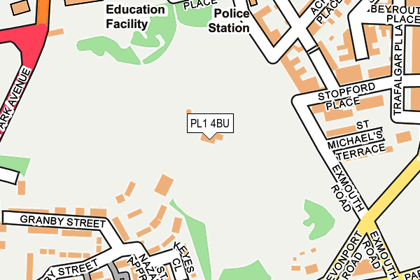
PL1 4BU is located in the Devonport electoral ward, within the unitary authority of Plymouth and the English Parliamentary constituency of Plymouth, Sutton and Devonport. The Sub Integrated Care Board (ICB) Location is NHS Devon ICB - 15N and the police force is Devon & Cornwall. This postcode has been in use since January 1980.


GetTheData
Source: OS OpenMap – Local (Ordnance Survey)
Source: OS VectorMap District (Ordnance Survey)
Licence: Open Government Licence (requires attribution)
| Easting | 245734 |
| Northing | 54942 |
| Latitude | 50.374082 |
| Longitude | -4.170832 |
GetTheData
Source: Open Postcode Geo
Licence: Open Government Licence
| Country | England |
| Postcode District | PL1 |
➜ See where PL1 is on a map ➜ Where is Plymouth? | |
GetTheData
Source: Land Registry Price Paid Data
Licence: Open Government Licence
Elevation or altitude of PL1 4BU as distance above sea level:
| Metres | Feet | |
|---|---|---|
| Elevation | 30m | 98ft |
Elevation is measured from the approximate centre of the postcode, to the nearest point on an OS contour line from OS Terrain 50, which has contour spacing of ten vertical metres.
➜ How high above sea level am I? Find the elevation of your current position using your device's GPS.
GetTheData
Source: Open Postcode Elevation
Licence: Open Government Licence
| Ward | Devonport |
| Constituency | Plymouth, Sutton And Devonport |
GetTheData
Source: ONS Postcode Database
Licence: Open Government Licence
| Devonport Park (Fore Street) | Stoke | 47m |
| Devonport Park (Fore Street) | Stoke | 60m |
| Exmouth Road (Devonport Road) | Stoke | 142m |
| Exmouth Road (Devonport Road) | Stoke | 154m |
| City College Plymouth | Stoke | 215m |
| Devonport Station | 0.5km |
| Dockyard (Plymouth) Station | 1km |
| Keyham Station | 1.9km |
GetTheData
Source: NaPTAN
Licence: Open Government Licence
GetTheData
Source: ONS Postcode Database
Licence: Open Government Licence


➜ Get more ratings from the Food Standards Agency
GetTheData
Source: Food Standards Agency
Licence: FSA terms & conditions
| Last Collection | |||
|---|---|---|---|
| Location | Mon-Fri | Sat | Distance |
| Haddington Road | 17:30 | 12:15 | 304m |
| Waterloo Street | 17:30 | 12:45 | 349m |
| Madden Road | 17:30 | 12:45 | 365m |
GetTheData
Source: Dracos
Licence: Creative Commons Attribution-ShareAlike
The below table lists the International Territorial Level (ITL) codes (formerly Nomenclature of Territorial Units for Statistics (NUTS) codes) and Local Administrative Units (LAU) codes for PL1 4BU:
| ITL 1 Code | Name |
|---|---|
| TLK | South West (England) |
| ITL 2 Code | Name |
| TLK4 | Devon |
| ITL 3 Code | Name |
| TLK41 | Plymouth |
| LAU 1 Code | Name |
| E06000026 | Plymouth |
GetTheData
Source: ONS Postcode Directory
Licence: Open Government Licence
The below table lists the Census Output Area (OA), Lower Layer Super Output Area (LSOA), and Middle Layer Super Output Area (MSOA) for PL1 4BU:
| Code | Name | |
|---|---|---|
| OA | E00075978 | |
| LSOA | E01015045 | Plymouth 026B |
| MSOA | E02003147 | Plymouth 026 |
GetTheData
Source: ONS Postcode Directory
Licence: Open Government Licence
| PL1 5QR | Paradise Road | 116m |
| PL1 4QG | St Michaels Terrace | 183m |
| PL1 4BZ | Keyes Close | 189m |
| PL1 4BY | Knowland Close | 189m |
| PL1 4BX | Porteous Close | 213m |
| PL1 4DE | Dieppe Close | 236m |
| PL1 4DA | St Nazaire Close | 254m |
| PL1 5QZ | Albemarle Villas | 258m |
| PL1 4QF | Stopford Place | 260m |
| PL1 4BS | Durrant Close | 266m |
GetTheData
Source: Open Postcode Geo; Land Registry Price Paid Data
Licence: Open Government Licence