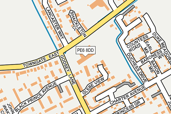
PE6 8DD is located in the Market & West Deeping electoral ward, within the local authority district of South Kesteven and the English Parliamentary constituency of South Holland and The Deepings. The Sub Integrated Care Board (ICB) Location is NHS Lincolnshire ICB - 71E and the police force is Lincolnshire. This postcode has been in use since June 1997.


GetTheData
Source: OS OpenMap – Local (Ordnance Survey)
Source: OS VectorMap District (Ordnance Survey)
Licence: Open Government Licence (requires attribution)
| Easting | 513921 |
| Northing | 310889 |
| Latitude | 52.683726 |
| Longitude | -0.316194 |
GetTheData
Source: Open Postcode Geo
Licence: Open Government Licence
| Country | England |
| Postcode District | PE6 |
➜ See where PE6 is on a map ➜ Where is Market Deeping? | |
GetTheData
Source: Land Registry Price Paid Data
Licence: Open Government Licence
Elevation or altitude of PE6 8DD as distance above sea level:
| Metres | Feet | |
|---|---|---|
| Elevation | 10m | 33ft |
Elevation is measured from the approximate centre of the postcode, to the nearest point on an OS contour line from OS Terrain 50, which has contour spacing of ten vertical metres.
➜ How high above sea level am I? Find the elevation of your current position using your device's GPS.
GetTheData
Source: Open Postcode Elevation
Licence: Open Government Licence
| Ward | Market & West Deeping |
| Constituency | South Holland And The Deepings |
GetTheData
Source: ONS Postcode Database
Licence: Open Government Licence
| Health Centre (Godsey Lane) | Market Deeping | 68m |
| Lancaster Way (Towngate East) | Market Deeping | 70m |
| Lancaster Way (Towngate East) | Market Deeping | 74m |
| Health Centre (Godsey Lane) | Market Deeping | 81m |
| Tesco (Godseys Lane) | Market Deeping | 201m |
GetTheData
Source: NaPTAN
Licence: Open Government Licence
GetTheData
Source: ONS Postcode Database
Licence: Open Government Licence


➜ Get more ratings from the Food Standards Agency
GetTheData
Source: Food Standards Agency
Licence: FSA terms & conditions
| Last Collection | |||
|---|---|---|---|
| Location | Mon-Fri | Sat | Distance |
| Lancaster Way | 16:30 | 11:00 | 250m |
| Joan Wake Close | 16:30 | 11:00 | 329m |
| Towngate | 16:15 | 11:00 | 573m |
GetTheData
Source: Dracos
Licence: Creative Commons Attribution-ShareAlike
The below table lists the International Territorial Level (ITL) codes (formerly Nomenclature of Territorial Units for Statistics (NUTS) codes) and Local Administrative Units (LAU) codes for PE6 8DD:
| ITL 1 Code | Name |
|---|---|
| TLF | East Midlands (England) |
| ITL 2 Code | Name |
| TLF3 | Lincolnshire |
| ITL 3 Code | Name |
| TLF30 | Lincolnshire CC |
| LAU 1 Code | Name |
| E07000141 | South Kesteven |
GetTheData
Source: ONS Postcode Directory
Licence: Open Government Licence
The below table lists the Census Output Area (OA), Lower Layer Super Output Area (LSOA), and Middle Layer Super Output Area (MSOA) for PE6 8DD:
| Code | Name | |
|---|---|---|
| OA | E00133768 | |
| LSOA | E01026337 | South Kesteven 013D |
| MSOA | E02005488 | South Kesteven 013 |
GetTheData
Source: ONS Postcode Directory
Licence: Open Government Licence
| PE6 8GD | Courtfields | 47m |
| PE6 8GB | Glebe View | 81m |
| PE6 8DN | Shackleton Close | 129m |
| PE6 8GH | Kingsgate | 139m |
| PE6 8FN | Duchess Drive | 147m |
| PE6 8LT | Black Prince Avenue | 155m |
| PE6 8GE | Godsey Lane | 158m |
| PE6 8LR | Black Prince Avenue | 163m |
| PE6 8FL | Countess Road | 191m |
| PE6 8LA | Lancaster Way | 192m |
GetTheData
Source: Open Postcode Geo; Land Registry Price Paid Data
Licence: Open Government Licence