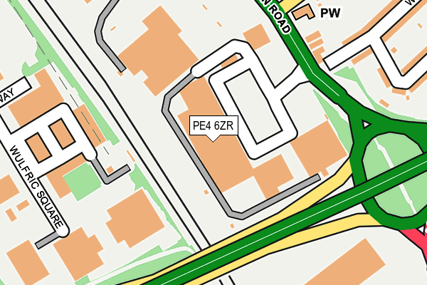
PE4 6ZR is located in the Paston and Walton electoral ward, within the unitary authority of Peterborough and the English Parliamentary constituency of Peterborough. The Sub Integrated Care Board (ICB) Location is NHS Cambridgeshire and Peterborough ICB - 06H and the police force is Cambridgeshire. This postcode has been in use since February 1990.


GetTheData
Source: OS OpenMap – Local (Ordnance Survey)
Source: OS VectorMap District (Ordnance Survey)
Licence: Open Government Licence (requires attribution)
| Easting | 517549 |
| Northing | 301522 |
| Latitude | 52.598784 |
| Longitude | -0.265883 |
GetTheData
Source: Open Postcode Geo
Licence: Open Government Licence
| Country | England |
| Postcode District | PE4 |
➜ See where PE4 is on a map ➜ Where is Peterborough? | |
GetTheData
Source: Land Registry Price Paid Data
Licence: Open Government Licence
Elevation or altitude of PE4 6ZR as distance above sea level:
| Metres | Feet | |
|---|---|---|
| Elevation | 20m | 66ft |
Elevation is measured from the approximate centre of the postcode, to the nearest point on an OS contour line from OS Terrain 50, which has contour spacing of ten vertical metres.
➜ How high above sea level am I? Find the elevation of your current position using your device's GPS.
GetTheData
Source: Open Postcode Elevation
Licence: Open Government Licence
| Ward | Paston And Walton |
| Constituency | Peterborough |
GetTheData
Source: ONS Postcode Database
Licence: Open Government Licence
| Brotherhood Retail Park (Lincoln Road) | Walton | 181m |
| Brotherhood Retail Park (Lincoln Road) | Walton | 194m |
| Morrison's (Lincoln Road- Morrisons) | Walton | 260m |
| Paul Pry (Lincoln Road) | Walton | 400m |
| Bourges Boulevard | New England | 414m |
| Peterborough Station | 2.9km |
GetTheData
Source: NaPTAN
Licence: Open Government Licence
| Median download speed | 15.3Mbps |
| Average download speed | 17.2Mbps |
| Maximum download speed | 36.45Mbps |
| Median upload speed | 1.0Mbps |
| Average upload speed | 1.9Mbps |
| Maximum upload speed | 7.71Mbps |
GetTheData
Source: Ofcom
Licence: Ofcom Terms of Use (requires attribution)
GetTheData
Source: ONS Postcode Database
Licence: Open Government Licence


➜ Get more ratings from the Food Standards Agency
GetTheData
Source: Food Standards Agency
Licence: FSA terms & conditions
| Last Collection | |||
|---|---|---|---|
| Location | Mon-Fri | Sat | Distance |
| Lincoln Road Walton | 17:45 | 11:45 | 216m |
| Willesden Avenue Post Office | 18:00 | 12:00 | 415m |
| Keats Way-chaucer Road | 17:45 | 12:45 | 445m |
GetTheData
Source: Dracos
Licence: Creative Commons Attribution-ShareAlike
The below table lists the International Territorial Level (ITL) codes (formerly Nomenclature of Territorial Units for Statistics (NUTS) codes) and Local Administrative Units (LAU) codes for PE4 6ZR:
| ITL 1 Code | Name |
|---|---|
| TLH | East |
| ITL 2 Code | Name |
| TLH1 | East Anglia |
| ITL 3 Code | Name |
| TLH11 | Peterborough |
| LAU 1 Code | Name |
| E06000031 | Peterborough |
GetTheData
Source: ONS Postcode Directory
Licence: Open Government Licence
The below table lists the Census Output Area (OA), Lower Layer Super Output Area (LSOA), and Middle Layer Super Output Area (MSOA) for PE4 6ZR:
| Code | Name | |
|---|---|---|
| OA | E00079277 | |
| LSOA | E01015677 | Peterborough 010E |
| MSOA | E02003246 | Peterborough 010 |
GetTheData
Source: ONS Postcode Directory
Licence: Open Government Licence
| PE3 8YF | Sturrock Way | 152m |
| PE4 6AE | Lincoln Road | 198m |
| PE4 6AF | Lincoln Road | 273m |
| PE4 6EA | Willesden Avenue | 304m |
| PE4 6BL | Frederick Drive | 314m |
| PE4 6BH | Sandringham Road | 319m |
| PE4 6EE | Montagu Road | 322m |
| PE3 7PN | Ivatt Way | 331m |
| PE4 6AQ | Council Street | 338m |
| PE4 6HB | Paston Lane | 342m |
GetTheData
Source: Open Postcode Geo; Land Registry Price Paid Data
Licence: Open Government Licence