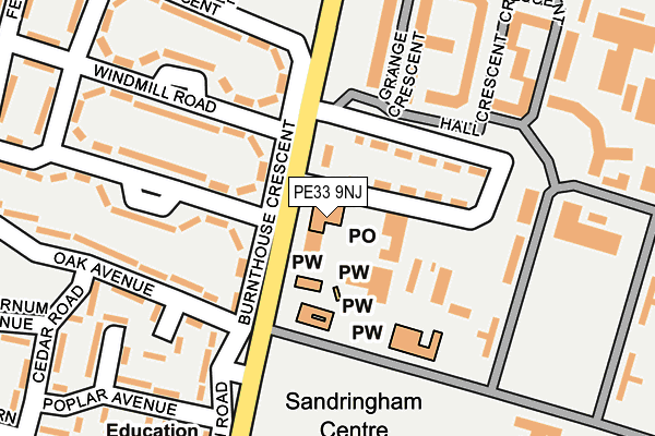
PE33 9NJ is located in the Airfield electoral ward, within the local authority district of King's Lynn and West Norfolk and the English Parliamentary constituency of South West Norfolk. The Sub Integrated Care Board (ICB) Location is NHS Norfolk and Waveney ICB - 26A and the police force is Norfolk. This postcode has been in use since May 2020.


GetTheData
Source: OS OpenMap – Local (Ordnance Survey)
Source: OS VectorMap District (Ordnance Survey)
Licence: Open Government Licence (requires attribution)
| Easting | 572171 |
| Northing | 309817 |
| Latitude | 52.658759 |
| Longitude | 0.544195 |
GetTheData
Source: Open Postcode Geo
Licence: Open Government Licence
| Country | England |
| Postcode District | PE33 |
➜ See where PE33 is on a map | |
GetTheData
Source: Land Registry Price Paid Data
Licence: Open Government Licence
Elevation or altitude of PE33 9NJ as distance above sea level:
| Metres | Feet | |
|---|---|---|
| Elevation | 20m | 66ft |
Elevation is measured from the approximate centre of the postcode, to the nearest point on an OS contour line from OS Terrain 50, which has contour spacing of ten vertical metres.
➜ How high above sea level am I? Find the elevation of your current position using your device's GPS.
GetTheData
Source: Open Postcode Elevation
Licence: Open Government Licence
| Ward | Airfield |
| Constituency | South West Norfolk |
GetTheData
Source: ONS Postcode Database
Licence: Open Government Licence
| Oak Avenue (Burnthouse Drove) | Marham | 62m |
| Woodview Road (Burnthouse Drove) | Marham | 102m |
| Woodview Road (Burnt House Drove) | Marham | 134m |
| Raf Main Gate (Burnthouse Drove) | Marham | 586m |
| Raf Main Gate (Burnthouse Drove) | Marham | 605m |
GetTheData
Source: NaPTAN
Licence: Open Government Licence
GetTheData
Source: ONS Postcode Database
Licence: Open Government Licence


➜ Get more ratings from the Food Standards Agency
GetTheData
Source: Food Standards Agency
Licence: FSA terms & conditions
| Last Collection | |||
|---|---|---|---|
| Location | Mon-Fri | Sat | Distance |
| Fincham Post Office | 16:50 | 10:00 | 4,691m |
| Shouldham Post Office | 17:10 | 10:15 | 4,749m |
| High Street | 16:55 | 10:00 | 5,116m |
GetTheData
Source: Dracos
Licence: Creative Commons Attribution-ShareAlike
The below table lists the International Territorial Level (ITL) codes (formerly Nomenclature of Territorial Units for Statistics (NUTS) codes) and Local Administrative Units (LAU) codes for PE33 9NJ:
| ITL 1 Code | Name |
|---|---|
| TLH | East |
| ITL 2 Code | Name |
| TLH1 | East Anglia |
| ITL 3 Code | Name |
| TLH16 | North and West Norfolk |
| LAU 1 Code | Name |
| E07000146 | King's Lynn and West Norfolk |
GetTheData
Source: ONS Postcode Directory
Licence: Open Government Licence
The below table lists the Census Output Area (OA), Lower Layer Super Output Area (LSOA), and Middle Layer Super Output Area (MSOA) for PE33 9NJ:
| Code | Name | |
|---|---|---|
| OA | E00169862 | |
| LSOA | E01026644 | King's Lynn and West Norfolk 014C |
| MSOA | E02005564 | King's Lynn and West Norfolk 014 |
GetTheData
Source: ONS Postcode Directory
Licence: Open Government Licence
| PE33 9LG | Burnthouse Crescent | 277m |
| PE33 9LE | Windmill Road | 300m |
| PE33 9LQ | Fen Road | 343m |
| PE33 9NX | Burnthouse Drove | 623m |
| PE33 9PN | Squires Hill | 804m |
| PE33 9JN | The Street | 842m |
| PE33 9JL | Chapel Street | 855m |
| PE33 9JP | The Street | 895m |
| PE33 9JW | Hoggs Drove | 964m |
| PE33 9JJ | Hillside | 988m |
GetTheData
Source: Open Postcode Geo; Land Registry Price Paid Data
Licence: Open Government Licence