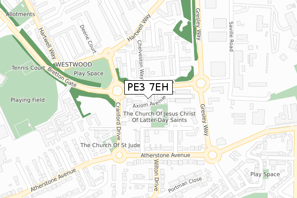
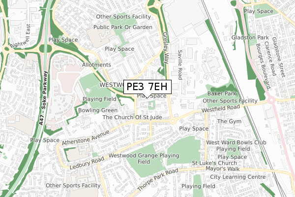
PE3 7EH lies on Axiom Avenue in Peterborough. PE3 7EH is located in the Ravensthorpe electoral ward, within the unitary authority of Peterborough and the English Parliamentary constituency of Peterborough. The Sub Integrated Care Board (ICB) Location is NHS Cambridgeshire and Peterborough ICB - 06H and the police force is Cambridgeshire. This postcode has been in use since January 1980.


GetTheData
Source: OS Open Zoomstack (Ordnance Survey)
Licence: Open Government Licence (requires attribution)
Attribution: Contains OS data © Crown copyright and database right 2025
Source: Open Postcode Geo
Licence: Open Government Licence (requires attribution)
Attribution: Contains OS data © Crown copyright and database right 2025; Contains Royal Mail data © Royal Mail copyright and database right 2025; Source: Office for National Statistics licensed under the Open Government Licence v.3.0
| Easting | 517424 |
| Northing | 299869 |
| Latitude | 52.583957 |
| Longitude | -0.268314 |
GetTheData
Source: Open Postcode Geo
Licence: Open Government Licence
| Street | Axiom Avenue |
| Town/City | Peterborough |
| Country | England |
| Postcode District | PE3 |
➜ See where PE3 is on a map ➜ Where is Peterborough? | |
GetTheData
Source: Land Registry Price Paid Data
Licence: Open Government Licence
Elevation or altitude of PE3 7EH as distance above sea level:
| Metres | Feet | |
|---|---|---|
| Elevation | 20m | 66ft |
Elevation is measured from the approximate centre of the postcode, to the nearest point on an OS contour line from OS Terrain 50, which has contour spacing of ten vertical metres.
➜ How high above sea level am I? Find the elevation of your current position using your device's GPS.
GetTheData
Source: Open Postcode Elevation
Licence: Open Government Licence
| Ward | Ravensthorpe |
| Constituency | Peterborough |
GetTheData
Source: ONS Postcode Database
Licence: Open Government Licence
| St Judes Church (Cranford Drive) | Westwood | 119m |
| St Judes Church (Cranford Drive) | Westwood | 145m |
| Cranford Drive | Westwood | 146m |
| Wilton Drive (Atherstone Avenue) | Netherton | 193m |
| Wilton Drive (Atherstone Avenue) | Netherton | 194m |
| Peterborough Station | 1.6km |
GetTheData
Source: NaPTAN
Licence: Open Government Licence
| Percentage of properties with Next Generation Access | 100.0% |
| Percentage of properties with Superfast Broadband | 100.0% |
| Percentage of properties with Ultrafast Broadband | 96.6% |
| Percentage of properties with Full Fibre Broadband | 0.0% |
Superfast Broadband is between 30Mbps and 300Mbps
Ultrafast Broadband is > 300Mbps
| Median download speed | 70.0Mbps |
| Average download speed | 85.0Mbps |
| Maximum download speed | 350.00Mbps |
| Median upload speed | 9.8Mbps |
| Average upload speed | 7.7Mbps |
| Maximum upload speed | 19.53Mbps |
| Percentage of properties unable to receive 2Mbps | 0.0% |
| Percentage of properties unable to receive 5Mbps | 0.0% |
| Percentage of properties unable to receive 10Mbps | 0.0% |
| Percentage of properties unable to receive 30Mbps | 0.0% |
GetTheData
Source: Ofcom
Licence: Ofcom Terms of Use (requires attribution)
Estimated total energy consumption in PE3 7EH by fuel type, 2015.
| Consumption (kWh) | 482,292 |
|---|---|
| Meter count | 60 |
| Mean (kWh/meter) | 8,038 |
| Median (kWh/meter) | 7,428 |
| Consumption (kWh) | 173,389 |
|---|---|
| Meter count | 61 |
| Mean (kWh/meter) | 2,842 |
| Median (kWh/meter) | 2,514 |
GetTheData
Source: Postcode level gas estimates: 2015 (experimental)
Source: Postcode level electricity estimates: 2015 (experimental)
Licence: Open Government Licence
GetTheData
Source: ONS Postcode Database
Licence: Open Government Licence


➜ Get more ratings from the Food Standards Agency
GetTheData
Source: Food Standards Agency
Licence: FSA terms & conditions
| Last Collection | |||
|---|---|---|---|
| Location | Mon-Fri | Sat | Distance |
| Cranford Drive Roundabout | 18:45 | 13:15 | 237m |
| Atherstone Avenue | 18:30 | 13:00 | 290m |
| Hartwell Way-hartwell Court | 18:30 | 13:00 | 344m |
GetTheData
Source: Dracos
Licence: Creative Commons Attribution-ShareAlike
The below table lists the International Territorial Level (ITL) codes (formerly Nomenclature of Territorial Units for Statistics (NUTS) codes) and Local Administrative Units (LAU) codes for PE3 7EH:
| ITL 1 Code | Name |
|---|---|
| TLH | East |
| ITL 2 Code | Name |
| TLH1 | East Anglia |
| ITL 3 Code | Name |
| TLH11 | Peterborough |
| LAU 1 Code | Name |
| E06000031 | Peterborough |
GetTheData
Source: ONS Postcode Directory
Licence: Open Government Licence
The below table lists the Census Output Area (OA), Lower Layer Super Output Area (LSOA), and Middle Layer Super Output Area (MSOA) for PE3 7EH:
| Code | Name | |
|---|---|---|
| OA | E00079218 | |
| LSOA | E01015663 | Peterborough 009D |
| MSOA | E02003245 | Peterborough 009 |
GetTheData
Source: ONS Postcode Directory
Licence: Open Government Licence
| PE3 7EJ | Axiom Avenue | 32m |
| PE3 9TR | Kildare Drive | 76m |
| PE3 9TS | Kildare Drive | 120m |
| PE3 7EG | Chelveston Way | 132m |
| PE3 9TP | Cottesmore Close | 155m |
| PE3 7EE | Clipston Walk | 159m |
| PE3 7EQ | Chelveston Way | 164m |
| PE3 7ED | Clipston Walk | 170m |
| PE3 9TU | Atherstone Avenue | 174m |
| PE3 7EF | Irchester Place | 177m |
GetTheData
Source: Open Postcode Geo; Land Registry Price Paid Data
Licence: Open Government Licence