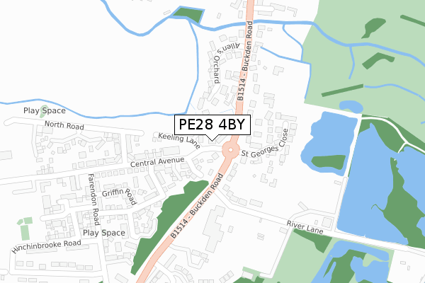
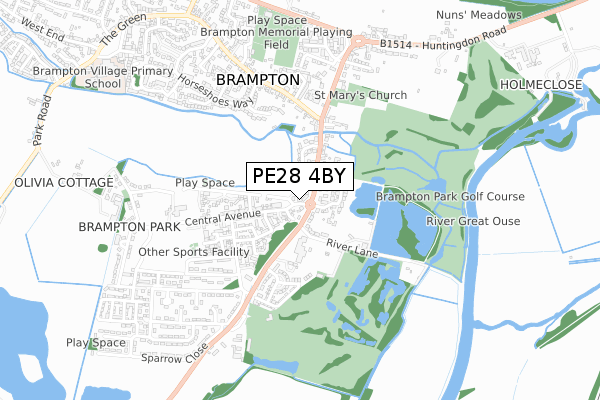
PE28 4BY is located in the Brampton electoral ward, within the local authority district of Huntingdonshire and the English Parliamentary constituency of Huntingdon. The Sub Integrated Care Board (ICB) Location is NHS Cambridgeshire and Peterborough ICB - 06H and the police force is Cambridgeshire. This postcode has been in use since October 2019.


GetTheData
Source: OS Open Zoomstack (Ordnance Survey)
Licence: Open Government Licence (requires attribution)
Attribution: Contains OS data © Crown copyright and database right 2024
Source: Open Postcode Geo
Licence: Open Government Licence (requires attribution)
Attribution: Contains OS data © Crown copyright and database right 2024; Contains Royal Mail data © Royal Mail copyright and database right 2024; Source: Office for National Statistics licensed under the Open Government Licence v.3.0
| Easting | 521351 |
| Northing | 270296 |
| Latitude | 52.317378 |
| Longitude | -0.221102 |
GetTheData
Source: Open Postcode Geo
Licence: Open Government Licence
| Country | England |
| Postcode District | PE28 |
| ➜ PE28 open data dashboard ➜ See where PE28 is on a map ➜ Where is Brampton? | |
GetTheData
Source: Land Registry Price Paid Data
Licence: Open Government Licence
| Ward | Brampton |
| Constituency | Huntingdon |
GetTheData
Source: ONS Postcode Database
Licence: Open Government Licence
| October 2023 | Vehicle crime | On or near Allen'S Orchard | 155m |
| October 2023 | Vehicle crime | On or near Allen'S Orchard | 155m |
| August 2023 | Violence and sexual offences | On or near Allen'S Orchard | 155m |
| ➜ Get more crime data in our Crime section | |||
GetTheData
Source: data.police.uk
Licence: Open Government Licence
| Allen's Orchard (Buckden Road) | Brampton | 117m |
| Allen's Orchard (Buckden Road) | Brampton | 184m |
| Park Lane (Buckden Road) | Brampton | 432m |
| Park Lane (Buckden Road) | Brampton | 434m |
| Horseshoes Way (High Street) | Brampton | 501m |
| Huntingdon Station | 2.3km |
GetTheData
Source: NaPTAN
Licence: Open Government Licence
GetTheData
Source: ONS Postcode Database
Licence: Open Government Licence


➜ Get more ratings from the Food Standards Agency
GetTheData
Source: Food Standards Agency
Licence: FSA terms & conditions
| Last Collection | |||
|---|---|---|---|
| Location | Mon-Fri | Sat | Distance |
| Buckden Road | 17:30 | 09:00 | 95m |
| Brampton Post Office | 17:30 | 10:20 | 511m |
| Brampton Church | 17:30 | 10:30 | 569m |
GetTheData
Source: Dracos
Licence: Creative Commons Attribution-ShareAlike
| Facility | Distance |
|---|---|
| Brampton Park Golf Club Buckden Road, Brampton, Huntingdon Golf | 528m |
| Raf Brampton (Closed) Montagu Road, Brampton, Huntingdon Sports Hall, Health and Fitness Gym, Grass Pitches, Squash Courts | 626m |
| Brampton Memorial Playing Field Thrapston Road, Brampton, Huntingdon Grass Pitches | 780m |
GetTheData
Source: Active Places
Licence: Open Government Licence
| School | Phase of Education | Distance |
|---|---|---|
| Brampton Village Primary School The Green, Brampton, Huntingdon, PE28 4RF | Primary | 965m |
| Hinchingbrooke School Brampton Road, Huntingdon, PE29 3BN | Secondary | 1.8km |
| Cromwell Academy Parkway, Hinchingbrooke Park, Huntingdon, PE29 6JA | Primary | 2.1km |
GetTheData
Source: Edubase
Licence: Open Government Licence
| Risk of PE28 4BY flooding from rivers and sea | Medium |
| ➜ PE28 4BY flood map | |
GetTheData
Source: Open Flood Risk by Postcode
Licence: Open Government Licence
The below table lists the International Territorial Level (ITL) codes (formerly Nomenclature of Territorial Units for Statistics (NUTS) codes) and Local Administrative Units (LAU) codes for PE28 4BY:
| ITL 1 Code | Name |
|---|---|
| TLH | East |
| ITL 2 Code | Name |
| TLH1 | East Anglia |
| ITL 3 Code | Name |
| TLH12 | Cambridgeshire CC |
| LAU 1 Code | Name |
| E07000011 | Huntingdonshire |
GetTheData
Source: ONS Postcode Directory
Licence: Open Government Licence
The below table lists the Census Output Area (OA), Lower Layer Super Output Area (LSOA), and Middle Layer Super Output Area (MSOA) for PE28 4BY:
| Code | Name | |
|---|---|---|
| OA | E00091403 | |
| LSOA | E01018117 | Huntingdonshire 010E |
| MSOA | E02003762 | Huntingdonshire 010 |
GetTheData
Source: ONS Postcode Directory
Licence: Open Government Licence
| PE28 4PR | Buckden Road | 100m |
| PE28 4US | St Georges Close | 108m |
| PE28 4UZ | Bradshaw Close | 141m |
| PE28 4PS | Buckden Road | 148m |
| PE28 4PU | River Lane | 168m |
| PE28 4NW | Allens Orchard | 170m |
| PE28 4PG | Baker Close | 326m |
| PE28 4TW | Hawkes End | 387m |
| PE28 4TG | High Street | 429m |
| PE28 4UF | Manor Close | 488m |
GetTheData
Source: Open Postcode Geo; Land Registry Price Paid Data
Licence: Open Government Licence