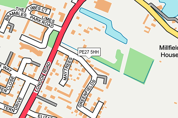
PE27 5HH is located in the St Ives South electoral ward, within the local authority district of Huntingdonshire and the English Parliamentary constituency of Huntingdon. The Sub Integrated Care Board (ICB) Location is NHS Cambridgeshire and Peterborough ICB - 06H and the police force is Cambridgeshire. This postcode has been in use since February 2017.


GetTheData
Source: OS OpenMap – Local (Ordnance Survey)
Source: OS VectorMap District (Ordnance Survey)
Licence: Open Government Licence (requires attribution)
| Easting | 530939 |
| Northing | 270253 |
| Latitude | 52.314791 |
| Longitude | -0.080537 |
GetTheData
Source: Open Postcode Geo
Licence: Open Government Licence
| Country | England |
| Postcode District | PE27 |
| ➜ PE27 open data dashboard ➜ See where PE27 is on a map ➜ Where is Hemingford Grey? | |
GetTheData
Source: Land Registry Price Paid Data
Licence: Open Government Licence
| Ward | St Ives South |
| Constituency | Huntingdon |
GetTheData
Source: ONS Postcode Database
Licence: Open Government Licence
| June 2022 | Violence and sexual offences | On or near Maytrees | 91m |
| June 2022 | Violence and sexual offences | On or near Maytrees | 91m |
| June 2022 | Violence and sexual offences | On or near Maytrees | 91m |
| ➜ Get more crime data in our Crime section | |||
GetTheData
Source: data.police.uk
Licence: Open Government Licence
| Greenfields (London Road) | St Ives | 125m |
| Greenfields (London Road) | St Ives | 163m |
| Filbert's Walk (Hemingford Road) | Hemingford Grey | 361m |
| Filbert's Walk (Hemingford Road) | Hemingford Grey | 377m |
| Pembroke Close (Hemingford Road) | Hemingford Grey | 691m |
GetTheData
Source: NaPTAN
Licence: Open Government Licence
➜ Broadband speed and availability dashboard for PE27 5HH
| Percentage of properties with Next Generation Access | 100.0% |
| Percentage of properties with Superfast Broadband | 100.0% |
| Percentage of properties with Ultrafast Broadband | 0.0% |
| Percentage of properties with Full Fibre Broadband | 0.0% |
Superfast Broadband is between 30Mbps and 300Mbps
Ultrafast Broadband is > 300Mbps
| Median download speed | 60.0Mbps |
| Average download speed | 55.8Mbps |
| Maximum download speed | 78.13Mbps |
| Median upload speed | 14.8Mbps |
| Average upload speed | 13.1Mbps |
| Maximum upload speed | 20.00Mbps |
| Percentage of properties unable to receive 2Mbps | 0.0% |
| Percentage of properties unable to receive 5Mbps | 0.0% |
| Percentage of properties unable to receive 10Mbps | 0.0% |
| Percentage of properties unable to receive 30Mbps | 0.0% |
➜ Broadband speed and availability dashboard for PE27 5HH
GetTheData
Source: Ofcom
Licence: Ofcom Terms of Use (requires attribution)
GetTheData
Source: ONS Postcode Database
Licence: Open Government Licence


➜ Get more ratings from the Food Standards Agency
GetTheData
Source: Food Standards Agency
Licence: FSA terms & conditions
| Last Collection | |||
|---|---|---|---|
| Location | Mon-Fri | Sat | Distance |
| London Road | 17:30 | 08:00 | 148m |
| Gasworks | 17:30 | 08:30 | 481m |
| Hemingford Road | 17:30 | 08:00 | 670m |
GetTheData
Source: Dracos
Licence: Creative Commons Attribution-ShareAlike
| Facility | Distance |
|---|---|
| Optimum Gym (Closed) Market Hill, St. Ives Health and Fitness Gym | 1.1km |
| Daintree Green Daintree Way, Hemingford Grey, Huntingdon Grass Pitches | 1.1km |
| Hemingford Grey Primary School St. Ives Road, Hemingford Grey, Huntingdon Grass Pitches | 1.1km |
GetTheData
Source: Active Places
Licence: Open Government Licence
| School | Phase of Education | Distance |
|---|---|---|
| Hemingford Grey Primary School St Ives Road, Hemingford Grey, St. Ives Road, Huntingdon, PE28 9DU | Primary | 1.1km |
| Westfield Junior School Ramsey Road, St Ives, PE27 5RG | Primary | 1.7km |
| Eastfield Infant and Nursery School Pig Lane, St Ives, PE27 5QT | Primary | 1.7km |
GetTheData
Source: Edubase
Licence: Open Government Licence
| Risk of PE27 5HH flooding from rivers and sea | Low |
| ➜ PE27 5HH flood map | |
GetTheData
Source: Open Flood Risk by Postcode
Licence: Open Government Licence
The below table lists the International Territorial Level (ITL) codes (formerly Nomenclature of Territorial Units for Statistics (NUTS) codes) and Local Administrative Units (LAU) codes for PE27 5HH:
| ITL 1 Code | Name |
|---|---|
| TLH | East |
| ITL 2 Code | Name |
| TLH1 | East Anglia |
| ITL 3 Code | Name |
| TLH12 | Cambridgeshire CC |
| LAU 1 Code | Name |
| E07000011 | Huntingdonshire |
GetTheData
Source: ONS Postcode Directory
Licence: Open Government Licence
The below table lists the Census Output Area (OA), Lower Layer Super Output Area (LSOA), and Middle Layer Super Output Area (MSOA) for PE27 5HH:
| Code | Name | |
|---|---|---|
| OA | E00091468 | |
| LSOA | E01018129 | Huntingdonshire 016A |
| MSOA | E02003768 | Huntingdonshire 016 |
GetTheData
Source: ONS Postcode Directory
Licence: Open Government Licence
| PE27 5WZ | Maytrees | 110m |
| PE27 5HB | Greenfields | 114m |
| PE27 5EX | London Road | 172m |
| PE27 5HA | Limes Park | 213m |
| PE27 5BQ | Elizabeth Court | 218m |
| PE27 5NG | Limes Court | 238m |
| PE27 5DJ | Dunnock Way | 265m |
| PE27 5EU | London Road | 279m |
| PE27 5DR | Tern Drive | 310m |
| PE27 5DH | Dunnock Way | 317m |
GetTheData
Source: Open Postcode Geo; Land Registry Price Paid Data
Licence: Open Government Licence