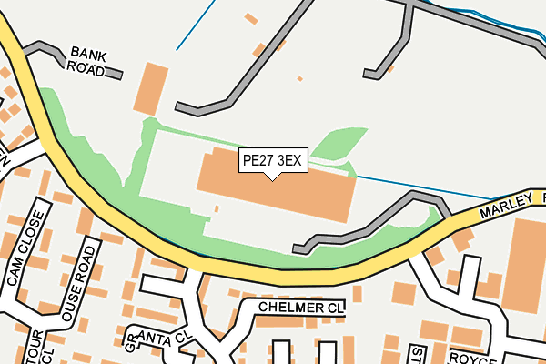
PE27 3EX is located in the St Ives East electoral ward, within the local authority district of Huntingdonshire and the English Parliamentary constituency of Huntingdon. The Sub Integrated Care Board (ICB) Location is NHS Cambridgeshire and Peterborough ICB - 06H and the police force is Cambridgeshire. This postcode has been in use since June 2000.


GetTheData
Source: OS OpenMap – Local (Ordnance Survey)
Source: OS VectorMap District (Ordnance Survey)
Licence: Open Government Licence (requires attribution)
| Easting | 531739 |
| Northing | 273222 |
| Latitude | 52.341262 |
| Longitude | -0.067669 |
GetTheData
Source: Open Postcode Geo
Licence: Open Government Licence
| Country | England |
| Postcode District | PE27 |
➜ See where PE27 is on a map | |
GetTheData
Source: Land Registry Price Paid Data
Licence: Open Government Licence
Elevation or altitude of PE27 3EX as distance above sea level:
| Metres | Feet | |
|---|---|---|
| Elevation | 10m | 33ft |
Elevation is measured from the approximate centre of the postcode, to the nearest point on an OS contour line from OS Terrain 50, which has contour spacing of ten vertical metres.
➜ How high above sea level am I? Find the elevation of your current position using your device's GPS.
GetTheData
Source: Open Postcode Elevation
Licence: Open Government Licence
| Ward | St Ives East |
| Constituency | Huntingdon |
GetTheData
Source: ONS Postcode Database
Licence: Open Government Licence
| Post Box (Marley Road) | St Ives | 125m |
| Post Box (Marley Road) | St Ives | 133m |
| Burrel Road (Marley Road) | St Ives | 142m |
| Burrel Road (Marley Road) | St Ives | 147m |
| Waveney Road (Marley Road) | St Ives | 227m |
GetTheData
Source: NaPTAN
Licence: Open Government Licence
GetTheData
Source: ONS Postcode Database
Licence: Open Government Licence


➜ Get more ratings from the Food Standards Agency
GetTheData
Source: Food Standards Agency
Licence: FSA terms & conditions
| Last Collection | |||
|---|---|---|---|
| Location | Mon-Fri | Sat | Distance |
| Waveney Road | 17:30 | 11:30 | 127m |
| Constable Road Shop Centre | 17:30 | 11:30 | 564m |
| Nuffield Road | 17:30 | 11:30 | 597m |
GetTheData
Source: Dracos
Licence: Creative Commons Attribution-ShareAlike
The below table lists the International Territorial Level (ITL) codes (formerly Nomenclature of Territorial Units for Statistics (NUTS) codes) and Local Administrative Units (LAU) codes for PE27 3EX:
| ITL 1 Code | Name |
|---|---|
| TLH | East |
| ITL 2 Code | Name |
| TLH1 | East Anglia |
| ITL 3 Code | Name |
| TLH12 | Cambridgeshire CC |
| LAU 1 Code | Name |
| E07000011 | Huntingdonshire |
GetTheData
Source: ONS Postcode Directory
Licence: Open Government Licence
The below table lists the Census Output Area (OA), Lower Layer Super Output Area (LSOA), and Middle Layer Super Output Area (MSOA) for PE27 3EX:
| Code | Name | |
|---|---|---|
| OA | E00091627 | |
| LSOA | E01018162 | Huntingdonshire 011B |
| MSOA | E02003763 | Huntingdonshire 011 |
GetTheData
Source: ONS Postcode Directory
Licence: Open Government Licence
| PE27 3WN | Redmoor Close | 153m |
| PE27 3FX | Chelmer Close | 153m |
| PE27 3FY | Tay Close | 203m |
| PE27 3EY | Granta Close | 224m |
| PE27 3FT | Ouse Road | 257m |
| PE27 3HP | Derwent Close | 257m |
| PE27 3FG | Cam Close | 275m |
| PE27 3NE | Royce Court | 280m |
| PE27 3HL | Alwyn Close | 287m |
| PE27 3WJ | Stephenson Road | 293m |
GetTheData
Source: Open Postcode Geo; Land Registry Price Paid Data
Licence: Open Government Licence