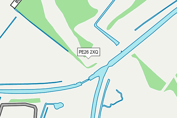
PE26 2XQ is located in the Ramsey electoral ward, within the local authority district of Huntingdonshire and the English Parliamentary constituency of North West Cambridgeshire. The Sub Integrated Care Board (ICB) Location is NHS Cambridgeshire and Peterborough ICB - 06H and the police force is Cambridgeshire. This postcode has been in use since June 2000.


GetTheData
Source: OS OpenMap – Local (Ordnance Survey)
Source: OS VectorMap District (Ordnance Survey)
Licence: Open Government Licence (requires attribution)
| Easting | 528961 |
| Northing | 287028 |
| Latitude | 52.465988 |
| Longitude | -0.103087 |
GetTheData
Source: Open Postcode Geo
Licence: Open Government Licence
| Country | England |
| Postcode District | PE26 |
➜ See where PE26 is on a map | |
GetTheData
Source: Land Registry Price Paid Data
Licence: Open Government Licence
Elevation or altitude of PE26 2XQ as distance above sea level:
| Metres | Feet | |
|---|---|---|
| Elevation | 0m | 0ft |
Elevation is measured from the approximate centre of the postcode, to the nearest point on an OS contour line from OS Terrain 50, which has contour spacing of ten vertical metres.
➜ How high above sea level am I? Find the elevation of your current position using your device's GPS.
GetTheData
Source: Open Postcode Elevation
Licence: Open Government Licence
| Ward | Ramsey |
| Constituency | North West Cambridgeshire |
GetTheData
Source: ONS Postcode Database
Licence: Open Government Licence
| Bodsey Cottages (Bodsey Toll Road) | Ramsey | 711m |
| Bodsey Cottages (Bodsey Toll Road) | Ramsey | 722m |
| Tesco (Neil Way) | Ramsey | 1,348m |
| Wells Bridge | Ramsey | 1,434m |
| Wells Bridge | Ramsey | 1,444m |
GetTheData
Source: NaPTAN
Licence: Open Government Licence
GetTheData
Source: ONS Postcode Database
Licence: Open Government Licence


➜ Get more ratings from the Food Standards Agency
GetTheData
Source: Food Standards Agency
Licence: FSA terms & conditions
| Last Collection | |||
|---|---|---|---|
| Location | Mon-Fri | Sat | Distance |
| Great Whyte Ramsey | 16:45 | 12:00 | 1,534m |
| Wood Lane Ramsey | 16:00 | 12:00 | 1,649m |
| Newtown Road Ramsey | 16:45 | 12:00 | 1,654m |
GetTheData
Source: Dracos
Licence: Creative Commons Attribution-ShareAlike
The below table lists the International Territorial Level (ITL) codes (formerly Nomenclature of Territorial Units for Statistics (NUTS) codes) and Local Administrative Units (LAU) codes for PE26 2XQ:
| ITL 1 Code | Name |
|---|---|
| TLH | East |
| ITL 2 Code | Name |
| TLH1 | East Anglia |
| ITL 3 Code | Name |
| TLH12 | Cambridgeshire CC |
| LAU 1 Code | Name |
| E07000011 | Huntingdonshire |
GetTheData
Source: ONS Postcode Directory
Licence: Open Government Licence
The below table lists the Census Output Area (OA), Lower Layer Super Output Area (LSOA), and Middle Layer Super Output Area (MSOA) for PE26 2XQ:
| Code | Name | |
|---|---|---|
| OA | E00091599 | |
| LSOA | E01018157 | Huntingdonshire 003B |
| MSOA | E02003755 | Huntingdonshire 003 |
GetTheData
Source: ONS Postcode Directory
Licence: Open Government Licence
| PE26 2XH | Bodsey | 706m |
| PE26 2XE | Wood Lane | 1068m |
| PE26 2RB | Highlode Industrial Estate | 1130m |
| PE26 2SL | St Marys Road | 1376m |
| PE26 2XJ | Wells Bridge | 1380m |
| PE26 2XZ | Belvedere | 1422m |
| PE26 1SA | Stocking Fen Road | 1436m |
| PE26 2XX | Windsor Drive | 1482m |
| PE26 1GH | Great Whyte | 1486m |
| PE26 1EU | Millfields | 1492m |
GetTheData
Source: Open Postcode Geo; Land Registry Price Paid Data
Licence: Open Government Licence