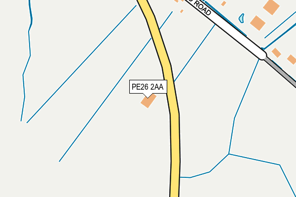
PE26 2AA is located in the Warboys electoral ward, within the local authority district of Huntingdonshire and the English Parliamentary constituency of North West Cambridgeshire. The Sub Integrated Care Board (ICB) Location is NHS Cambridgeshire and Peterborough ICB - 06H and the police force is Cambridgeshire. This postcode has been in use since January 2010.


GetTheData
Source: OS OpenMap – Local (Ordnance Survey)
Source: OS VectorMap District (Ordnance Survey)
Licence: Open Government Licence (requires attribution)
| Easting | 525410 |
| Northing | 284245 |
| Latitude | 52.441791 |
| Longitude | -0.156394 |
GetTheData
Source: Open Postcode Geo
Licence: Open Government Licence
| Country | England |
| Postcode District | PE26 |
➜ See where PE26 is on a map | |
GetTheData
Source: Land Registry Price Paid Data
Licence: Open Government Licence
Elevation or altitude of PE26 2AA as distance above sea level:
| Metres | Feet | |
|---|---|---|
| Elevation | 10m | 33ft |
Elevation is measured from the approximate centre of the postcode, to the nearest point on an OS contour line from OS Terrain 50, which has contour spacing of ten vertical metres.
➜ How high above sea level am I? Find the elevation of your current position using your device's GPS.
GetTheData
Source: Open Postcode Elevation
Licence: Open Government Licence
| Ward | Warboys |
| Constituency | North West Cambridgeshire |
GetTheData
Source: ONS Postcode Database
Licence: Open Government Licence
| Chapel Road (Ugg Mere Court Road) | Ramsey Heights | 563m |
| Chapel Road (Ugg Mere Court Road) | Ramsey Heights | 564m |
| Middle Drove (Ugg Mere Court Road) | Ramsey Heights | 1,220m |
| Middle Drove (Ugg Mere Court Road) | Ramsey Heights | 1,222m |
| Ramsey Road (High Street) | Upwood | 1,402m |
GetTheData
Source: NaPTAN
Licence: Open Government Licence
GetTheData
Source: ONS Postcode Database
Licence: Open Government Licence


➜ Get more ratings from the Food Standards Agency
GetTheData
Source: Food Standards Agency
Licence: FSA terms & conditions
| Last Collection | |||
|---|---|---|---|
| Location | Mon-Fri | Sat | Distance |
| Ramsey Heights | 16:30 | 07:30 | 1,234m |
| Upwood Village | 16:30 | 09:30 | 1,420m |
| Fairmead Park | 16:30 | 07:10 | 2,073m |
GetTheData
Source: Dracos
Licence: Creative Commons Attribution-ShareAlike
The below table lists the International Territorial Level (ITL) codes (formerly Nomenclature of Territorial Units for Statistics (NUTS) codes) and Local Administrative Units (LAU) codes for PE26 2AA:
| ITL 1 Code | Name |
|---|---|
| TLH | East |
| ITL 2 Code | Name |
| TLH1 | East Anglia |
| ITL 3 Code | Name |
| TLH12 | Cambridgeshire CC |
| LAU 1 Code | Name |
| E07000011 | Huntingdonshire |
GetTheData
Source: ONS Postcode Directory
Licence: Open Government Licence
The below table lists the Census Output Area (OA), Lower Layer Super Output Area (LSOA), and Middle Layer Super Output Area (MSOA) for PE26 2AA:
| Code | Name | |
|---|---|---|
| OA | E00091845 | |
| LSOA | E01018207 | Huntingdonshire 006F |
| MSOA | E02003758 | Huntingdonshire 006 |
GetTheData
Source: ONS Postcode Directory
Licence: Open Government Licence
| PE26 2RY | Upwood Road | 378m |
| PE26 2RL | Ugg Mere Court Road | 713m |
| PE26 2RS | Chapel Road | 1114m |
| PE26 2RR | Harpers Drove | 1199m |
| PE26 2RP | School Drove | 1202m |
| PE26 2RJ | Ugg Mere Court Road | 1251m |
| PE26 2QD | Longholme Road | 1345m |
| PE26 2RG | Middle Drove | 1559m |
| PE26 2QP | Barley Way | 1578m |
| PE26 2QE | High Street | 1622m |
GetTheData
Source: Open Postcode Geo; Land Registry Price Paid Data
Licence: Open Government Licence