PE24 5LU maps, stats, and open data
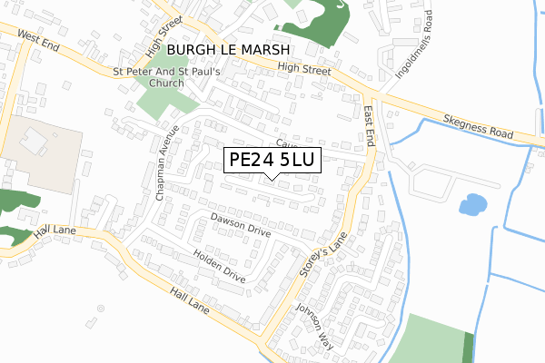
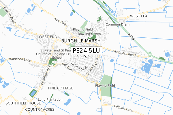
PE24 5LU lies on Barnack Estate in Burgh Le Marsh, Skegness. PE24 5LU is located in the Burgh le Marsh electoral ward, within the local authority district of East Lindsey and the English Parliamentary constituency of Boston and Skegness. The Sub Integrated Care Board (ICB) Location is NHS Lincolnshire ICB - 71E and the police force is Lincolnshire. This postcode has been in use since January 1980.
PE24 5LU maps


Licence: Open Government Licence (requires attribution)
Attribution: Contains OS data © Crown copyright and database right 2025
Source: Open Postcode Geo
Licence: Open Government Licence (requires attribution)
Attribution: Contains OS data © Crown copyright and database right 2025; Contains Royal Mail data © Royal Mail copyright and database right 2025; Source: Office for National Statistics licensed under the Open Government Licence v.3.0
PE24 5LU geodata
| Easting | 550288 |
| Northing | 364811 |
| Latitude | 53.159220 |
| Longitude | 0.246332 |
Where is PE24 5LU?
| Street | Barnack Estate |
| Locality | Burgh Le Marsh |
| Town/City | Skegness |
| Country | England |
| Postcode District | PE24 |
PE24 5LU Elevation
Elevation or altitude of PE24 5LU as distance above sea level:
| Metres | Feet | |
|---|---|---|
| Elevation | 10m | 33ft |
Elevation is measured from the approximate centre of the postcode, to the nearest point on an OS contour line from OS Terrain 50, which has contour spacing of ten vertical metres.
➜ How high above sea level am I? Find the elevation of your current position using your device's GPS.
Politics
| Ward | Burgh Le Marsh |
|---|---|
| Constituency | Boston And Skegness |
Transport
Nearest bus stops to PE24 5LU
| Market Close (High Street) | Burgh Le Marsh | 219m |
| Market Close (High Street) | Burgh Le Marsh | 220m |
| Johnson Way (Storey's Lane) | Burgh Le Marsh | 253m |
| East End (Skegness Road) | Burgh Le Marsh | 255m |
| Bell Hotel (High Street) | Burgh Le Marsh | 287m |
Nearest railway stations to PE24 5LU
| Thorpe Culvert Station | 5.1km |
| Havenhouse Station | 5.3km |
Broadband
Broadband access in PE24 5LU (2020 data)
| Percentage of properties with Next Generation Access | 100.0% |
| Percentage of properties with Superfast Broadband | 100.0% |
| Percentage of properties with Ultrafast Broadband | 0.0% |
| Percentage of properties with Full Fibre Broadband | 0.0% |
Superfast Broadband is between 30Mbps and 300Mbps
Ultrafast Broadband is > 300Mbps
Broadband speed in PE24 5LU (2019 data)
Download
| Median download speed | 39.1Mbps |
| Average download speed | 38.1Mbps |
| Maximum download speed | 79.98Mbps |
Upload
| Median upload speed | 7.3Mbps |
| Average upload speed | 7.0Mbps |
| Maximum upload speed | 20.00Mbps |
Broadband limitations in PE24 5LU (2020 data)
| Percentage of properties unable to receive 2Mbps | 0.0% |
| Percentage of properties unable to receive 5Mbps | 0.0% |
| Percentage of properties unable to receive 10Mbps | 0.0% |
| Percentage of properties unable to receive 30Mbps | 0.0% |
PE24 5LU gas and electricity consumption
Estimated total energy consumption in PE24 5LU by fuel type, 2015.
Gas
| Consumption (kWh) | 358,779 |
|---|---|
| Meter count | 34 |
| Mean (kWh/meter) | 10,552 |
| Median (kWh/meter) | 9,699 |
Electricity
| Consumption (kWh) | 121,222 |
|---|---|
| Meter count | 37 |
| Mean (kWh/meter) | 3,276 |
| Median (kWh/meter) | 3,130 |
- Consumption: The estimated total energy consumption, in kWh, across all meters in PE24 5LU, for 2015.
- Meter count: The total number of meters in PE24 5LU.
- Mean: The mean average consumption per meter, in kWh.
- Median: The median average consumption per meter, in kWh.
Source: Postcode level electricity estimates: 2015 (experimental)
Licence: Open Government Licence
Deprivation
80.7% of English postcodes are less deprived than PE24 5LU:Food Standards Agency
Three nearest food hygiene ratings to PE24 5LU (metres)


➜ Get more ratings from the Food Standards Agency
PE24 5LU ITL and PE24 5LU LAU
The below table lists the International Territorial Level (ITL) codes (formerly Nomenclature of Territorial Units for Statistics (NUTS) codes) and Local Administrative Units (LAU) codes for PE24 5LU:
| ITL 1 Code | Name |
|---|---|
| TLF | East Midlands (England) |
| ITL 2 Code | Name |
| TLF3 | Lincolnshire |
| ITL 3 Code | Name |
| TLF30 | Lincolnshire CC |
| LAU 1 Code | Name |
| E07000137 | East Lindsey |
PE24 5LU census areas
The below table lists the Census Output Area (OA), Lower Layer Super Output Area (LSOA), and Middle Layer Super Output Area (MSOA) for PE24 5LU:
| Code | Name | |
|---|---|---|
| OA | E00132178 | |
| LSOA | E01026046 | East Lindsey 013A |
| MSOA | E02005436 | East Lindsey 013 |
Nearest postcodes to PE24 5LU
| PE24 5LE | Jane Palmer Court | 59m |
| PE24 5NA | Dawson Drive | 83m |
| PE24 5LT | The Causeway | 90m |
| PE24 5NG | Walls Avenue | 135m |
| PE24 5LQ | Old Chapel Lane | 154m |
| PE24 5LZ | Holden Drive | 163m |
| PE24 5LR | Storeys Lane | 177m |
| PE24 5LF | The Causeway | 181m |
| PE24 5LW | East End | 183m |
| PE24 5LY | Chapman Avenue | 194m |