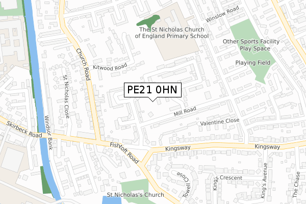
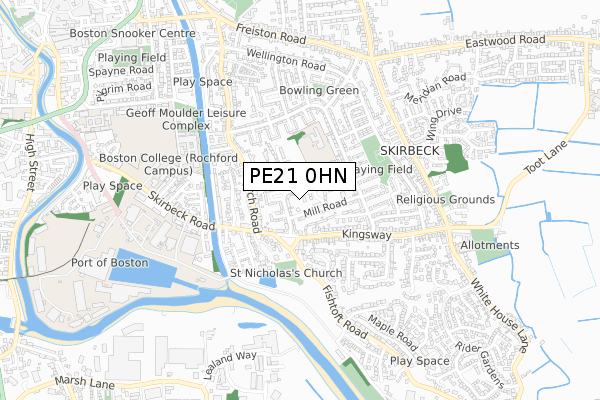
PE21 0HN is located in the Skirbeck electoral ward, within the local authority district of Boston and the English Parliamentary constituency of Boston and Skegness. The Sub Integrated Care Board (ICB) Location is NHS Lincolnshire ICB - 71E and the police force is Lincolnshire. This postcode has been in use since November 2019.


GetTheData
Source: OS Open Zoomstack (Ordnance Survey)
Licence: Open Government Licence (requires attribution)
Attribution: Contains OS data © Crown copyright and database right 2024
Source: Open Postcode Geo
Licence: Open Government Licence (requires attribution)
Attribution: Contains OS data © Crown copyright and database right 2024; Contains Royal Mail data © Royal Mail copyright and database right 2024; Source: Office for National Statistics licensed under the Open Government Licence v.3.0
| Easting | 533860 |
| Northing | 343404 |
| Latitude | 52.971311 |
| Longitude | -0.008086 |
GetTheData
Source: Open Postcode Geo
Licence: Open Government Licence
| Country | England |
| Postcode District | PE21 |
| ➜ PE21 open data dashboard ➜ See where PE21 is on a map ➜ Where is Boston? | |
GetTheData
Source: Land Registry Price Paid Data
Licence: Open Government Licence
| Ward | Skirbeck |
| Constituency | Boston And Skegness |
GetTheData
Source: ONS Postcode Database
Licence: Open Government Licence
| June 2022 | Anti-social behaviour | On or near Mill Road | 92m |
| June 2022 | Anti-social behaviour | On or near St Nicholas Road | 105m |
| June 2022 | Criminal damage and arson | On or near St Nicholas Road | 105m |
| ➜ Get more crime data in our Crime section | |||
GetTheData
Source: data.police.uk
Licence: Open Government Licence
| College Annexe (Mill Road) | Boston | 51m |
| Post Office (Kingsway) | Boston | 152m |
| Ice Cream Parlour (Kingsway) | Boston | 206m |
| Mill Road (Woad Farm Road) | Boston | 241m |
| Mill Road (Woad Farm Road) | Boston | 260m |
| Boston Station | 1.7km |
GetTheData
Source: NaPTAN
Licence: Open Government Licence
GetTheData
Source: ONS Postcode Database
Licence: Open Government Licence


➜ Get more ratings from the Food Standards Agency
GetTheData
Source: Food Standards Agency
Licence: FSA terms & conditions
| Last Collection | |||
|---|---|---|---|
| Location | Mon-Fri | Sat | Distance |
| Kingsway Post Office | 17:30 | 12:00 | 138m |
| Mount Bridge | 17:45 | 12:00 | 378m |
| Kingsway | 17:30 | 12:00 | 390m |
GetTheData
Source: Dracos
Licence: Creative Commons Attribution-ShareAlike
| Facility | Distance |
|---|---|
| Boston College (Closed) Mill Road, Boston Grass Pitches, Sports Hall | 33m |
| Boston St Nicholas Ce Primary School Woad Farm Road, Boston Grass Pitches | 255m |
| Geoff Moulder Leisure Complex Rowley Road, Boston Swimming Pool, Health and Fitness Gym, Studio | 587m |
GetTheData
Source: Active Places
Licence: Open Government Licence
| School | Phase of Education | Distance |
|---|---|---|
| St Nicholas CE Primary Academy Woad Farm Road, Boston, PE21 0EF | Primary | 255m |
| Boston Nursery School Church Road, Boston, PE21 0LJ | Nursery | 277m |
| Boston College Rochford Campus, Skirbeck Road, Boston, PE21 6JF | 16 plus | 498m |
GetTheData
Source: Edubase
Licence: Open Government Licence
| Risk of PE21 0HN flooding from rivers and sea | High |
| ➜ PE21 0HN flood map | |
GetTheData
Source: Open Flood Risk by Postcode
Licence: Open Government Licence
The below table lists the International Territorial Level (ITL) codes (formerly Nomenclature of Territorial Units for Statistics (NUTS) codes) and Local Administrative Units (LAU) codes for PE21 0HN:
| ITL 1 Code | Name |
|---|---|
| TLF | East Midlands (England) |
| ITL 2 Code | Name |
| TLF3 | Lincolnshire |
| ITL 3 Code | Name |
| TLF30 | Lincolnshire CC |
| LAU 1 Code | Name |
| E07000136 | Boston |
GetTheData
Source: ONS Postcode Directory
Licence: Open Government Licence
The below table lists the Census Output Area (OA), Lower Layer Super Output Area (LSOA), and Middle Layer Super Output Area (MSOA) for PE21 0HN:
| Code | Name | |
|---|---|---|
| OA | E00132072 | |
| LSOA | E01026026 | Boston 004C |
| MSOA | E02005420 | Boston 004 |
GetTheData
Source: ONS Postcode Directory
Licence: Open Government Licence
| PE21 0HH | St Nicholas Road | 101m |
| PE21 0HF | Mill Road | 102m |
| PE21 0HJ | St Nicholas Road | 148m |
| PE21 0HQ | St Nicholas Road | 154m |
| PE21 0AN | Kingsway | 180m |
| PE21 0PX | Kitwood Road | 200m |
| PE21 0AL | Fishtoft Road | 204m |
| PE21 0EN | Woad Farm Road | 220m |
| PE21 0DL | Fishtoft Road | 223m |
| PE21 0LW | Church Road | 231m |
GetTheData
Source: Open Postcode Geo; Land Registry Price Paid Data
Licence: Open Government Licence