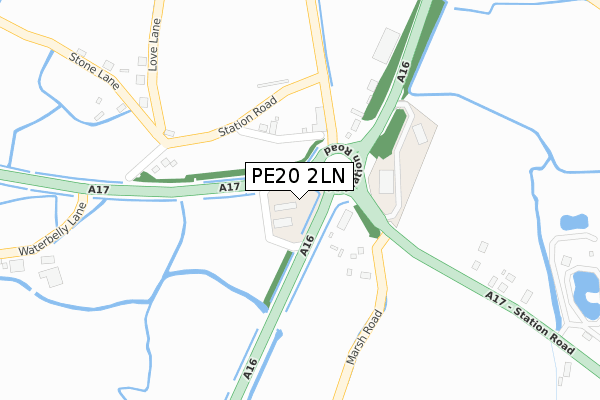
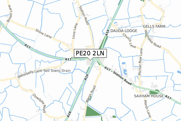
PE20 2LN is located in the Five Village electoral ward, within the local authority district of Boston and the English Parliamentary constituency of Boston and Skegness. The Sub Integrated Care Board (ICB) Location is NHS Lincolnshire ICB - 71E and the police force is Lincolnshire. This postcode has been in use since February 2019.


GetTheData
Source: OS Open Zoomstack (Ordnance Survey)
Licence: Open Government Licence (requires attribution)
Attribution: Contains OS data © Crown copyright and database right 2024
Source: Open Postcode Geo
Licence: Open Government Licence (requires attribution)
Attribution: Contains OS data © Crown copyright and database right 2024; Contains Royal Mail data © Royal Mail copyright and database right 2024; Source: Office for National Statistics licensed under the Open Government Licence v.3.0
| Easting | 528873 |
| Northing | 334120 |
| Latitude | 52.889121 |
| Longitude | -0.085985 |
GetTheData
Source: Open Postcode Geo
Licence: Open Government Licence
| Country | England |
| Postcode District | PE20 |
| ➜ PE20 open data dashboard ➜ See where PE20 is on a map ➜ Where is Sutterton Dowdyke? | |
GetTheData
Source: Land Registry Price Paid Data
Licence: Open Government Licence
| Ward | Five Village |
| Constituency | Boston And Skegness |
GetTheData
Source: ONS Postcode Database
Licence: Open Government Licence
| June 2022 | Anti-social behaviour | On or near Station Road | 211m |
| May 2022 | Other theft | On or near Station Road | 211m |
| May 2022 | Burglary | On or near Station Road | 211m |
| ➜ Get more crime data in our Crime section | |||
GetTheData
Source: data.police.uk
Licence: Open Government Licence
| Church Lane Nursery (A16) | Algarkirk | 629m |
| Marsh Lane (A17) | Algarkirk | 764m |
| Marsh Lane (A17) | Algarkirk | 777m |
| Marsh Road (Dowdyke Road) | Sutterton Dowdyke | 841m |
| Willow Tree Farm (Dowdyke Road) | Sutterton Dowdyke | 857m |
GetTheData
Source: NaPTAN
Licence: Open Government Licence
GetTheData
Source: ONS Postcode Database
Licence: Open Government Licence


➜ Get more ratings from the Food Standards Agency
GetTheData
Source: Food Standards Agency
Licence: FSA terms & conditions
| Last Collection | |||
|---|---|---|---|
| Location | Mon-Fri | Sat | Distance |
| Waggoners Rest Public House | 16:00 | 07:45 | 276m |
| Moulton Marsh | 10:30 | 10:30 | 4,971m |
| Middlegate Road | 16:30 | 07:30 | 5,787m |
GetTheData
Source: Dracos
Licence: Creative Commons Attribution-ShareAlike
| Facility | Distance |
|---|---|
| Sutterton Glebe Playing Field Park Avenue, Sutterton, Boston Grass Pitches | 1.3km |
| Fosdyke Playing Field Puttock Gate, Fosdyke, Boston Grass Pitches | 3.2km |
| Kirton Middlecott Sports & Fitness Centre Edinburgh Drive, Kirton, Boston Sports Hall, Health and Fitness Gym, Grass Pitches, Studio, Outdoor Tennis Courts | 4.3km |
GetTheData
Source: Active Places
Licence: Open Government Licence
| School | Phase of Education | Distance |
|---|---|---|
| The Fourfields Church of England School, Sutterton Park Avenue, Sutterton, Boston, PE20 2JN | Primary | 1.4km |
| Thomas Middlecott Academy Edinburgh Drive, Kirton, Boston, PE20 1JS | Secondary | 4.3km |
| Kirton Primary School Station Road, Kirton, Boston, PE20 1HY | Primary | 4.9km |
GetTheData
Source: Edubase
Licence: Open Government Licence
| Risk of PE20 2LN flooding from rivers and sea | Medium |
| ➜ PE20 2LN flood map | |
GetTheData
Source: Open Flood Risk by Postcode
Licence: Open Government Licence
The below table lists the International Territorial Level (ITL) codes (formerly Nomenclature of Territorial Units for Statistics (NUTS) codes) and Local Administrative Units (LAU) codes for PE20 2LN:
| ITL 1 Code | Name |
|---|---|
| TLF | East Midlands (England) |
| ITL 2 Code | Name |
| TLF3 | Lincolnshire |
| ITL 3 Code | Name |
| TLF30 | Lincolnshire CC |
| LAU 1 Code | Name |
| E07000136 | Boston |
GetTheData
Source: ONS Postcode Directory
Licence: Open Government Licence
The below table lists the Census Output Area (OA), Lower Layer Super Output Area (LSOA), and Middle Layer Super Output Area (MSOA) for PE20 2LN:
| Code | Name | |
|---|---|---|
| OA | E00132019 | |
| LSOA | E01026017 | Boston 007A |
| MSOA | E02005423 | Boston 007 |
GetTheData
Source: ONS Postcode Directory
Licence: Open Government Licence
| PE20 2JY | Stone Lane | 308m |
| PE20 2JZ | Stone Lane | 365m |
| PE20 2LR | Marsh Road | 379m |
| PE20 2LG | Holbeach Road | 380m |
| PE20 2LD | Waterbelly Lane | 432m |
| PE20 2LQ | Main Road | 693m |
| PE20 2HN | Church Lane | 705m |
| PE20 2LJ | Pitcher Row Lane | 746m |
| PE20 2LH | Main Road | 754m |
| PE20 2LX | Dowdyke Road | 816m |
GetTheData
Source: Open Postcode Geo; Land Registry Price Paid Data
Licence: Open Government Licence