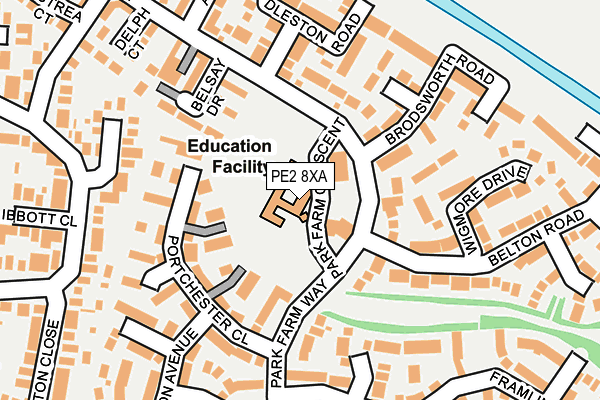
PE2 8XA is located in the Stanground South electoral ward, within the unitary authority of Peterborough and the English Parliamentary constituency of North West Cambridgeshire. The Sub Integrated Care Board (ICB) Location is NHS Cambridgeshire and Peterborough ICB - 06H and the police force is Cambridgeshire. This postcode has been in use since December 1997.


GetTheData
Source: OS OpenMap – Local (Ordnance Survey)
Source: OS VectorMap District (Ordnance Survey)
Licence: Open Government Licence (requires attribution)
| Easting | 521750 |
| Northing | 296392 |
| Latitude | 52.551765 |
| Longitude | -0.205773 |
GetTheData
Source: Open Postcode Geo
Licence: Open Government Licence
| Country | England |
| Postcode District | PE2 |
➜ See where PE2 is on a map ➜ Where is Peterborough? | |
GetTheData
Source: Land Registry Price Paid Data
Licence: Open Government Licence
Elevation or altitude of PE2 8XA as distance above sea level:
| Metres | Feet | |
|---|---|---|
| Elevation | 10m | 33ft |
Elevation is measured from the approximate centre of the postcode, to the nearest point on an OS contour line from OS Terrain 50, which has contour spacing of ten vertical metres.
➜ How high above sea level am I? Find the elevation of your current position using your device's GPS.
GetTheData
Source: Open Postcode Elevation
Licence: Open Government Licence
| Ward | Stanground South |
| Constituency | North West Cambridgeshire |
GetTheData
Source: ONS Postcode Database
Licence: Open Government Licence
| Park Farm Crescent (Park Farm Way) | Stanground | 91m |
| Park Farm Crescent (Park Farm Way) | Stanground | 105m |
| Belsay Drive (Park Farm Way) | Stanground | 177m |
| Belsay Drive (Park Farm Way) | Stanground | 217m |
| Ellwood Avenue | Stanground | 267m |
| Peterborough Station | 3.9km |
GetTheData
Source: NaPTAN
Licence: Open Government Licence
GetTheData
Source: ONS Postcode Database
Licence: Open Government Licence


➜ Get more ratings from the Food Standards Agency
GetTheData
Source: Food Standards Agency
Licence: FSA terms & conditions
| Last Collection | |||
|---|---|---|---|
| Location | Mon-Fri | Sat | Distance |
| Parkfarm Way | 18:00 | 12:15 | 181m |
| Ramsey Way | 18:00 | 12:15 | 226m |
| Southfields Avenue | 18:00 | 12:15 | 538m |
GetTheData
Source: Dracos
Licence: Creative Commons Attribution-ShareAlike
The below table lists the International Territorial Level (ITL) codes (formerly Nomenclature of Territorial Units for Statistics (NUTS) codes) and Local Administrative Units (LAU) codes for PE2 8XA:
| ITL 1 Code | Name |
|---|---|
| TLH | East |
| ITL 2 Code | Name |
| TLH1 | East Anglia |
| ITL 3 Code | Name |
| TLH11 | Peterborough |
| LAU 1 Code | Name |
| E06000031 | Peterborough |
GetTheData
Source: ONS Postcode Directory
Licence: Open Government Licence
The below table lists the Census Output Area (OA), Lower Layer Super Output Area (LSOA), and Middle Layer Super Output Area (MSOA) for PE2 8XA:
| Code | Name | |
|---|---|---|
| OA | E00079271 | |
| LSOA | E01015673 | Peterborough 019F |
| MSOA | E02003255 | Peterborough 019 |
GetTheData
Source: ONS Postcode Directory
Licence: Open Government Licence
| PE2 8UN | Park Farm Way | 111m |
| PE2 8UT | Park Farm Way | 121m |
| PE2 8UP | Portchester Close | 122m |
| PE2 8XG | Middleham Close | 136m |
| PE2 8XH | Helmsley Court | 154m |
| PE2 8XF | Brodsworth Road | 168m |
| PE2 8UW | Sudbury Court | 186m |
| PE2 8UL | Oxburgh Close | 194m |
| PE2 8UZ | Wigmore Drive | 197m |
| PE2 8XL | Kedleston Road | 198m |
GetTheData
Source: Open Postcode Geo; Land Registry Price Paid Data
Licence: Open Government Licence