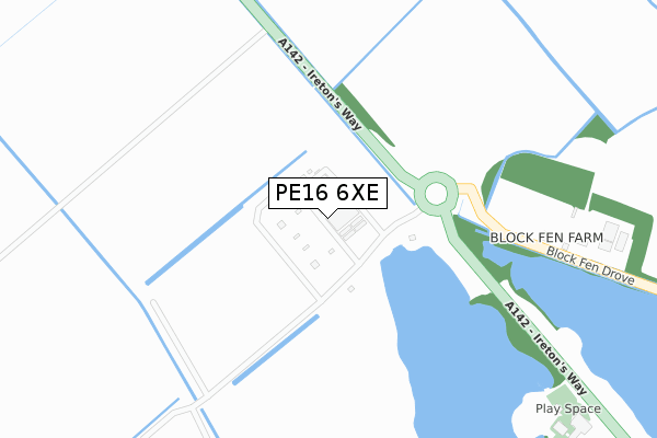
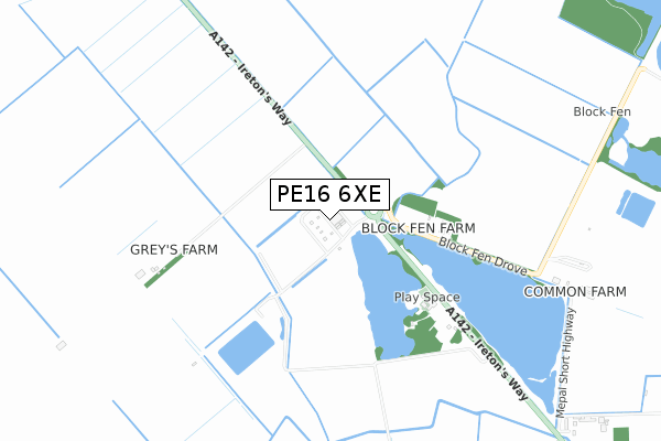
PE16 6XE is located in the Chatteris North & Manea electoral ward, within the local authority district of Fenland and the English Parliamentary constituency of North East Cambridgeshire. The Sub Integrated Care Board (ICB) Location is NHS Cambridgeshire and Peterborough ICB - 06H and the police force is Cambridgeshire. This postcode has been in use since March 2019.


GetTheData
Source: OS Open Zoomstack (Ordnance Survey)
Licence: Open Government Licence (requires attribution)
Attribution: Contains OS data © Crown copyright and database right 2024
Source: Open Postcode Geo
Licence: Open Government Licence (requires attribution)
Attribution: Contains OS data © Crown copyright and database right 2024; Contains Royal Mail data © Royal Mail copyright and database right 2024; Source: Office for National Statistics licensed under the Open Government Licence v.3.0
| Easting | 541882 |
| Northing | 283352 |
| Latitude | 52.429761 |
| Longitude | 0.085422 |
GetTheData
Source: Open Postcode Geo
Licence: Open Government Licence
| Country | England |
| Postcode District | PE16 |
| ➜ PE16 open data dashboard ➜ See where PE16 is on a map | |
GetTheData
Source: Land Registry Price Paid Data
Licence: Open Government Licence
| Ward | Chatteris North & Manea |
| Constituency | North East Cambridgeshire |
GetTheData
Source: ONS Postcode Database
Licence: Open Government Licence
| Mepal Outdoor Centre (Iretons Way) | Mepal | 512m |
| Mepal Outdoor Centre (Iretons Way) | Mepal | 516m |
GetTheData
Source: NaPTAN
Licence: Open Government Licence
GetTheData
Source: ONS Postcode Database
Licence: Open Government Licence
| Last Collection | |||
|---|---|---|---|
| Location | Mon-Fri | Sat | Distance |
| Bedford Bridge | 16:00 | 07:45 | 2,764m |
| Wenny Estate | 17:00 | 11:45 | 3,007m |
| Blackmill Road | 17:00 | 11:30 | 3,241m |
GetTheData
Source: Dracos
Licence: Creative Commons Attribution-ShareAlike
| Facility | Distance |
|---|---|
| Peacock's Paddock Iretons Way, Chatteris Grass Pitches | 2.5km |
| Chatteris Cricket Club Tribune Close, Chatteris Grass Pitches | 2.7km |
| Cromwell Community College Wenny Road, Chatteris Sports Hall, Health and Fitness Gym, Grass Pitches, Artificial Grass Pitch, Studio, Outdoor Tennis Courts | 3km |
GetTheData
Source: Active Places
Licence: Open Government Licence
| School | Phase of Education | Distance |
|---|---|---|
| Cromwell Community College Wenny Road, Chatteris, PE16 6UU | All-through | 3.2km |
| Mepal and Witcham Church of England Primary School Brangehill Lane, Mepal, Ely, CB6 2AL | Primary | 3.2km |
| Glebelands Primary Academy Farriers Gate, Chatteris, PE16 6EZ | Primary | 3.5km |
GetTheData
Source: Edubase
Licence: Open Government Licence
| Risk of PE16 6XE flooding from rivers and sea | Medium |
| ➜ PE16 6XE flood map | |
GetTheData
Source: Open Flood Risk by Postcode
Licence: Open Government Licence
The below table lists the International Territorial Level (ITL) codes (formerly Nomenclature of Territorial Units for Statistics (NUTS) codes) and Local Administrative Units (LAU) codes for PE16 6XE:
| ITL 1 Code | Name |
|---|---|
| TLH | East |
| ITL 2 Code | Name |
| TLH1 | East Anglia |
| ITL 3 Code | Name |
| TLH12 | Cambridgeshire CC |
| LAU 1 Code | Name |
| E07000010 | Fenland |
GetTheData
Source: ONS Postcode Directory
Licence: Open Government Licence
The below table lists the Census Output Area (OA), Lower Layer Super Output Area (LSOA), and Middle Layer Super Output Area (MSOA) for PE16 6XE:
| Code | Name | |
|---|---|---|
| OA | E00091374 | |
| LSOA | E01018110 | Fenland 011E |
| MSOA | E02003752 | Fenland 011 |
GetTheData
Source: ONS Postcode Directory
Licence: Open Government Licence
| CB6 2AZ | Chatteris Road | 1297m |
| PE16 6UZ | Iretons Way | 1714m |
| PE16 6XB | Langwood Hill Drove | 2241m |
| PE16 6SH | Stocking Drove | 2434m |
| CB6 2BG | The Gault | 2515m |
| CB6 2AX | Engine Bank | 2578m |
| CB6 2BQ | The Gault | 2773m |
| PE16 6UY | Tribune Close | 2787m |
| PE16 6UR | Cricketers Way | 2802m |
| PE16 6UX | Wenny Estate | 2894m |
GetTheData
Source: Open Postcode Geo; Land Registry Price Paid Data
Licence: Open Government Licence