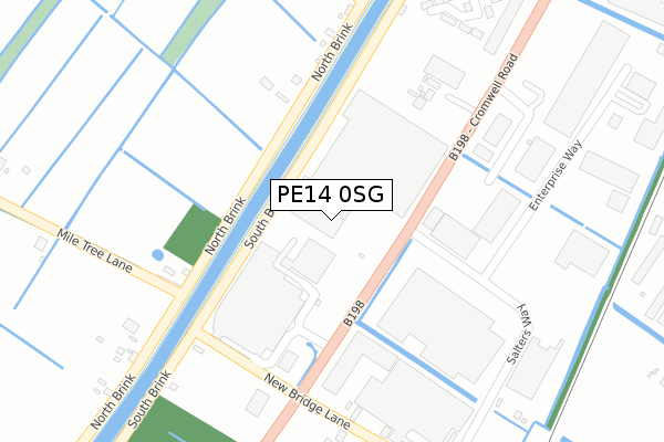
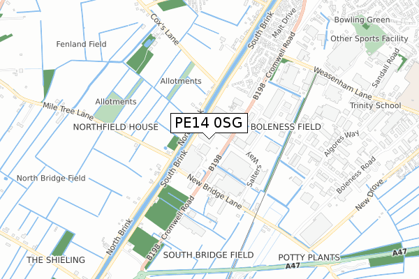
PE14 0SG is located in the Wisbech South electoral ward, within the local authority district of Fenland and the English Parliamentary constituency of North East Cambridgeshire. The Sub Integrated Care Board (ICB) Location is NHS Cambridgeshire and Peterborough ICB - 06H and the police force is Cambridgeshire. This postcode has been in use since September 2018.


GetTheData
Source: OS Open Zoomstack (Ordnance Survey)
Licence: Open Government Licence (requires attribution)
Attribution: Contains OS data © Crown copyright and database right 2024
Source: Open Postcode Geo
Licence: Open Government Licence (requires attribution)
Attribution: Contains OS data © Crown copyright and database right 2024; Contains Royal Mail data © Royal Mail copyright and database right 2024; Source: Office for National Statistics licensed under the Open Government Licence v.3.0
| Easting | 545112 |
| Northing | 308222 |
| Latitude | 52.652338 |
| Longitude | 0.143746 |
GetTheData
Source: Open Postcode Geo
Licence: Open Government Licence
| Country | England |
| Postcode District | PE14 |
| ➜ PE14 open data dashboard ➜ See where PE14 is on a map ➜ Where is Wisbech? | |
GetTheData
Source: Land Registry Price Paid Data
Licence: Open Government Licence
| Ward | Wisbech South |
| Constituency | North East Cambridgeshire |
GetTheData
Source: ONS Postcode Database
Licence: Open Government Licence
| January 2024 | Violence and sexual offences | On or near Cox Close | 368m |
| January 2024 | Possession of weapons | On or near Cox Close | 368m |
| December 2023 | Anti-social behaviour | On or near Cox Close | 368m |
| ➜ Get more crime data in our Crime section | |||
GetTheData
Source: data.police.uk
Licence: Open Government Licence
| Tesco (Cromwell Road) | Wisbech | 127m |
| Market Hall (Salters Way) | Wisbech | 352m |
| Cromwell Retail Park (Cromwell Road) | Wisbech | 391m |
| Cromwell Retail Park (Cromwell Road) | Wisbech | 396m |
| Oldfield Lane (Cromwell Road) | Wisbech | 694m |
GetTheData
Source: NaPTAN
Licence: Open Government Licence
GetTheData
Source: ONS Postcode Database
Licence: Open Government Licence


➜ Get more ratings from the Food Standards Agency
GetTheData
Source: Food Standards Agency
Licence: FSA terms & conditions
| Last Collection | |||
|---|---|---|---|
| Location | Mon-Fri | Sat | Distance |
| Magazine Lane North Brink | 18:30 | 11:45 | 873m |
| Barton Road | 16:45 | 11:30 | 1,129m |
| North Brink | 16:45 | 08:00 | 1,412m |
GetTheData
Source: Dracos
Licence: Creative Commons Attribution-ShareAlike
| Facility | Distance |
|---|---|
| Puregym (Wisbech) Cromwell Road, Wisbech Health and Fitness Gym, Studio | 163m |
| Ironworks Gym Europa Way, Wisbech Health and Fitness Gym | 576m |
| Lakers Gymnasium Anglia Way, Wisbech Health and Fitness Gym | 688m |
GetTheData
Source: Active Places
Licence: Open Government Licence
| School | Phase of Education | Distance |
|---|---|---|
| On Track Education Services Ltd Enterprise House, Oldfield Lane, Wisbech, Wisbech, PE13 2RJ | Not applicable | 1.1km |
| Olive AP Academy - Nene Valley Coalwharf Road, Wisbech, PE13 2FP | Not applicable | 1.4km |
| Wisbech Grammar School Wisbech Grammar School, Chapel Road, Wisbech, Cambridgeshire, PE13 1RH | Not applicable | 1.4km |
GetTheData
Source: Edubase
Licence: Open Government Licence
| Risk of PE14 0SG flooding from rivers and sea | Medium |
| ➜ PE14 0SG flood map | |
GetTheData
Source: Open Flood Risk by Postcode
Licence: Open Government Licence
The below table lists the International Territorial Level (ITL) codes (formerly Nomenclature of Territorial Units for Statistics (NUTS) codes) and Local Administrative Units (LAU) codes for PE14 0SG:
| ITL 1 Code | Name |
|---|---|
| TLH | East |
| ITL 2 Code | Name |
| TLH1 | East Anglia |
| ITL 3 Code | Name |
| TLH12 | Cambridgeshire CC |
| LAU 1 Code | Name |
| E07000010 | Fenland |
GetTheData
Source: ONS Postcode Directory
Licence: Open Government Licence
The below table lists the Census Output Area (OA), Lower Layer Super Output Area (LSOA), and Middle Layer Super Output Area (MSOA) for PE14 0SG:
| Code | Name | |
|---|---|---|
| OA | E00170782 | |
| LSOA | E01033111 | Fenland 003H |
| MSOA | E02003744 | Fenland 003 |
GetTheData
Source: ONS Postcode Directory
Licence: Open Government Licence
| PE14 0RG | Cromwell Road | 49m |
| PE14 0RF | Lickings Drove | 225m |
| PE13 4TA | North Brink | 282m |
| PE14 0RH | South Brink | 339m |
| PE14 0SH | Salters Way | 418m |
| PE14 0TE | Ellerby Drive | 472m |
| PE14 0RJ | South Brink | 480m |
| PE14 0SE | New Bridge Lane | 486m |
| PE14 0TA | Ellerby Drive | 492m |
| PE13 4TT | North Brink | 547m |
GetTheData
Source: Open Postcode Geo; Land Registry Price Paid Data
Licence: Open Government Licence