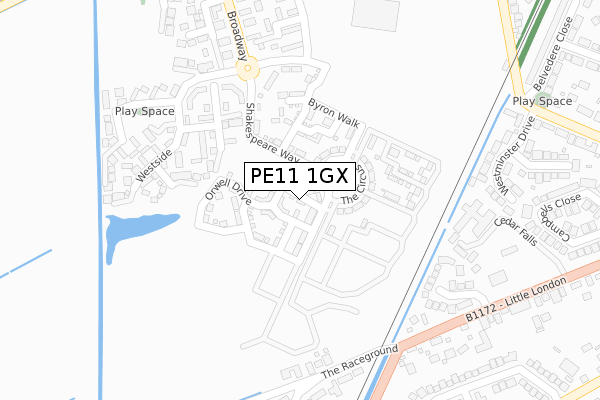
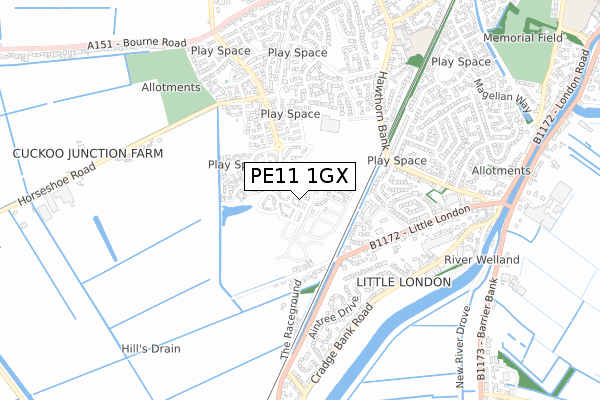
PE11 1GX is located in the Spalding Monks House electoral ward, within the local authority district of South Holland and the English Parliamentary constituency of South Holland and The Deepings. The Sub Integrated Care Board (ICB) Location is NHS Lincolnshire ICB - 71E and the police force is Lincolnshire. This postcode has been in use since November 2018.


GetTheData
Source: OS Open Zoomstack (Ordnance Survey)
Licence: Open Government Licence (requires attribution)
Attribution: Contains OS data © Crown copyright and database right 2024
Source: Open Postcode Geo
Licence: Open Government Licence (requires attribution)
Attribution: Contains OS data © Crown copyright and database right 2024; Contains Royal Mail data © Royal Mail copyright and database right 2024; Source: Office for National Statistics licensed under the Open Government Licence v.3.0
| Easting | 523440 |
| Northing | 321342 |
| Latitude | 52.775584 |
| Longitude | -0.171516 |
GetTheData
Source: Open Postcode Geo
Licence: Open Government Licence
| Country | England |
| Postcode District | PE11 |
| ➜ PE11 open data dashboard ➜ See where PE11 is on a map ➜ Where is Spalding? | |
GetTheData
Source: Land Registry Price Paid Data
Licence: Open Government Licence
| Ward | Spalding Monks House |
| Constituency | South Holland And The Deepings |
GetTheData
Source: ONS Postcode Database
Licence: Open Government Licence
2, SEWELL WAY, SPALDING, PE11 1GX 2019 28 FEB £184,395 |
4, SEWELL WAY, SPALDING, PE11 1GX 2018 23 NOV £187,995 |
GetTheData
Source: HM Land Registry Price Paid Data
Licence: Contains HM Land Registry data © Crown copyright and database right 2024. This data is licensed under the Open Government Licence v3.0.
| June 2022 | Violence and sexual offences | On or near Astor Place | 222m |
| June 2022 | Violence and sexual offences | On or near Astor Place | 222m |
| June 2022 | Violence and sexual offences | On or near Astor Place | 222m |
| ➜ Get more crime data in our Crime section | |||
GetTheData
Source: data.police.uk
Licence: Open Government Licence
| Mayfair Drive (London Road) | Spalding | 347m |
| Mayfair Drive (London Road) | Spalding | 381m |
| Westminster Drive (Hawthorn Bank) | Spalding | 465m |
| Westminster Drive (Hawthorn Bank) | Spalding | 466m |
| Aalsmeer Rise (The Parkway) | Spalding | 558m |
| Spalding Station | 1.8km |
GetTheData
Source: NaPTAN
Licence: Open Government Licence
| Percentage of properties with Next Generation Access | 100.0% |
| Percentage of properties with Superfast Broadband | 100.0% |
| Percentage of properties with Ultrafast Broadband | 100.0% |
| Percentage of properties with Full Fibre Broadband | 100.0% |
Superfast Broadband is between 30Mbps and 300Mbps
Ultrafast Broadband is > 300Mbps
| Percentage of properties unable to receive 2Mbps | 0.0% |
| Percentage of properties unable to receive 5Mbps | 0.0% |
| Percentage of properties unable to receive 10Mbps | 0.0% |
| Percentage of properties unable to receive 30Mbps | 0.0% |
GetTheData
Source: Ofcom
Licence: Ofcom Terms of Use (requires attribution)
GetTheData
Source: ONS Postcode Database
Licence: Open Government Licence


➜ Get more ratings from the Food Standards Agency
GetTheData
Source: Food Standards Agency
Licence: FSA terms & conditions
| Last Collection | |||
|---|---|---|---|
| Location | Mon-Fri | Sat | Distance |
| Westlode Street | 17:45 | 12:00 | 1,968m |
| Horseshoe Road Bridge | 16:00 | 11:00 | 2,994m |
| Springfields | 17:40 | 12:00 | 3,912m |
GetTheData
Source: Dracos
Licence: Creative Commons Attribution-ShareAlike
| Facility | Distance |
|---|---|
| Spalding Grammar School (Memorial Field) St Thomas Road, Spalding Grass Pitches | 1.1km |
| Spalding Rugby Club St Thomas's Road, Spalding Grass Pitches | 1.1km |
| Monks House Playing Field Monks House Lane, Spalding Grass Pitches | 1.1km |
GetTheData
Source: Active Places
Licence: Open Government Licence
| School | Phase of Education | Distance |
|---|---|---|
| The Spalding St John the Baptist Church of England Primary School Hawthorn Bank, Spalding, PE11 1JQ | Primary | 771m |
| Monkshouse Primary Academy Pennygate, Spalding, PE11 1LG | Primary | 1.1km |
| Ayscoughfee Hall School Welland Hall, London Road, Spalding, PE11 2TE | Not applicable | 1.5km |
GetTheData
Source: Edubase
Licence: Open Government Licence
| Risk of PE11 1GX flooding from rivers and sea | Medium |
| ➜ PE11 1GX flood map | |
GetTheData
Source: Open Flood Risk by Postcode
Licence: Open Government Licence
The below table lists the International Territorial Level (ITL) codes (formerly Nomenclature of Territorial Units for Statistics (NUTS) codes) and Local Administrative Units (LAU) codes for PE11 1GX:
| ITL 1 Code | Name |
|---|---|
| TLF | East Midlands (England) |
| ITL 2 Code | Name |
| TLF3 | Lincolnshire |
| ITL 3 Code | Name |
| TLF30 | Lincolnshire CC |
| LAU 1 Code | Name |
| E07000140 | South Holland |
GetTheData
Source: ONS Postcode Directory
Licence: Open Government Licence
The below table lists the Census Output Area (OA), Lower Layer Super Output Area (LSOA), and Middle Layer Super Output Area (MSOA) for PE11 1GX:
| Code | Name | |
|---|---|---|
| OA | E00169385 | |
| LSOA | E01026263 | South Holland 009B |
| MSOA | E02005473 | South Holland 009 |
GetTheData
Source: ONS Postcode Directory
Licence: Open Government Licence
| PE11 3WJ | Astor Place | 199m |
| PE11 3WH | Ambassador Walk | 204m |
| PE11 3SH | Meadow Way | 207m |
| PE11 3WN | Delacorte Green | 231m |
| PE11 3WG | Westside | 276m |
| PE11 2UG | Mayfair Drive | 288m |
| PE11 3SX | Jasmine Court | 290m |
| PE11 3WF | Gershwin Lane | 308m |
| PE11 2UF | Little London | 325m |
| PE11 3SU | Honeysuckle Way | 327m |
GetTheData
Source: Open Postcode Geo; Land Registry Price Paid Data
Licence: Open Government Licence