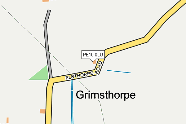
PE10 0LU is located in the Castle electoral ward, within the local authority district of South Kesteven and the English Parliamentary constituency of Grantham and Stamford. The Sub Integrated Care Board (ICB) Location is NHS Lincolnshire ICB - 71E and the police force is Lincolnshire. This postcode has been in use since January 1980.


GetTheData
Source: OS OpenMap – Local (Ordnance Survey)
Source: OS VectorMap District (Ordnance Survey)
Licence: Open Government Licence (requires attribution)
| Easting | 505043 |
| Northing | 323386 |
| Latitude | 52.797840 |
| Longitude | -0.443467 |
GetTheData
Source: Open Postcode Geo
Licence: Open Government Licence
| Country | England |
| Postcode District | PE10 |
➜ See where PE10 is on a map ➜ Where is Grimsthorpe? | |
GetTheData
Source: Land Registry Price Paid Data
Licence: Open Government Licence
Elevation or altitude of PE10 0LU as distance above sea level:
| Metres | Feet | |
|---|---|---|
| Elevation | 40m | 131ft |
Elevation is measured from the approximate centre of the postcode, to the nearest point on an OS contour line from OS Terrain 50, which has contour spacing of ten vertical metres.
➜ How high above sea level am I? Find the elevation of your current position using your device's GPS.
GetTheData
Source: Open Postcode Elevation
Licence: Open Government Licence
| Ward | Castle |
| Constituency | Grantham And Stamford |
GetTheData
Source: ONS Postcode Database
Licence: Open Government Licence
| The Black Horse Inn (A151) | Grimsthorpe | 520m |
| Demand Responsive Area | Grimsthorpe | 528m |
| The Black Horse Inn (A151) | Grimsthorpe | 536m |
| Letter Box (Main Street) | Elsthorpe | 957m |
| Demand Responsive Area | Elsthorpe | 959m |
GetTheData
Source: NaPTAN
Licence: Open Government Licence
| Percentage of properties with Next Generation Access | 100.0% |
| Percentage of properties with Superfast Broadband | 100.0% |
| Percentage of properties with Ultrafast Broadband | 100.0% |
| Percentage of properties with Full Fibre Broadband | 100.0% |
Superfast Broadband is between 30Mbps and 300Mbps
Ultrafast Broadband is > 300Mbps
| Percentage of properties unable to receive 2Mbps | 0.0% |
| Percentage of properties unable to receive 5Mbps | 0.0% |
| Percentage of properties unable to receive 10Mbps | 0.0% |
| Percentage of properties unable to receive 30Mbps | 0.0% |
GetTheData
Source: Ofcom
Licence: Ofcom Terms of Use (requires attribution)
GetTheData
Source: ONS Postcode Database
Licence: Open Government Licence


➜ Get more ratings from the Food Standards Agency
GetTheData
Source: Food Standards Agency
Licence: FSA terms & conditions
| Last Collection | |||
|---|---|---|---|
| Location | Mon-Fri | Sat | Distance |
| Grimsthorpe | 16:30 | 07:50 | 504m |
| Elsthorpe | 16:00 | 08:00 | 949m |
| Edenham Post Office | 16:30 | 10:30 | 2,006m |
GetTheData
Source: Dracos
Licence: Creative Commons Attribution-ShareAlike
The below table lists the International Territorial Level (ITL) codes (formerly Nomenclature of Territorial Units for Statistics (NUTS) codes) and Local Administrative Units (LAU) codes for PE10 0LU:
| ITL 1 Code | Name |
|---|---|
| TLF | East Midlands (England) |
| ITL 2 Code | Name |
| TLF3 | Lincolnshire |
| ITL 3 Code | Name |
| TLF30 | Lincolnshire CC |
| LAU 1 Code | Name |
| E07000141 | South Kesteven |
GetTheData
Source: ONS Postcode Directory
Licence: Open Government Licence
The below table lists the Census Output Area (OA), Lower Layer Super Output Area (LSOA), and Middle Layer Super Output Area (MSOA) for PE10 0LU:
| Code | Name | |
|---|---|---|
| OA | E00133663 | |
| LSOA | E01026316 | South Kesteven 007D |
| MSOA | E02005482 | South Kesteven 007 |
GetTheData
Source: ONS Postcode Directory
Licence: Open Government Licence
| PE10 0LY | 514m | |
| PE10 0LP | School Lane | 1835m |
| PE10 0LL | Main Street | 2014m |
| PE10 0LN | Scottlethorpe Road | 2247m |
| PE10 0RU | 2742m | |
| PE10 0RW | Elsthorpe Road | 3131m |
| PE10 0RS | Elsthorpe Road | 3194m |
| NG33 4PH | Park Road | 3222m |
| NG33 4PW | Bertie Close | 3223m |
| NG33 4QH | Macham Close | 3286m |
GetTheData
Source: Open Postcode Geo; Land Registry Price Paid Data
Licence: Open Government Licence