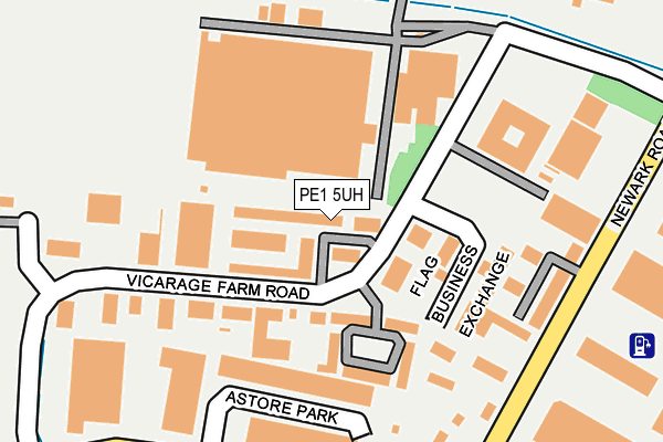
PE1 5UH is located in the East electoral ward, within the unitary authority of Peterborough and the English Parliamentary constituency of Peterborough. The Sub Integrated Care Board (ICB) Location is NHS Cambridgeshire and Peterborough ICB - 06H and the police force is Cambridgeshire. This postcode has been in use since July 1990.


GetTheData
Source: OS OpenMap – Local (Ordnance Survey)
Source: OS VectorMap District (Ordnance Survey)
Licence: Open Government Licence (requires attribution)
| Easting | 521267 |
| Northing | 299431 |
| Latitude | 52.579179 |
| Longitude | -0.211783 |
GetTheData
Source: Open Postcode Geo
Licence: Open Government Licence
| Country | England |
| Postcode District | PE1 |
➜ See where PE1 is on a map ➜ Where is Peterborough? | |
GetTheData
Source: Land Registry Price Paid Data
Licence: Open Government Licence
Elevation or altitude of PE1 5UH as distance above sea level:
| Metres | Feet | |
|---|---|---|
| Elevation | 10m | 33ft |
Elevation is measured from the approximate centre of the postcode, to the nearest point on an OS contour line from OS Terrain 50, which has contour spacing of ten vertical metres.
➜ How high above sea level am I? Find the elevation of your current position using your device's GPS.
GetTheData
Source: Open Postcode Elevation
Licence: Open Government Licence
| Ward | East |
| Constituency | Peterborough |
GetTheData
Source: ONS Postcode Database
Licence: Open Government Licence
| Leofric Square (Vicarage Farm Road) | Eastern Industry | 60m |
| Leofric Square (Vicarage Farm Road) | Eastern Industry | 70m |
| Vicarage Farm Road | Eastern Industry | 186m |
| Vicarage Farm Road | Eastern Industry | 189m |
| The Square (Vicarage Farm Road) | Eastern Industry | 201m |
| Peterborough Station | 2.6km |
GetTheData
Source: NaPTAN
Licence: Open Government Licence
Estimated total energy consumption in PE1 5UH by fuel type, 2015.
| Consumption (kWh) | 14,122 |
|---|---|
| Meter count | 6 |
| Mean (kWh/meter) | 2,354 |
| Median (kWh/meter) | 2,164 |
GetTheData
Source: Postcode level gas estimates: 2015 (experimental)
Source: Postcode level electricity estimates: 2015 (experimental)
Licence: Open Government Licence
GetTheData
Source: ONS Postcode Database
Licence: Open Government Licence


➜ Get more ratings from the Food Standards Agency
GetTheData
Source: Food Standards Agency
Licence: FSA terms & conditions
| Last Collection | |||
|---|---|---|---|
| Location | Mon-Fri | Sat | Distance |
| Vicarage Farm Road | 18:15 | 12:15 | 338m |
| Vicarage Farm Road | 342m | ||
| Padholme Road | 17:45 | 12:30 | 922m |
GetTheData
Source: Dracos
Licence: Creative Commons Attribution-ShareAlike
The below table lists the International Territorial Level (ITL) codes (formerly Nomenclature of Territorial Units for Statistics (NUTS) codes) and Local Administrative Units (LAU) codes for PE1 5UH:
| ITL 1 Code | Name |
|---|---|
| TLH | East |
| ITL 2 Code | Name |
| TLH1 | East Anglia |
| ITL 3 Code | Name |
| TLH11 | Peterborough |
| LAU 1 Code | Name |
| E06000031 | Peterborough |
GetTheData
Source: ONS Postcode Directory
Licence: Open Government Licence
The below table lists the Census Output Area (OA), Lower Layer Super Output Area (LSOA), and Middle Layer Super Output Area (MSOA) for PE1 5UH:
| Code | Name | |
|---|---|---|
| OA | E00078957 | |
| LSOA | E01015616 | Peterborough 013F |
| MSOA | E02003249 | Peterborough 013 |
GetTheData
Source: ONS Postcode Directory
Licence: Open Government Licence
| PE1 5TS | The Square | 60m |
| PE1 5TU | Leofric Square | 95m |
| PE1 5PP | Newark Road | 182m |
| PE1 5FL | Newark Road | 297m |
| PE1 5XF | Belgic Square | 304m |
| PE1 5XL | Padholme Road East | 345m |
| PE1 5UN | Fairweather Court | 372m |
| PE1 5YS | Bramhall Place | 395m |
| PE1 5YB | Royce Road | 409m |
| PE1 5UA | Newark Road | 423m |
GetTheData
Source: Open Postcode Geo; Land Registry Price Paid Data
Licence: Open Government Licence