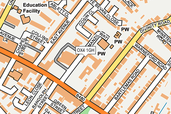
OX4 1GH is located in the St Clement's electoral ward, within the local authority district of Oxford and the English Parliamentary constituency of Oxford East. The Sub Integrated Care Board (ICB) Location is NHS Buckinghamshire, Oxfordshire and Berkshire West ICB - 10Q and the police force is Thames Valley. This postcode has been in use since January 1991.


GetTheData
Source: OS OpenMap – Local (Ordnance Survey)
Source: OS VectorMap District (Ordnance Survey)
Licence: Open Government Licence (requires attribution)
| Easting | 453141 |
| Northing | 205673 |
| Latitude | 51.747248 |
| Longitude | -1.231647 |
GetTheData
Source: Open Postcode Geo
Licence: Open Government Licence
| Country | England |
| Postcode District | OX4 |
| ➜ OX4 open data dashboard ➜ See where OX4 is on a map ➜ Where is Oxford? | |
GetTheData
Source: Land Registry Price Paid Data
Licence: Open Government Licence
Elevation or altitude of OX4 1GH as distance above sea level:
| Metres | Feet | |
|---|---|---|
| Elevation | 70m | 230ft |
Elevation is measured from the approximate centre of the postcode, to the nearest point on an OS contour line from OS Terrain 50, which has contour spacing of ten vertical metres.
➜ How high above sea level am I? Find the elevation of your current position using your device's GPS.
GetTheData
Source: Open Postcode Elevation
Licence: Open Government Licence
| Ward | St Clement's |
| Constituency | Oxford East |
GetTheData
Source: ONS Postcode Database
Licence: Open Government Licence
| June 2022 | Anti-social behaviour | On or near Manzil Way | 17m |
| June 2022 | Bicycle theft | On or near Manzil Way | 17m |
| June 2022 | Bicycle theft | On or near Manzil Way | 17m |
| ➜ Get more crime data in our Crime section | |||
GetTheData
Source: data.police.uk
Licence: Open Government Licence
| Manzil Way (Cowley Road) | Oxford | 122m |
| Manzil Way (Cowley Road) | Oxford | 162m |
| East Avenue (Morrell Avenue) | Oxford | 269m |
| East Avenue (Morrell Avenue) | Oxford | 309m |
| Magdalen Road East (Cowley Road) | Oxford | 345m |
| Oxford Station | 2.7km |
GetTheData
Source: NaPTAN
Licence: Open Government Licence
| Percentage of properties with Next Generation Access | 100.0% |
| Percentage of properties with Superfast Broadband | 100.0% |
| Percentage of properties with Ultrafast Broadband | 0.0% |
| Percentage of properties with Full Fibre Broadband | 0.0% |
Superfast Broadband is between 30Mbps and 300Mbps
Ultrafast Broadband is > 300Mbps
| Percentage of properties unable to receive 2Mbps | 0.0% |
| Percentage of properties unable to receive 5Mbps | 0.0% |
| Percentage of properties unable to receive 10Mbps | 0.0% |
| Percentage of properties unable to receive 30Mbps | 0.0% |
GetTheData
Source: Ofcom
Licence: Ofcom Terms of Use (requires attribution)
GetTheData
Source: ONS Postcode Database
Licence: Open Government Licence


➜ Get more ratings from the Food Standards Agency
GetTheData
Source: Food Standards Agency
Licence: FSA terms & conditions
| Last Collection | |||
|---|---|---|---|
| Location | Mon-Fri | Sat | Distance |
| Morrell Avenue | 17:15 | 11:30 | 261m |
| Divinity Road | 17:00 | 11:45 | 267m |
| Cowley Road Post Office | 18:15 | 12:00 | 368m |
GetTheData
Source: Dracos
Licence: Creative Commons Attribution-ShareAlike
| Facility | Distance |
|---|---|
| Asian Cultural Centre Oxford Manzil Way, Oxford Sports Hall | 140m |
| East Oxford Games Hall (Closed) Collins Street, Oxford Sports Hall | 186m |
| East Oxford Astroturf Ablett Close, Oxford Artificial Grass Pitch | 257m |
GetTheData
Source: Active Places
Licence: Open Government Licence
| School | Phase of Education | Distance |
|---|---|---|
| East Oxford Primary School Union Street, Cowley, Oxford, OX4 1JP | Primary | 329m |
| Comper Foundation Stage School Hertford Street, Oxford, OX4 3AJ | Nursery | 477m |
| Oxford International College 1-5 London Place, Oxford, OX4 1BD | Not applicable | 662m |
GetTheData
Source: Edubase
Licence: Open Government Licence
The below table lists the International Territorial Level (ITL) codes (formerly Nomenclature of Territorial Units for Statistics (NUTS) codes) and Local Administrative Units (LAU) codes for OX4 1GH:
| ITL 1 Code | Name |
|---|---|
| TLJ | South East (England) |
| ITL 2 Code | Name |
| TLJ1 | Berkshire, Buckinghamshire and Oxfordshire |
| ITL 3 Code | Name |
| TLJ14 | Oxfordshire CC |
| LAU 1 Code | Name |
| E07000178 | Oxford |
GetTheData
Source: ONS Postcode Directory
Licence: Open Government Licence
The below table lists the Census Output Area (OA), Lower Layer Super Output Area (LSOA), and Middle Layer Super Output Area (MSOA) for OX4 1GH:
| Code | Name | |
|---|---|---|
| OA | E00145598 | |
| LSOA | E01028579 | Oxford 011A |
| MSOA | E02005950 | Oxford 011 |
GetTheData
Source: ONS Postcode Directory
Licence: Open Government Licence
| OX4 1LH | Divinity Road | 88m |
| OX4 1GD | Cosin Close | 99m |
| OX4 1LJ | Divinity Road | 114m |
| OX4 1XP | East Avenue | 117m |
| OX4 1XF | Cowley Road | 129m |
| OX4 1XW | East Avenue | 138m |
| OX4 1UH | Cowley Road | 149m |
| OX4 1UQ | Cowley Road | 154m |
| OX4 1XA | Cowley Road | 157m |
| OX4 1XU | Bartlemas Road | 161m |
GetTheData
Source: Open Postcode Geo; Land Registry Price Paid Data
Licence: Open Government Licence