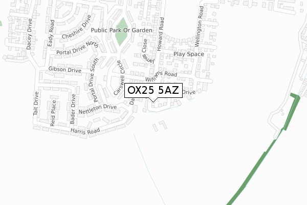
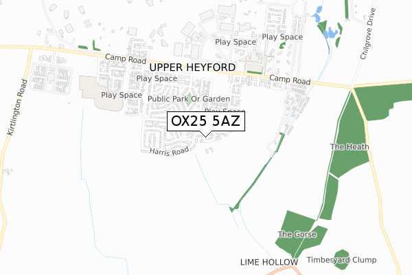
OX25 5AZ is located in the Fringford and Heyfords electoral ward, within the local authority district of Cherwell and the English Parliamentary constituency of Banbury. The Sub Integrated Care Board (ICB) Location is NHS Buckinghamshire, Oxfordshire and Berkshire West ICB - 10Q and the police force is Thames Valley. This postcode has been in use since April 2018.


GetTheData
Source: OS Open Zoomstack (Ordnance Survey)
Licence: Open Government Licence (requires attribution)
Attribution: Contains OS data © Crown copyright and database right 2024
Source: Open Postcode Geo
Licence: Open Government Licence (requires attribution)
Attribution: Contains OS data © Crown copyright and database right 2024; Contains Royal Mail data © Royal Mail copyright and database right 2024; Source: Office for National Statistics licensed under the Open Government Licence v.3.0
| Easting | 451293 |
| Northing | 225372 |
| Latitude | 51.924521 |
| Longitude | -1.255500 |
GetTheData
Source: Open Postcode Geo
Licence: Open Government Licence
| Country | England |
| Postcode District | OX25 |
| ➜ OX25 open data dashboard ➜ See where OX25 is on a map ➜ Where is Upper Heyford? | |
GetTheData
Source: Land Registry Price Paid Data
Licence: Open Government Licence
| Ward | Fringford And Heyfords |
| Constituency | Banbury |
GetTheData
Source: ONS Postcode Database
Licence: Open Government Licence
2022 1 NOV £692,500 |
8, COOPER CLOSE, UPPER HEYFORD, BICESTER, OX25 5AZ 2022 20 MAY £660,000 |
2020 29 SEP £595,000 |
5, COOPER CLOSE, UPPER HEYFORD, BICESTER, OX25 5AZ 2019 31 JAN £550,000 |
3, COOPER CLOSE, UPPER HEYFORD, BICESTER, OX25 5AZ 2019 8 JAN £554,995 |
1, COOPER CLOSE, UPPER HEYFORD, BICESTER, OX25 5AZ 2018 20 APR £680,000 |
10, COOPER CLOSE, UPPER HEYFORD, BICESTER, OX25 5AZ 2017 28 NOV £434,995 |
GetTheData
Source: HM Land Registry Price Paid Data
Licence: Contains HM Land Registry data © Crown copyright and database right 2024. This data is licensed under the Open Government Licence v3.0.
| June 2022 | Violence and sexual offences | On or near Portal Drive North | 306m |
| June 2022 | Violence and sexual offences | On or near Dow Street | 379m |
| June 2022 | Vehicle crime | On or near Dow Street | 379m |
| ➜ Get more crime data in our Crime section | |||
GetTheData
Source: data.police.uk
Licence: Open Government Licence
| Upper Heyford Shop (Camp Road) | Upper Heyford | 403m |
| Horse And Groom Ph (Lower Heyford Road) | Lower Heyford | 1,075m |
| Horse And Groom Ph (Lower Heyford Road) | Lower Heyford | 1,083m |
| Camp Road West End (Camp Road) | Upper Heyford | 1,473m |
| Camp Road West End (Camp Road) | Upper Heyford | 1,477m |
| Heyford Station | 3.1km |
| Tackley Station | 5.6km |
GetTheData
Source: NaPTAN
Licence: Open Government Licence
➜ Broadband speed and availability dashboard for OX25 5AZ
| Percentage of properties with Next Generation Access | 100.0% |
| Percentage of properties with Superfast Broadband | 100.0% |
| Percentage of properties with Ultrafast Broadband | 100.0% |
| Percentage of properties with Full Fibre Broadband | 100.0% |
Superfast Broadband is between 30Mbps and 300Mbps
Ultrafast Broadband is > 300Mbps
| Median download speed | 360.0Mbps |
| Average download speed | 360.0Mbps |
| Maximum download speed | 360.00Mbps |
| Median upload speed | 360.0Mbps |
| Average upload speed | 360.0Mbps |
| Maximum upload speed | 360.00Mbps |
| Percentage of properties unable to receive 2Mbps | 0.0% |
| Percentage of properties unable to receive 5Mbps | 0.0% |
| Percentage of properties unable to receive 10Mbps | 0.0% |
| Percentage of properties unable to receive 30Mbps | 0.0% |
➜ Broadband speed and availability dashboard for OX25 5AZ
GetTheData
Source: Ofcom
Licence: Ofcom Terms of Use (requires attribution)
GetTheData
Source: ONS Postcode Database
Licence: Open Government Licence
➜ Get more ratings from the Food Standards Agency
GetTheData
Source: Food Standards Agency
Licence: FSA terms & conditions
| Last Collection | |||
|---|---|---|---|
| Location | Mon-Fri | Sat | Distance |
| The Leys | 16:45 | 09:00 | 507m |
| Caulcot | 17:00 | 08:00 | 1,237m |
| High Street | 16:45 | 07:30 | 1,574m |
GetTheData
Source: Dracos
Licence: Creative Commons Attribution-ShareAlike
| Facility | Distance |
|---|---|
| National Sports Training Centre @ Upper Heyford (Closed) Heyford Park, Camp Road, Upper Heyford, Bicester Athletics, Sports Hall, Grass Pitches, Squash Courts | 711m |
| Heyford Park Free School Izzard Road, Upper Heyford, Bicester Outdoor Tennis Courts, Sports Hall, Grass Pitches, Health and Fitness Gym, Squash Courts | 757m |
| Upper Heyford Playing Field Somerton Road, Upper Heyford, Bicester Grass Pitches | 1.6km |
GetTheData
Source: Active Places
Licence: Open Government Licence
| School | Phase of Education | Distance |
|---|---|---|
| Heyford Park School 74 Camp Road, Heyford Park, Bicester, OX25 5HD | All-through | 563m |
| Dr Radcliffe's Church of England Primary School Fir Lane, Steeple Aston, Bicester, OX25 4SF | Primary | 3.8km |
| Fritwell Church of England Primary School East Street, Fritwell, Bicester, OX27 7PX | Primary | 4.3km |
GetTheData
Source: Edubase
Licence: Open Government Licence
The below table lists the International Territorial Level (ITL) codes (formerly Nomenclature of Territorial Units for Statistics (NUTS) codes) and Local Administrative Units (LAU) codes for OX25 5AZ:
| ITL 1 Code | Name |
|---|---|
| TLJ | South East (England) |
| ITL 2 Code | Name |
| TLJ1 | Berkshire, Buckinghamshire and Oxfordshire |
| ITL 3 Code | Name |
| TLJ14 | Oxfordshire CC |
| LAU 1 Code | Name |
| E07000177 | Cherwell |
GetTheData
Source: ONS Postcode Directory
Licence: Open Government Licence
The below table lists the Census Output Area (OA), Lower Layer Super Output Area (LSOA), and Middle Layer Super Output Area (MSOA) for OX25 5AZ:
| Code | Name | |
|---|---|---|
| OA | E00145239 | |
| LSOA | E01028505 | Cherwell 010C |
| MSOA | E02005930 | Cherwell 010 |
GetTheData
Source: ONS Postcode Directory
Licence: Open Government Licence
| OX25 5AG | Camp Road | 474m |
| OX25 5AF | Hart Walk | 489m |
| OX25 5AE | Bourne End | 634m |
| OX25 5AD | Broad Way | 692m |
| OX25 5TA | Larsen Road | 706m |
| OX25 5AB | Izzard Road | 782m |
| OX25 5TB | Trenchard Circle | 863m |
| OX25 5LS | Camp Road | 1063m |
| OX25 4ND | Lower Heyford Road | 1098m |
| OX25 5NA | Kirtlington Road | 1251m |
GetTheData
Source: Open Postcode Geo; Land Registry Price Paid Data
Licence: Open Government Licence