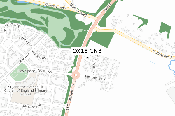
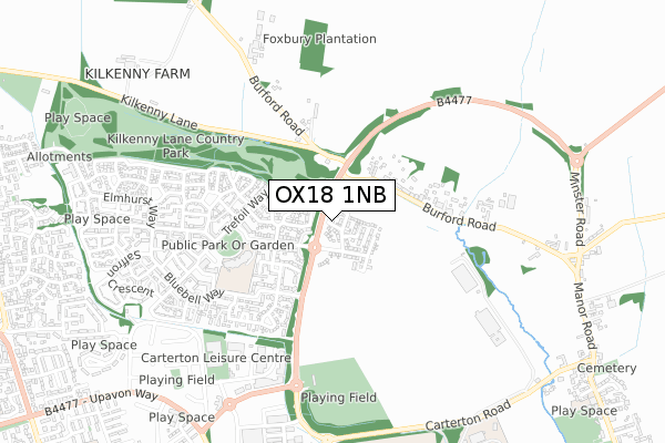
OX18 1NB is located in the Brize Norton and Shilton electoral ward, within the local authority district of West Oxfordshire and the English Parliamentary constituency of Witney. The Sub Integrated Care Board (ICB) Location is NHS Buckinghamshire, Oxfordshire and Berkshire West ICB - 10Q and the police force is Thames Valley. This postcode has been in use since November 2019.


GetTheData
Source: OS Open Zoomstack (Ordnance Survey)
Licence: Open Government Licence (requires attribution)
Attribution: Contains OS data © Crown copyright and database right 2024
Source: Open Postcode Geo
Licence: Open Government Licence (requires attribution)
Attribution: Contains OS data © Crown copyright and database right 2024; Contains Royal Mail data © Royal Mail copyright and database right 2024; Source: Office for National Statistics licensed under the Open Government Licence v.3.0
| Easting | 429041 |
| Northing | 208142 |
| Latitude | 51.771210 |
| Longitude | -1.580515 |
GetTheData
Source: Open Postcode Geo
Licence: Open Government Licence
| Country | England |
| Postcode District | OX18 |
| ➜ OX18 open data dashboard ➜ See where OX18 is on a map ➜ Where is Carterton? | |
GetTheData
Source: Land Registry Price Paid Data
Licence: Open Government Licence
| Ward | Brize Norton And Shilton |
| Constituency | Witney |
GetTheData
Source: ONS Postcode Database
Licence: Open Government Licence
2023 1 JUN £475,000 |
2023 10 MAR £470,000 |
2021 22 APR £437,600 |
6, TIMMS LANE, BRIZE NORTON, CARTERTON, OX18 1NB 2020 11 MAR £419,950 |
4, TIMMS LANE, BRIZE NORTON, CARTERTON, OX18 1NB 2020 4 FEB £419,950 |
8, TIMMS LANE, BRIZE NORTON, CARTERTON, OX18 1NB 2020 24 JAN £484,950 |
3, TIMMS LANE, BRIZE NORTON, CARTERTON, OX18 1NB 2019 29 NOV £440,000 |
7, TIMMS LANE, BRIZE NORTON, CARTERTON, OX18 1NB 2019 29 NOV £349,950 |
2, TIMMS LANE, BRIZE NORTON, CARTERTON, OX18 1NB 2019 29 NOV £409,950 |
2019 29 NOV £417,950 |
GetTheData
Source: HM Land Registry Price Paid Data
Licence: Contains HM Land Registry data © Crown copyright and database right 2024. This data is licensed under the Open Government Licence v3.0.
| May 2023 | Violence and sexual offences | On or near Bryony Gardens | 164m |
| June 2022 | Violence and sexual offences | On or near Teasel Way | 130m |
| June 2022 | Anti-social behaviour | On or near Teasel Way | 130m |
| ➜ Get more crime data in our Crime section | |||
GetTheData
Source: data.police.uk
Licence: Open Government Licence
| Teasel Way (Monahan Way) | Carterton | 189m |
| Teasel Way (Monohan Way) | Carterton | 217m |
| Meadow Way (Teasel Way) | Carterton | 263m |
| Woodrush Gardens (Bluebell Way) | Carterton | 351m |
| Trefoil Way | Carterton | 410m |
GetTheData
Source: NaPTAN
Licence: Open Government Licence
GetTheData
Source: ONS Postcode Database
Licence: Open Government Licence


➜ Get more ratings from the Food Standards Agency
GetTheData
Source: Food Standards Agency
Licence: FSA terms & conditions
| Last Collection | |||
|---|---|---|---|
| Location | Mon-Fri | Sat | Distance |
| Bluebell Way | 16:00 | 11:00 | 345m |
| Ox18 The Lawns | 16:00 | 11:00 | 686m |
| Swinbrook Road | 16:30 | 11:30 | 1,330m |
GetTheData
Source: Dracos
Licence: Creative Commons Attribution-ShareAlike
| Facility | Distance |
|---|---|
| St John The Evangelist Ce Primary School Bluebell Way, Carterton Grass Pitches, Artificial Grass Pitch | 397m |
| Heroez Gym Broadshires Way, Carterton Health and Fitness Gym | 577m |
| Monahan Way Sports Ground Monahan Way, Brize Norton, Carterton Grass Pitches | 644m |
GetTheData
Source: Active Places
Licence: Open Government Licence
| School | Phase of Education | Distance |
|---|---|---|
| St John the Evangelist CofE VA Primary School Bluebell Way, Shilton Park, Carterton, OX18 1JF | Primary | 396m |
| Brize Norton Primary School Station Road, Brize Norton, Carterton, OX18 3PL | Primary | 1.2km |
| Carterton Primary School Burford Road, Carterton, OX18 3AD | Primary | 1.4km |
GetTheData
Source: Edubase
Licence: Open Government Licence
The below table lists the International Territorial Level (ITL) codes (formerly Nomenclature of Territorial Units for Statistics (NUTS) codes) and Local Administrative Units (LAU) codes for OX18 1NB:
| ITL 1 Code | Name |
|---|---|
| TLJ | South East (England) |
| ITL 2 Code | Name |
| TLJ1 | Berkshire, Buckinghamshire and Oxfordshire |
| ITL 3 Code | Name |
| TLJ14 | Oxfordshire CC |
| LAU 1 Code | Name |
| E07000181 | West Oxfordshire |
GetTheData
Source: ONS Postcode Directory
Licence: Open Government Licence
The below table lists the Census Output Area (OA), Lower Layer Super Output Area (LSOA), and Middle Layer Super Output Area (MSOA) for OX18 1NB:
| Code | Name | |
|---|---|---|
| OA | E00146518 | |
| LSOA | E01028766 | West Oxfordshire 012B |
| MSOA | E02006004 | West Oxfordshire 012 |
GetTheData
Source: ONS Postcode Directory
Licence: Open Government Licence
| OX18 1JN | Bryony Gardens | 145m |
| OX18 1JD | Teasel Way | 205m |
| OX18 1JB | Teasel Way | 214m |
| OX18 1JP | Meadow Way | 237m |
| OX18 3NR | Burford Road | 254m |
| OX18 1JQ | Trefoil Way | 266m |
| OX18 1JE | Woodrush Gardens | 291m |
| OX18 1FD | Trefoil Way | 317m |
| OX18 1HA | Meadow Way | 322m |
| OX18 1FE | Harvest Crescent | 328m |
GetTheData
Source: Open Postcode Geo; Land Registry Price Paid Data
Licence: Open Government Licence