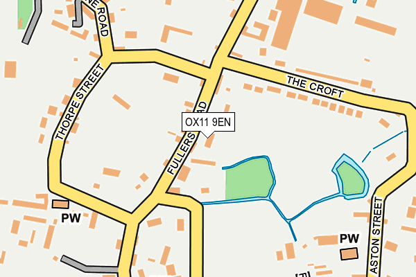
OX11 9EN lies on Fullers Road in Aston Tirrold, Didcot. OX11 9EN is located in the Cholsey electoral ward, within the local authority district of South Oxfordshire and the English Parliamentary constituency of Wantage. The Sub Integrated Care Board (ICB) Location is NHS Buckinghamshire, Oxfordshire and Berkshire West ICB - 10Q and the police force is Thames Valley. This postcode has been in use since January 1980.


GetTheData
Source: OS OpenMap – Local (Ordnance Survey)
Source: OS VectorMap District (Ordnance Survey)
Licence: Open Government Licence (requires attribution)
| Easting | 455496 |
| Northing | 186237 |
| Latitude | 51.572279 |
| Longitude | -1.200638 |
GetTheData
Source: Open Postcode Geo
Licence: Open Government Licence
| Street | Fullers Road |
| Locality | Aston Tirrold |
| Town/City | Didcot |
| Country | England |
| Postcode District | OX11 |
➜ See where OX11 is on a map ➜ Where is Aston Upthorpe? | |
GetTheData
Source: Land Registry Price Paid Data
Licence: Open Government Licence
Elevation or altitude of OX11 9EN as distance above sea level:
| Metres | Feet | |
|---|---|---|
| Elevation | 60m | 197ft |
Elevation is measured from the approximate centre of the postcode, to the nearest point on an OS contour line from OS Terrain 50, which has contour spacing of ten vertical metres.
➜ How high above sea level am I? Find the elevation of your current position using your device's GPS.
GetTheData
Source: Open Postcode Elevation
Licence: Open Government Licence
| Ward | Cholsey |
| Constituency | Wantage |
GetTheData
Source: ONS Postcode Database
Licence: Open Government Licence
CEDARCOTT, FULLERS ROAD, ASTON TIRROLD, DIDCOT, OX11 9EN 2018 4 SEP £500,000 |
2010 19 MAR £1,685,000 |
2008 1 FEB £1,000,000 |
2004 17 MAY £95,000 |
2003 22 DEC £625,000 |
1998 29 DEC £320,000 |
1995 10 MAR £152,000 |
GetTheData
Source: HM Land Registry Price Paid Data
Licence: Contains HM Land Registry data © Crown copyright and database right 2025. This data is licensed under the Open Government Licence v3.0.
| The Chequers Ph (Baker Street) | Aston Upthorpe | 108m |
| The Chequers Ph (Fullers Road) | Aston Upthorpe | 114m |
| Upthorpe Farm (Moreton Road) | Aston Upthorpe | 295m |
| Upthorpe Farm (Moreton Road) | Aston Upthorpe | 299m |
| The Close (Aston Street) | Aston Tirrold | 442m |
| Cholsey Station | 3km |
| Didcot Parkway Station | 5.2km |
GetTheData
Source: NaPTAN
Licence: Open Government Licence
| Percentage of properties with Next Generation Access | 100.0% |
| Percentage of properties with Superfast Broadband | 100.0% |
| Percentage of properties with Ultrafast Broadband | 0.0% |
| Percentage of properties with Full Fibre Broadband | 0.0% |
Superfast Broadband is between 30Mbps and 300Mbps
Ultrafast Broadband is > 300Mbps
| Median download speed | 40.0Mbps |
| Average download speed | 39.8Mbps |
| Maximum download speed | 80.00Mbps |
| Median upload speed | 10.0Mbps |
| Average upload speed | 9.5Mbps |
| Maximum upload speed | 20.00Mbps |
| Percentage of properties unable to receive 2Mbps | 0.0% |
| Percentage of properties unable to receive 5Mbps | 0.0% |
| Percentage of properties unable to receive 10Mbps | 0.0% |
| Percentage of properties unable to receive 30Mbps | 0.0% |
GetTheData
Source: Ofcom
Licence: Ofcom Terms of Use (requires attribution)
GetTheData
Source: ONS Postcode Database
Licence: Open Government Licence

➜ Get more ratings from the Food Standards Agency
GetTheData
Source: Food Standards Agency
Licence: FSA terms & conditions
| Last Collection | |||
|---|---|---|---|
| Location | Mon-Fri | Sat | Distance |
| North Moreton Post Office | 16:15 | 09:00 | 3,135m |
| Papist Way | 16:30 | 08:30 | 3,301m |
| Cholsey Post Office | 16:30 | 11:30 | 3,313m |
GetTheData
Source: Dracos
Licence: Creative Commons Attribution-ShareAlike
The below table lists the International Territorial Level (ITL) codes (formerly Nomenclature of Territorial Units for Statistics (NUTS) codes) and Local Administrative Units (LAU) codes for OX11 9EN:
| ITL 1 Code | Name |
|---|---|
| TLJ | South East (England) |
| ITL 2 Code | Name |
| TLJ1 | Berkshire, Buckinghamshire and Oxfordshire |
| ITL 3 Code | Name |
| TLJ14 | Oxfordshire CC |
| LAU 1 Code | Name |
| E07000179 | South Oxfordshire |
GetTheData
Source: ONS Postcode Directory
Licence: Open Government Licence
The below table lists the Census Output Area (OA), Lower Layer Super Output Area (LSOA), and Middle Layer Super Output Area (MSOA) for OX11 9EN:
| Code | Name | |
|---|---|---|
| OA | E00145919 | |
| LSOA | E01028649 | South Oxfordshire 015E |
| MSOA | E02005972 | South Oxfordshire 015 |
GetTheData
Source: ONS Postcode Directory
Licence: Open Government Licence
| OX11 9EL | Fullers Road | 42m |
| OX11 9EF | 184m | |
| OX11 9EG | Thorpe Street | 188m |
| OX11 9DL | The Croft | 198m |
| OX11 9EQ | Thorpe Street | 219m |
| OX11 9EJ | Spring Lane | 220m |
| OX11 9EH | Spring Lane | 254m |
| OX11 9ER | Moreton Road | 258m |
| OX11 9FJ | Frimley Yard | 270m |
| OX11 9EW | Moreton Road | 289m |
GetTheData
Source: Open Postcode Geo; Land Registry Price Paid Data
Licence: Open Government Licence