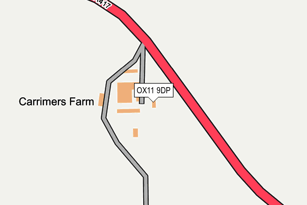
OX11 9DP is located in the Cholsey electoral ward, within the local authority district of South Oxfordshire and the English Parliamentary constituency of Wantage. The Sub Integrated Care Board (ICB) Location is NHS Buckinghamshire, Oxfordshire and Berkshire West ICB - 10Q and the police force is Thames Valley. This postcode has been in use since January 1980.


GetTheData
Source: OS OpenMap – Local (Ordnance Survey)
Source: OS VectorMap District (Ordnance Survey)
Licence: Open Government Licence (requires attribution)
| Easting | 455988 |
| Northing | 184941 |
| Latitude | 51.560581 |
| Longitude | -1.193726 |
GetTheData
Source: Open Postcode Geo
Licence: Open Government Licence
| Country | England |
| Postcode District | OX11 |
➜ See where OX11 is on a map | |
GetTheData
Source: Land Registry Price Paid Data
Licence: Open Government Licence
Elevation or altitude of OX11 9DP as distance above sea level:
| Metres | Feet | |
|---|---|---|
| Elevation | 70m | 230ft |
Elevation is measured from the approximate centre of the postcode, to the nearest point on an OS contour line from OS Terrain 50, which has contour spacing of ten vertical metres.
➜ How high above sea level am I? Find the elevation of your current position using your device's GPS.
GetTheData
Source: Open Postcode Elevation
Licence: Open Government Licence
| Ward | Cholsey |
| Constituency | Wantage |
GetTheData
Source: ONS Postcode Database
Licence: Open Government Licence
| The Close (Aston Street) | Aston Tirrold | 931m |
| The Close (Aston Street) | Aston Tirrold | 944m |
| The Chequers Ph (Baker Street) | Aston Upthorpe | 1,313m |
| The Chequers Ph (Fullers Road) | Aston Upthorpe | 1,346m |
| Cholsey Station | 2.7km |
| Goring & Streatley Station | 6.1km |
GetTheData
Source: NaPTAN
Licence: Open Government Licence
| Percentage of properties with Next Generation Access | 100.0% |
| Percentage of properties with Superfast Broadband | 0.0% |
| Percentage of properties with Ultrafast Broadband | 0.0% |
| Percentage of properties with Full Fibre Broadband | 0.0% |
Superfast Broadband is between 30Mbps and 300Mbps
Ultrafast Broadband is > 300Mbps
| Percentage of properties unable to receive 2Mbps | 0.0% |
| Percentage of properties unable to receive 5Mbps | 0.0% |
| Percentage of properties unable to receive 10Mbps | 0.0% |
| Percentage of properties unable to receive 30Mbps | 100.0% |
GetTheData
Source: Ofcom
Licence: Ofcom Terms of Use (requires attribution)
GetTheData
Source: ONS Postcode Database
Licence: Open Government Licence

➜ Get more ratings from the Food Standards Agency
GetTheData
Source: Food Standards Agency
Licence: FSA terms & conditions
| Last Collection | |||
|---|---|---|---|
| Location | Mon-Fri | Sat | Distance |
| Papist Way | 16:30 | 08:30 | 3,246m |
| Cholsey Post Office | 16:30 | 11:30 | 3,256m |
| Honey Park Estate | 16:30 | 08:30 | 3,283m |
GetTheData
Source: Dracos
Licence: Creative Commons Attribution-ShareAlike
The below table lists the International Territorial Level (ITL) codes (formerly Nomenclature of Territorial Units for Statistics (NUTS) codes) and Local Administrative Units (LAU) codes for OX11 9DP:
| ITL 1 Code | Name |
|---|---|
| TLJ | South East (England) |
| ITL 2 Code | Name |
| TLJ1 | Berkshire, Buckinghamshire and Oxfordshire |
| ITL 3 Code | Name |
| TLJ14 | Oxfordshire CC |
| LAU 1 Code | Name |
| E07000179 | South Oxfordshire |
GetTheData
Source: ONS Postcode Directory
Licence: Open Government Licence
The below table lists the Census Output Area (OA), Lower Layer Super Output Area (LSOA), and Middle Layer Super Output Area (MSOA) for OX11 9DP:
| Code | Name | |
|---|---|---|
| OA | E00145919 | |
| LSOA | E01028649 | South Oxfordshire 015E |
| MSOA | E02005972 | South Oxfordshire 015 |
GetTheData
Source: ONS Postcode Directory
Licence: Open Government Licence
| OX11 9DW | London Road | 469m |
| OX11 9DN | Chalk Hill | 687m |
| OX11 9DE | Downs View | 935m |
| OX11 9DQ | Aston Street | 973m |
| OX11 9DH | Rectory Lane | 1095m |
| OX11 9DD | Baker Street | 1099m |
| OX11 9DJ | Aston Street | 1165m |
| OX11 9EJ | Spring Lane | 1249m |
| OX11 9EH | Spring Lane | 1267m |
| OX11 9EQ | Thorpe Street | 1371m |
GetTheData
Source: Open Postcode Geo; Land Registry Price Paid Data
Licence: Open Government Licence