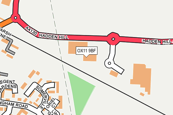
OX11 9BF is located in the Didcot North East electoral ward, within the local authority district of South Oxfordshire and the English Parliamentary constituency of Wantage. The Sub Integrated Care Board (ICB) Location is NHS Buckinghamshire, Oxfordshire and Berkshire West ICB - 10Q and the police force is Thames Valley. This postcode has been in use since January 1993.


GetTheData
Source: OS OpenMap – Local (Ordnance Survey)
Source: OS VectorMap District (Ordnance Survey)
Licence: Open Government Licence (requires attribution)
| Easting | 453843 |
| Northing | 189935 |
| Latitude | 51.605688 |
| Longitude | -1.223901 |
GetTheData
Source: Open Postcode Geo
Licence: Open Government Licence
| Country | England |
| Postcode District | OX11 |
➜ See where OX11 is on a map ➜ Where is Didcot? | |
GetTheData
Source: Land Registry Price Paid Data
Licence: Open Government Licence
Elevation or altitude of OX11 9BF as distance above sea level:
| Metres | Feet | |
|---|---|---|
| Elevation | 60m | 197ft |
Elevation is measured from the approximate centre of the postcode, to the nearest point on an OS contour line from OS Terrain 50, which has contour spacing of ten vertical metres.
➜ How high above sea level am I? Find the elevation of your current position using your device's GPS.
GetTheData
Source: Open Postcode Elevation
Licence: Open Government Licence
| Ward | Didcot North East |
| Constituency | Wantage |
GetTheData
Source: ONS Postcode Database
Licence: Open Government Licence
| Tesco (A4130) | Didcot | 142m |
| Regent Gardens (Sandringham Road) | Didcot | 344m |
| Regent Gardens (Sandringham Road) | Didcot | 363m |
| Campion Hall Drive (Sandringham Road) | Didcot | 408m |
| Campion Hall Drive (Sandringham Road) | Didcot | 422m |
| Didcot Parkway Station | 1.4km |
| Appleford Station | 4km |
| Cholsey Station | 6km |
GetTheData
Source: NaPTAN
Licence: Open Government Licence
GetTheData
Source: ONS Postcode Database
Licence: Open Government Licence


➜ Get more ratings from the Food Standards Agency
GetTheData
Source: Food Standards Agency
Licence: FSA terms & conditions
| Last Collection | |||
|---|---|---|---|
| Location | Mon-Fri | Sat | Distance |
| Hagbourne Road | 17:30 | 08:30 | 477m |
| Wessex Road | 17:00 | 09:00 | 958m |
| Didcot Post Office | 17:00 | 11:30 | 1,064m |
GetTheData
Source: Dracos
Licence: Creative Commons Attribution-ShareAlike
The below table lists the International Territorial Level (ITL) codes (formerly Nomenclature of Territorial Units for Statistics (NUTS) codes) and Local Administrative Units (LAU) codes for OX11 9BF:
| ITL 1 Code | Name |
|---|---|
| TLJ | South East (England) |
| ITL 2 Code | Name |
| TLJ1 | Berkshire, Buckinghamshire and Oxfordshire |
| ITL 3 Code | Name |
| TLJ14 | Oxfordshire CC |
| LAU 1 Code | Name |
| E07000179 | South Oxfordshire |
GetTheData
Source: ONS Postcode Directory
Licence: Open Government Licence
The below table lists the Census Output Area (OA), Lower Layer Super Output Area (LSOA), and Middle Layer Super Output Area (MSOA) for OX11 9BF:
| Code | Name | |
|---|---|---|
| OA | E00145819 | |
| LSOA | E01028628 | South Oxfordshire 009D |
| MSOA | E02005966 | South Oxfordshire 009 |
GetTheData
Source: ONS Postcode Directory
Licence: Open Government Licence
| OX11 8UQ | Magdalen Court | 162m |
| OX11 9BZ | Wallingford Road | 180m |
| OX11 8UG | Oriel Court | 197m |
| OX11 8UH | Exeter Court | 199m |
| OX11 8UE | Somerville | 231m |
| OX11 8UD | Somerville | 245m |
| OX11 8UF | Lincoln Gardens | 255m |
| OX11 8UJ | Merton Close | 265m |
| OX11 8FD | Marsh Lane | 297m |
| OX11 8UR | Worcester Drive | 300m |
GetTheData
Source: Open Postcode Geo; Land Registry Price Paid Data
Licence: Open Government Licence