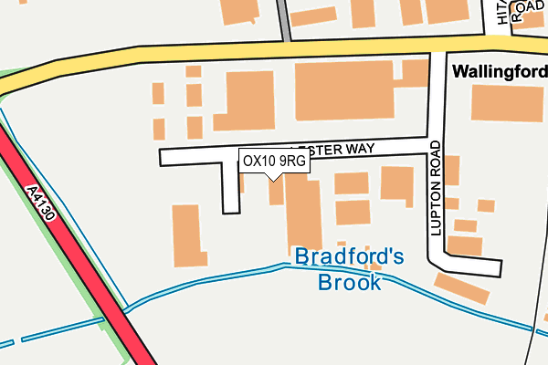
OX10 9RG is located in the Wallingford electoral ward, within the local authority district of South Oxfordshire and the English Parliamentary constituency of Wantage. The Sub Integrated Care Board (ICB) Location is NHS Buckinghamshire, Oxfordshire and Berkshire West ICB - 10Q and the police force is Thames Valley. This postcode has been in use since April 1986.


GetTheData
Source: OS OpenMap – Local (Ordnance Survey)
Source: OS VectorMap District (Ordnance Survey)
Licence: Open Government Licence (requires attribution)
| Easting | 459669 |
| Northing | 189007 |
| Latitude | 51.596757 |
| Longitude | -1.139962 |
GetTheData
Source: Open Postcode Geo
Licence: Open Government Licence
| Country | England |
| Postcode District | OX10 |
➜ See where OX10 is on a map ➜ Where is Wallingford? | |
GetTheData
Source: Land Registry Price Paid Data
Licence: Open Government Licence
Elevation or altitude of OX10 9RG as distance above sea level:
| Metres | Feet | |
|---|---|---|
| Elevation | 50m | 164ft |
Elevation is measured from the approximate centre of the postcode, to the nearest point on an OS contour line from OS Terrain 50, which has contour spacing of ten vertical metres.
➜ How high above sea level am I? Find the elevation of your current position using your device's GPS.
GetTheData
Source: Open Postcode Elevation
Licence: Open Government Licence
| Ward | Wallingford |
| Constituency | Wantage |
GetTheData
Source: ONS Postcode Database
Licence: Open Government Licence
| Lester Way | Wallingford | 137m |
| Lester Way | Wallingford | 140m |
| Moses Winter Way (Hithercroft Road) | Wallingford | 142m |
| Moses Winter Way (Hithercroft Road) | Wallingford | 169m |
| Cholsey & Wallingford Railway Station (Hithercroft Road) | Wallingford | 268m |
| Wallingford (Cholsey & Wallingford Railway) | Wallingford | 343m |
| Cholsey Station | 3.2km |
GetTheData
Source: NaPTAN
Licence: Open Government Licence
GetTheData
Source: ONS Postcode Database
Licence: Open Government Licence


➜ Get more ratings from the Food Standards Agency
GetTheData
Source: Food Standards Agency
Licence: FSA terms & conditions
| Last Collection | |||
|---|---|---|---|
| Location | Mon-Fri | Sat | Distance |
| Hithercroft Industrial Estate | 17:30 | 10:00 | 190m |
| Wallingford Delivery Office | 17:45 | 11:30 | 195m |
| Benson Raf Post Office | 16:15 | 09:30 | 417m |
GetTheData
Source: Dracos
Licence: Creative Commons Attribution-ShareAlike
The below table lists the International Territorial Level (ITL) codes (formerly Nomenclature of Territorial Units for Statistics (NUTS) codes) and Local Administrative Units (LAU) codes for OX10 9RG:
| ITL 1 Code | Name |
|---|---|
| TLJ | South East (England) |
| ITL 2 Code | Name |
| TLJ1 | Berkshire, Buckinghamshire and Oxfordshire |
| ITL 3 Code | Name |
| TLJ14 | Oxfordshire CC |
| LAU 1 Code | Name |
| E07000179 | South Oxfordshire |
GetTheData
Source: ONS Postcode Directory
Licence: Open Government Licence
The below table lists the Census Output Area (OA), Lower Layer Super Output Area (LSOA), and Middle Layer Super Output Area (MSOA) for OX10 9RG:
| Code | Name | |
|---|---|---|
| OA | E00173184 | |
| LSOA | E01028617 | South Oxfordshire 012B |
| MSOA | E02005969 | South Oxfordshire 012 |
GetTheData
Source: ONS Postcode Directory
Licence: Open Government Licence
| OX10 9TA | Thames Park | 127m |
| OX10 9BS | Lupton Road | 192m |
| OX10 9FE | Hithercroft Road | 227m |
| OX10 9DG | Hithercroft Road | 236m |
| OX10 9EZ | Beadle Trading Estate | 335m |
| OX10 9GF | Sovereign Place | 368m |
| OX10 9DA | Rockfort Industrial Estate | 369m |
| OX10 9GQ | Hithercroft Road | 393m |
| OX10 9GH | Hanover Court | 396m |
| OX10 0PL | Fir Tree Avenue | 399m |
GetTheData
Source: Open Postcode Geo; Land Registry Price Paid Data
Licence: Open Government Licence