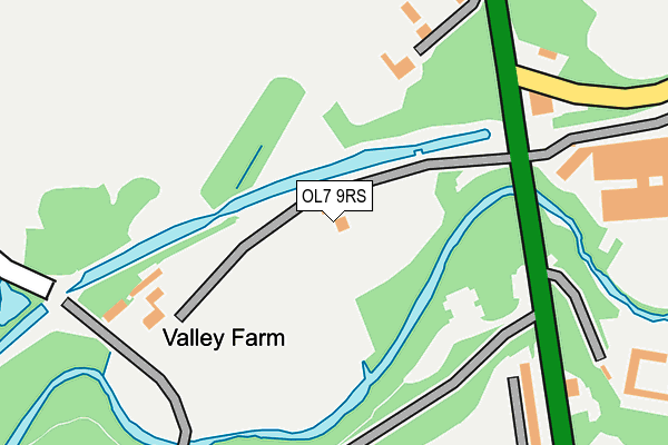
OL7 9RS is located in the Ashton Waterloo electoral ward, within the metropolitan district of Tameside and the English Parliamentary constituency of Ashton-under-Lyne. The Sub Integrated Care Board (ICB) Location is NHS Greater Manchester ICB - 01Y and the police force is Greater Manchester. This postcode has been in use since January 1980.


GetTheData
Source: OS OpenMap – Local (Ordnance Survey)
Source: OS VectorMap District (Ordnance Survey)
Licence: Open Government Licence (requires attribution)
| Easting | 392843 |
| Northing | 401292 |
| Latitude | 53.508281 |
| Longitude | -2.109382 |
GetTheData
Source: Open Postcode Geo
Licence: Open Government Licence
| Country | England |
| Postcode District | OL7 |
➜ See where OL7 is on a map | |
GetTheData
Source: Land Registry Price Paid Data
Licence: Open Government Licence
Elevation or altitude of OL7 9RS as distance above sea level:
| Metres | Feet | |
|---|---|---|
| Elevation | 100m | 328ft |
Elevation is measured from the approximate centre of the postcode, to the nearest point on an OS contour line from OS Terrain 50, which has contour spacing of ten vertical metres.
➜ How high above sea level am I? Find the elevation of your current position using your device's GPS.
GetTheData
Source: Open Postcode Elevation
Licence: Open Government Licence
| Ward | Ashton Waterloo |
| Constituency | Ashton-under-lyne |
GetTheData
Source: ONS Postcode Database
Licence: Open Government Licence
| Oldham Rd/Bardsley Bridge (Oldham Rd) | Bardsley | 170m |
| Oldham Rd/Bardsley Bridge (Oldham Rd) | Bardsley | 247m |
| Oldham Rd/Tree House Ave (Oldham Rd) | Limehurst | 426m |
| Ashton Rd/Victoria St (Ashton Rd) | Bardsley | 440m |
| Camberwell Drive (Sw Bnd) (Camberwell Dr) | Limehurst | 454m |
| Ashton-under-Lyne Station | 2.1km |
| Guide Bridge Station | 3.8km |
| Stalybridge Station | 4.1km |
GetTheData
Source: NaPTAN
Licence: Open Government Licence
| Percentage of properties with Next Generation Access | 100.0% |
| Percentage of properties with Superfast Broadband | 100.0% |
| Percentage of properties with Ultrafast Broadband | 0.0% |
| Percentage of properties with Full Fibre Broadband | 0.0% |
Superfast Broadband is between 30Mbps and 300Mbps
Ultrafast Broadband is > 300Mbps
| Percentage of properties unable to receive 2Mbps | 0.0% |
| Percentage of properties unable to receive 5Mbps | 0.0% |
| Percentage of properties unable to receive 10Mbps | 0.0% |
| Percentage of properties unable to receive 30Mbps | 0.0% |
GetTheData
Source: Ofcom
Licence: Ofcom Terms of Use (requires attribution)
GetTheData
Source: ONS Postcode Database
Licence: Open Government Licence


➜ Get more ratings from the Food Standards Agency
GetTheData
Source: Food Standards Agency
Licence: FSA terms & conditions
| Last Collection | |||
|---|---|---|---|
| Location | Mon-Fri | Sat | Distance |
| Lees Road P.o. | 17:30 | 12:05 | 1,670m |
| Christchurch | 17:25 | 11:50 | 1,712m |
| Higher Hurst Tso | 17:30 | 11:40 | 2,154m |
GetTheData
Source: Dracos
Licence: Creative Commons Attribution-ShareAlike
The below table lists the International Territorial Level (ITL) codes (formerly Nomenclature of Territorial Units for Statistics (NUTS) codes) and Local Administrative Units (LAU) codes for OL7 9RS:
| ITL 1 Code | Name |
|---|---|
| TLD | North West (England) |
| ITL 2 Code | Name |
| TLD3 | Greater Manchester |
| ITL 3 Code | Name |
| TLD35 | Greater Manchester South East |
| LAU 1 Code | Name |
| E08000008 | Tameside |
GetTheData
Source: ONS Postcode Directory
Licence: Open Government Licence
The below table lists the Census Output Area (OA), Lower Layer Super Output Area (LSOA), and Middle Layer Super Output Area (MSOA) for OL7 9RS:
| Code | Name | |
|---|---|---|
| OA | E00030171 | |
| LSOA | E01005956 | Tameside 005B |
| MSOA | E02001233 | Tameside 005 |
GetTheData
Source: ONS Postcode Directory
Licence: Open Government Licence
| OL7 9PF | Highfield Terrace | 229m |
| OL7 9PG | Oldham Road | 258m |
| OL7 9PE | Ronnis Mount | 268m |
| OL7 9RH | Oldham Road | 298m |
| OL8 3JA | Knott Lanes | 337m |
| OL7 9PX | Oaken Clough Drive | 368m |
| OL7 9PB | Oaken Street | 390m |
| OL8 3HX | Ashton Road | 399m |
| OL7 9PD | Oldham Road | 406m |
| OL7 9PQ | Oldham Road | 424m |
GetTheData
Source: Open Postcode Geo; Land Registry Price Paid Data
Licence: Open Government Licence