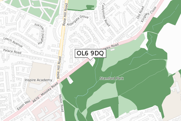
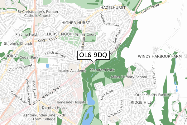
OL6 9DQ maps, stats, and open data
OL6 9DQ is located in the Ashton Hurst electoral ward, within the metropolitan district of Tameside and the English Parliamentary constituency of Stalybridge and Hyde. The Sub Integrated Care Board (ICB) Location is NHS Greater Manchester ICB - 01Y and the police force is Greater Manchester. This postcode has been in use since January 1980.
OL6 9DQ maps


Licence: Open Government Licence (requires attribution)
Attribution: Contains OS data © Crown copyright and database right 2025
Source: Open Postcode Geo
Licence: Open Government Licence (requires attribution)
Attribution: Contains OS data © Crown copyright and database right 2025; Contains Royal Mail data © Royal Mail copyright and database right 2025; Source: Office for National Statistics licensed under the Open Government Licence v.3.0
OL6 9DQ geodata
| Easting | 395711 |
| Northing | 400133 |
| Latitude | 53.497879 |
| Longitude | -2.066123 |
Where is OL6 9DQ?
| Country | England |
| Postcode District | OL6 |
OL6 9DQ Elevation
Elevation or altitude of OL6 9DQ as distance above sea level:
| Metres | Feet | |
|---|---|---|
| Elevation | 160m | 525ft |
Elevation is measured from the approximate centre of the postcode, to the nearest point on an OS contour line from OS Terrain 50, which has contour spacing of ten vertical metres.
➜ How high above sea level am I? Find the elevation of your current position using your device's GPS.
Politics
| Ward | Ashton Hurst |
|---|---|
| Constituency | Stalybridge And Hyde |
Transport
Nearest bus stops to OL6 9DQ
| Mossley Rd/The Ladysmith (Mossley Rd) | Hazelhurst | 46m |
| Mossley Rd/The Ladysmith (Mossley Rd) | Hazelhurst | 110m |
| Rose Hill Road/Palace Road (N Bnd) (Rose Hill Road) | Hazelhurst | 170m |
| Rose Hill Road (S Bnd) (Rose Hill Road) | Hazelhurst | 237m |
| Mossley Rd/Park Square (Mossley Rd) | Hazelhurst | 250m |
Nearest railway stations to OL6 9DQ
| Stalybridge Station | 1.5km |
| Ashton-under-Lyne Station | 2km |
| Mossley (Manchester) Station | 2.5km |
Deprivation
61.8% of English postcodes are less deprived than OL6 9DQ:Food Standards Agency
Three nearest food hygiene ratings to OL6 9DQ (metres)


➜ Get more ratings from the Food Standards Agency
Nearest post box to OL6 9DQ
| Last Collection | |||
|---|---|---|---|
| Location | Mon-Fri | Sat | Distance |
| Ladysmith Road | 17:15 | 11:30 | 634m |
| Springs Lane | 17:15 | 11:30 | 747m |
| 27 Broadbent Avenue | 17:00 | 11:00 | 882m |
OL6 9DQ ITL and OL6 9DQ LAU
The below table lists the International Territorial Level (ITL) codes (formerly Nomenclature of Territorial Units for Statistics (NUTS) codes) and Local Administrative Units (LAU) codes for OL6 9DQ:
| ITL 1 Code | Name |
|---|---|
| TLD | North West (England) |
| ITL 2 Code | Name |
| TLD3 | Greater Manchester |
| ITL 3 Code | Name |
| TLD35 | Greater Manchester South East |
| LAU 1 Code | Name |
| E08000008 | Tameside |
OL6 9DQ census areas
The below table lists the Census Output Area (OA), Lower Layer Super Output Area (LSOA), and Middle Layer Super Output Area (MSOA) for OL6 9DQ:
| Code | Name | |
|---|---|---|
| OA | E00030112 | |
| LSOA | E01005944 | Tameside 007D |
| MSOA | E02001235 | Tameside 007 |
Nearest postcodes to OL6 9DQ
| OL6 9AP | The Ladysmith | 91m |
| OL6 9AR | The Ladysmith | 99m |
| OL6 9BY | Old Road | 155m |
| OL6 8HR | Rose Hill Road | 157m |
| OL6 9RU | Mossley Road | 180m |
| OL6 9BG | Old Road | 200m |
| OL6 9DW | Marne Avenue | 210m |
| OL6 8YF | Rose Hill Road | 219m |
| OL6 8HX | Rose Hill Close | 221m |
| OL6 8YE | Aldergate Grove | 227m |