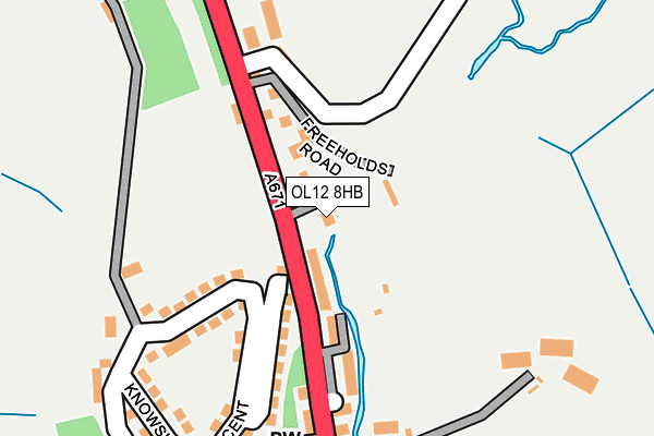
OL12 8HB is located in the Facit and Shawforth electoral ward, within the local authority district of Rossendale and the English Parliamentary constituency of Rossendale and Darwen. The Sub Integrated Care Board (ICB) Location is NHS Lancashire and South Cumbria ICB - 01A and the police force is Lancashire. This postcode has been in use since April 2003.


GetTheData
Source: OS OpenMap – Local (Ordnance Survey)
Source: OS VectorMap District (Ordnance Survey)
Licence: Open Government Licence (requires attribution)
| Easting | 389202 |
| Northing | 420776 |
| Latitude | 53.683328 |
| Longitude | -2.164964 |
GetTheData
Source: Open Postcode Geo
Licence: Open Government Licence
| Country | England |
| Postcode District | OL12 |
➜ See where OL12 is on a map ➜ Where is Whitworth? | |
GetTheData
Source: Land Registry Price Paid Data
Licence: Open Government Licence
Elevation or altitude of OL12 8HB as distance above sea level:
| Metres | Feet | |
|---|---|---|
| Elevation | 270m | 886ft |
Elevation is measured from the approximate centre of the postcode, to the nearest point on an OS contour line from OS Terrain 50, which has contour spacing of ten vertical metres.
➜ How high above sea level am I? Find the elevation of your current position using your device's GPS.
GetTheData
Source: Open Postcode Elevation
Licence: Open Government Licence
| Ward | Facit And Shawforth |
| Constituency | Rossendale And Darwen |
GetTheData
Source: ONS Postcode Database
Licence: Open Government Licence
| Shanter Close (Market Street) | Shawforth | 53m |
| Shanter Close (Market Street) | Shawforth | 72m |
| Chapel (Market Street) | Shawforth | 214m |
| Chapel (Market Street) | Shawforth | 243m |
| Peel Terrace (Market Street) | Shawforth | 289m |
| Walsden Station | 4.2km |
| Todmorden Station | 5.5km |
| Littleborough Station | 6.5km |
GetTheData
Source: NaPTAN
Licence: Open Government Licence
| Percentage of properties with Next Generation Access | 100.0% |
| Percentage of properties with Superfast Broadband | 100.0% |
| Percentage of properties with Ultrafast Broadband | 0.0% |
| Percentage of properties with Full Fibre Broadband | 0.0% |
Superfast Broadband is between 30Mbps and 300Mbps
Ultrafast Broadband is > 300Mbps
| Percentage of properties unable to receive 2Mbps | 0.0% |
| Percentage of properties unable to receive 5Mbps | 0.0% |
| Percentage of properties unable to receive 10Mbps | 0.0% |
| Percentage of properties unable to receive 30Mbps | 0.0% |
GetTheData
Source: Ofcom
Licence: Ofcom Terms of Use (requires attribution)
GetTheData
Source: ONS Postcode Database
Licence: Open Government Licence


➜ Get more ratings from the Food Standards Agency
GetTheData
Source: Food Standards Agency
Licence: FSA terms & conditions
| Last Collection | |||
|---|---|---|---|
| Location | Mon-Fri | Sat | Distance |
| Britannia Tso | 17:15 | 11:30 | 1,452m |
| South Street | 17:30 | 11:30 | 3,070m |
| 37 Market Street | 17:15 | 11:30 | 3,179m |
GetTheData
Source: Dracos
Licence: Creative Commons Attribution-ShareAlike
The below table lists the International Territorial Level (ITL) codes (formerly Nomenclature of Territorial Units for Statistics (NUTS) codes) and Local Administrative Units (LAU) codes for OL12 8HB:
| ITL 1 Code | Name |
|---|---|
| TLD | North West (England) |
| ITL 2 Code | Name |
| TLD4 | Lancashire |
| ITL 3 Code | Name |
| TLD46 | East Lancashire |
| LAU 1 Code | Name |
| E07000125 | Rossendale |
GetTheData
Source: ONS Postcode Directory
Licence: Open Government Licence
The below table lists the Census Output Area (OA), Lower Layer Super Output Area (LSOA), and Middle Layer Super Output Area (MSOA) for OL12 8HB:
| Code | Name | |
|---|---|---|
| OA | E00128713 | |
| LSOA | E01025359 | Rossendale 009A |
| MSOA | E02005286 | Rossendale 009 |
GetTheData
Source: ONS Postcode Directory
Licence: Open Government Licence
| OL12 8HJ | Yew Tree Terrace | 41m |
| OL12 8HW | Freehold Road | 63m |
| OL12 8HL | Freeholds Terrace | 106m |
| OL12 8HR | Knowsley Crescent | 129m |
| OL12 8HN | Market Street | 134m |
| OL12 8HH | Gertrude Street | 145m |
| OL12 8HQ | Percy Street | 173m |
| OL12 8HG | Jane Street | 178m |
| OL12 8HF | Market Street | 190m |
| OL12 8HS | Knott Hill | 238m |
GetTheData
Source: Open Postcode Geo; Land Registry Price Paid Data
Licence: Open Government Licence