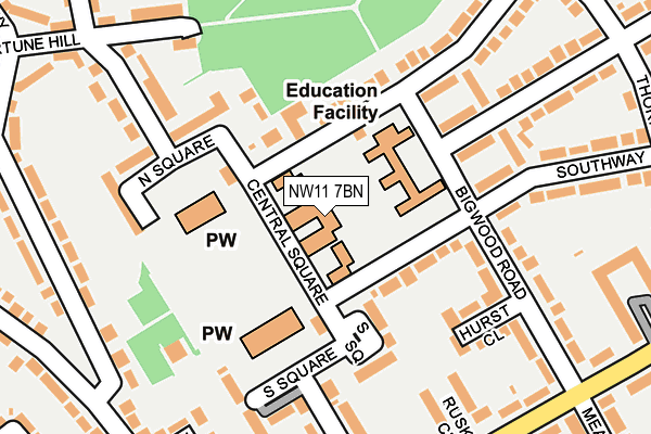
NW11 7BN is located in the Garden Suburb electoral ward, within the London borough of Barnet and the English Parliamentary constituency of Finchley and Golders Green. The Sub Integrated Care Board (ICB) Location is NHS North Central London ICB - 93C and the police force is Metropolitan Police. This postcode has been in use since January 1980.


GetTheData
Source: OS OpenMap – Local (Ordnance Survey)
Source: OS VectorMap District (Ordnance Survey)
Licence: Open Government Licence (requires attribution)
| Easting | 525566 |
| Northing | 188467 |
| Latitude | 51.581085 |
| Longitude | -0.189186 |
GetTheData
Source: Open Postcode Geo
Licence: Open Government Licence
| Country | England |
| Postcode District | NW11 |
➜ See where NW11 is on a map ➜ Where is London? | |
GetTheData
Source: Land Registry Price Paid Data
Licence: Open Government Licence
Elevation or altitude of NW11 7BN as distance above sea level:
| Metres | Feet | |
|---|---|---|
| Elevation | 80m | 262ft |
Elevation is measured from the approximate centre of the postcode, to the nearest point on an OS contour line from OS Terrain 50, which has contour spacing of ten vertical metres.
➜ How high above sea level am I? Find the elevation of your current position using your device's GPS.
GetTheData
Source: Open Postcode Elevation
Licence: Open Government Licence
| Ward | Garden Suburb |
| Constituency | Finchley And Golders Green |
GetTheData
Source: ONS Postcode Database
Licence: Open Government Licence
| Northway | Hampstead Garden Suburb | 66m |
| Henrietta Barnett School | Hampstead Garden Suburb | 117m |
| Willifield Way | Hampstead Garden Suburb | 236m |
| Linnell Close (Meadway) | Hampstead Garden Suburb | 257m |
| Bigwood Road | Hampstead Garden Suburb | 268m |
| Golders Green Underground Station | Golders Green | 1,038m |
| Cricklewood Station | 3km |
| Hampstead Heath Station | 3.3km |
| Hendon Station | 3.4km |
GetTheData
Source: NaPTAN
Licence: Open Government Licence
GetTheData
Source: ONS Postcode Database
Licence: Open Government Licence


➜ Get more ratings from the Food Standards Agency
GetTheData
Source: Food Standards Agency
Licence: FSA terms & conditions
| Last Collection | |||
|---|---|---|---|
| Location | Mon-Fri | Sat | Distance |
| South Square | 17:30 | 12:00 | 147m |
| Erskine Hill | 17:30 | 12:00 | 153m |
| Bigwood Road | 17:30 | 12:00 | 280m |
GetTheData
Source: Dracos
Licence: Creative Commons Attribution-ShareAlike
The below table lists the International Territorial Level (ITL) codes (formerly Nomenclature of Territorial Units for Statistics (NUTS) codes) and Local Administrative Units (LAU) codes for NW11 7BN:
| ITL 1 Code | Name |
|---|---|
| TLI | London |
| ITL 2 Code | Name |
| TLI7 | Outer London - West and North West |
| ITL 3 Code | Name |
| TLI71 | Barnet |
| LAU 1 Code | Name |
| E09000003 | Barnet |
GetTheData
Source: ONS Postcode Directory
Licence: Open Government Licence
The below table lists the Census Output Area (OA), Lower Layer Super Output Area (LSOA), and Middle Layer Super Output Area (MSOA) for NW11 7BN:
| Code | Name | |
|---|---|---|
| OA | E00001044 | |
| LSOA | E01000209 | Barnet 035B |
| MSOA | E02000058 | Barnet 035 |
GetTheData
Source: ONS Postcode Directory
Licence: Open Government Licence
| NW11 7AJ | South Square | 125m |
| NW11 7AD | North Square | 136m |
| NW11 7AB | North Square | 148m |
| NW11 7BG | Bigwood Road | 155m |
| NW11 6PB | Northway | 157m |
| NW11 6SS | Bigwood Road | 163m |
| NW11 6RU | Southway | 164m |
| NW11 7BE | Hurst Close | 186m |
| NW11 7AL | South Square | 191m |
| NW11 7AA | North Square | 197m |
GetTheData
Source: Open Postcode Geo; Land Registry Price Paid Data
Licence: Open Government Licence